
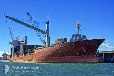
ELBELLA
Container Ship
Current Trip
| Trip Time | 16 h, 38 mins |
|---|---|
| Trip Distance | 167.19 nm |
| AVG Speed | 10.3 Knots |
| MAX Speed | 11.9 Knots |
| Dybgang | 9.7 m |
| AVG Wind | 5.6 knots |
| MAX Wind | 19 knots |
| MIN Temp | 8.7°C / 47.66°F |
| MAX Temp | 20°C / 68°F |
| Position Modtaget | 4 h, 20 m siden |
Current Position
| Longitude | --- |
|---|---|
| Latitude | --- |
| Status | Under way using engine |
| Fart | 9.6 Knots |
| Kurs | 92.8° |
| Område | Mediterranean Sea - Eastern Basin |
| Station | T-AIS |
| Position Modtaget | 4 h, 20 m siden |
Info
Information
The current position of ELBELLA is in Mediterranean Sea - Eastern Basin with coordinates 34.51793° / 35.78754° as reported on 2026-01-07 16:24 by AIS to our vessel tracker app. The vessel's current speed is 9.6 Knots and is currently inside the port of TRIPOLI.
The vessel ELBELLA (IMO: 9312640, MMSI: 248422000) is a Container Ship that was built in 2006 ( 20 år gamle ). It's sailing under the flag of [MT] Malta.
In this page you can find informations about the vessels current position, last detected port calls, and current voyage information. If the vessels is not in coverage by AIS you will find the latest position.
The current position of ELBELLA is detected by our AIS receivers and we are not responsible for the reliability of the data. The last position was recorded while the vessel was in Coverage by the Ais receivers of our vessel tracking app.
The current draught of ELBELLA as reported by AIS is 9.7 meters
Weather
| Temperature | 18.6°C / 65.48°F |
|---|---|
| Wind Speed | 6 knots |
| Direction | 57° ENE |
| Pressure | 1022.3 hPa |
| Humidity | 50.4 % |
| Cloud Coverage | 27 % |
Featured Company
Last Port Calls
| Port | Arrival | Departure | Time In Port |
|---|---|---|---|
| 2026-01-07 17:06 | |||
| 2026-01-06 13:12 | 2026-01-07 00:28 | 11 h | |
| 2026-01-02 06:57 | 2026-01-03 20:53 | 1 d | |
| 2025-12-30 11:12 | 2025-12-31 13:06 | 1 d | |
| 2025-12-27 07:43 | 2025-12-27 16:41 | 8 h | |
| 2025-12-26 03:41 | 2025-12-26 13:09 | 9 h | |
| 2025-12-23 14:40 | 2025-12-24 04:46 | 14 h | |
| 2025-12-21 05:32 | 2025-12-22 12:37 | 1 d | |
| 2025-12-16 21:58 | 2025-12-19 00:13 | 2 d | |
| 2025-12-11 15:13 | 2025-12-14 23:57 | 3 d |
Last Trips
| Origin | Departure | Destination | Arrival | Distance | |
|---|---|---|---|---|---|
| 2026-01-07 03:28 | 2026-01-07 19:06 | 167.19 nm | |||
| 2026-01-03 23:53 | 2026-01-06 16:12 | 95.71 nm | |||
| 2025-12-31 15:06 | 2026-01-02 09:57 | 198.78 nm | |||
| 2025-12-27 18:41 | 2025-12-30 13:12 | 332.42 nm | |||
| 2025-12-26 15:09 | 2025-12-27 09:43 | 209.99 nm | |||
| 2025-12-24 06:46 | 2025-12-26 05:41 | 564.35 nm | |||
| 2025-12-22 14:37 | 2025-12-23 16:40 | 279.42 nm | |||
| 2025-12-19 01:13 | 2025-12-21 07:32 | 752.17 nm | |||
| 2025-12-15 01:57 | 2025-12-16 22:58 | 275.89 nm | |||
| 2025-12-09 22:22 | 2025-12-11 17:13 | 218.74 nm |
Events
| Tid | Hændelsen | Detaljer | Position / Dest | Info |
|---|---|---|---|---|
| 2026-01-07 17:15 | STOP Sejllads |
34.46234 / 35.82706
[LB] TRIPOLI
|
Fart: 0.1 kn Kurs: 208° |
|
| 2026-01-07 17:06 | Skibe i havn |
|
34.46833 / 35.83167
[LB] TRIPOLI
|
Fart: 8.2 kn Kurs: 210° |
| 2026-01-07 16:25 | Status er ændret | Default Under way using engine |
34.51783 / 35.79122
LBKYE
|
Fart: 9.6 kn Kurs: 92.8° |
| 2026-01-07 16:24 | Udenfor Dækning |
34.51793 / 35.78754
Mediterranean Sea - Eastern Basin
[LB] TRIPOLI
|
Fart: 9.6 kn Kurs: 92.8° |
|
| 2026-01-07 13:40 | Ændre havområde | Lebanese part of the Mediterranean Sea - Eastern Basin Syrian part of the Mediterranean Sea - Eastern Basin |
34.74091 / 35.46170
Mediterranean Sea - Eastern Basin
LBKYE
|
Fart: 11.2 kn Kurs: 175.8° |
| 2026-01-07 10:15 | ETA er ændret | 2026/01/07 17:00 2026/01/07 16:00 |
35.38882 / 35.42645
LBKYE
|
Fart: 11.5 kn Kurs: 181.4° |
| 2026-01-07 09:56 | ETA er ændret | 2026/01/07 16:00 2026/01/07 00:01 |
35.45110 / 35.42860
LBKYE
|
Fart: 11.6 kn Kurs: 180.8° |
| 2026-01-07 09:49 | ETA er ændret | 2026/01/07 00:01 2026/01/08 00:01 |
35.47100 / 35.42895
LBKYE
|
Fart: 11.6 kn Kurs: 180.7° |
| 2026-01-07 07:13 | Ændre havområde | Syrian part of the Mediterranean Sea - Eastern Basin Turkish part of the Mediterranean Sea - Eastern Basin |
35.88842 / 35.41942
Mediterranean Sea - Eastern Basin
LBKYE
|
Fart: 8.6 kn Kurs: 172.8° |
| 2026-01-07 07:11 | Indenfor Dækning |
35.88842 / 35.41942
Mediterranean Sea - Eastern Basin
LBKYE
|
Fart: 8.6 kn Kurs: 172.8° |