
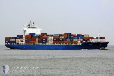
BOMAR PRAIA
Container Ship
Current Trip
| Trip Time | 4 days |
|---|---|
| Trip Distance | 1189.62 nm |
| AVG Speed | 17 Knots |
| MAX Speed | 23.2 Knots |
| Dybgang | 8.5 m |
| AVG Wind | 4.1 knots |
| MAX Wind | 14.1 knots |
| MIN Temp | 22.2°C / 71.96°F |
| MAX Temp | 30.7°C / 87.26°F |
| Position Modtaget | 3 d siden |
Current Position
| Longitude | -50.87067° |
|---|---|
| Latitude | 0.16735° |
| Status | Under way using engine |
| Fart | 16.8 Knots |
| Kurs | 76.6° |
| Område | North Atlantic Ocean |
| Station | T-AIS |
| Position Modtaget | 3 d siden |
Info
Information
The current position of BOMAR PRAIA is in North Atlantic Ocean with coordinates 0.16735° / -50.87067° as reported on 2024-04-23 06:21 by AIS to our vessel tracker app. The vessel's current speed is 16.8 Knots and is currently inside the port of VILA DO CONDE.
The vessel BOMAR PRAIA (IMO: 9419773, MMSI: 636017993) is a Container Ship that was built in 2009 ( 15 år gamle ). It's sailing under the flag of [LR] Liberia.
In this page you can find informations about the vessels current position, last detected port calls, and current voyage information. If the vessels is not in coverage by AIS you will find the latest position.
The current position of BOMAR PRAIA is detected by our AIS receivers and we are not responsible for the reliability of the data. The last position was recorded while the vessel was in Coverage by the Ais receivers of our vessel tracking app.
The current draught of BOMAR PRAIA as reported by AIS is 8.5 meters
Weather
| Temperature | 26.2°C / 79.16°F |
|---|---|
| Wind Speed | 5 knots |
| Direction | 43° NE |
| Pressure | 1010.6 hPa |
| Humidity | 83 % |
| Cloud Coverage | 100 % |
Featured Company
Last Port Calls
| Port | Arrival | Departure | Time In Port |
|---|---|---|---|
| 2024-04-26 09:03 | |||
| 2024-04-19 01:44 | 2024-04-21 17:23 | 2 d | |
| 2024-04-09 00:05 | 2024-04-10 01:48 | 1 d | |
| 2024-04-06 13:59 | 2024-04-07 09:39 | 19 h | |
| 2024-04-04 12:15 | 2024-04-05 07:20 | 19 h | |
| 2024-03-22 14:29 | 2024-03-23 13:06 | 22 h | |
| 2024-03-19 04:08 | 2024-03-19 15:11 | 11 h | |
| 2024-03-12 17:15 | 2024-03-15 10:21 | 2 d | |
| 2024-03-03 11:02 | 2024-03-04 10:28 | 23 h | |
| 2024-02-29 22:01 | 2024-03-01 19:11 | 21 h |
Most Visited Ports (Last year)
| Port | Arrivals | |
|---|---|---|
| 11 | ||
| 10 | ||
| 10 | ||
| 9 | ||
| 7 | ||
| 6 |
Last Trips
| Origin | Departure | Destination | Arrival | Distance | |
|---|---|---|---|---|---|
| 2024-04-21 13:23 | 2024-04-26 06:03 | 1189.62 nm | |||
| 2024-04-09 20:48 | 2024-04-18 21:44 | 3017.89 nm | |||
| 2024-04-07 04:39 | 2024-04-08 19:05 | 554.35 nm | |||
| 2024-04-05 02:20 | 2024-04-06 08:59 | 477.89 nm | |||
| 2024-03-23 10:06 | 2024-04-04 07:15 | 3157.99 nm | |||
| 2024-03-19 12:11 | 2024-03-22 11:29 | 754.02 nm | |||
| 2024-03-15 06:21 | 2024-03-19 01:08 | 882.18 nm | |||
| 2024-03-04 05:28 | 2024-03-12 13:15 | 2953.42 nm | |||
| 2024-03-01 14:11 | 2024-03-03 06:02 | 556.27 nm | |||
| 2024-02-27 22:23 | 2024-02-29 17:01 | 488.48 nm |
Events
| Tid | Hændelsen | Detaljer | Position / Dest | Info |
|---|---|---|---|---|
| 2024-04-26 09:04 | STOP Sejllads |
-1.53417 / -48.75057
[BR] VILA DO CONDE
|
Fart: Kurs: 221° |
|
| 2024-04-26 09:03 | Skibe i havn |
|
-1.53417 / -48.75057
[BR] VILA DO CONDE
|
Fart: 3.6 kn Kurs: 215° |
| 2024-04-26 06:26 | START Sejllads | 10.24 nm, North of ICOARACI |
-1.12264 / -48.50795
BRVCD
|
Fart: 5.4 kn Kurs: 213° |
| 2024-04-24 14:39 | STOP Sejllads | 10.65 nm, North of ICOARACI |
-1.11528 / -48.50310
BRVCD
|
Fart: 0.3 kn Kurs: 26° |
| 2024-04-23 06:28 | Status er ændret | Default Under way using engine |
.17486 / -50.84040
BRVCD
|
Fart: 16.8 kn Kurs: 76.6° |
| 2024-04-23 06:21 | Udenfor Dækning |
.16735 / -50.87067
North Atlantic Ocean
BRVCD
|
Fart: 16.8 kn Kurs: 76.6° |
|
| 2024-04-23 06:15 | Status er ændret | Under way using engine Default |
.15969 / -50.90219
BRVCD
|
Fart: 16.5 kn Kurs: 58° |
| 2024-04-23 06:04 | Status er ændret | Default Under way using engine |
.13506 / -50.94363
BRVCD
|
Fart: 15.6 kn Kurs: 48.4° |
| 2024-04-23 05:51 | Destination er ændret | BRVCD BRMCP |
.09357 / -50.97674
BRVCD
|
Fart: 13.2 kn Kurs: 32.2° |
| 2024-04-23 05:51 | ETA er ændret | 2024/04/24 15:00 2024/04/16 20:00 |
.09357 / -50.97674
BRVCD
|
Fart: 13.2 kn Kurs: 32.2° |