
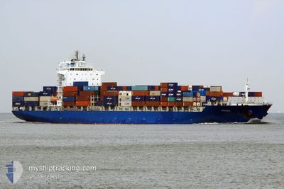
BOMAR PRAIA
Container Ship
Current Trip
BRVCD
| Time Travelled | 3 days |
|---|---|
| Remaining Time | --- |
| Distance Travelled | 1157.70 морская миля |
| Remaining Distance | --- |
| AVG Speed | 17.1 Узлы |
| MAX Speed | 23.2 Узлы |
| AVG Wind | 3.9 knots |
| MAX Wind | 14.1 knots |
| MIN Temp | 22.2°C / 71.96°F |
| MAX Temp | 30.7°C / 87.26°F |
| Осадка | 8.5 м |
| Позиция Получена | 2 d тому назад |
Current Position
| Долгота | -50.87067° |
|---|---|
| Широта | 0.16735° |
| Статус | Under way using engine |
| Скорость | 16.8 Узлы |
| Курс | 76.6° |
| Район | North Atlantic Ocean |
| Станция | T-AIS |
| Позиция Получена | 2 d тому назад |
Info
Information
The current position of BOMAR PRAIA is in North Atlantic Ocean with coordinates 0.16735° / -50.87067° as reported on 2024-04-23 06:21 by AIS to our vessel tracker app. The vessel's current speed is 16.8 Узлы
The vessel BOMAR PRAIA (IMO: 9419773, MMSI: 636017993) is a Container Ship that was built in 2009 ( 15 лет ). It's sailing under the flag of [LR] Liberia.
In this page you can find informations about the vessels current position, last detected port calls, and current voyage information. If the vessels is not in coverage by AIS you will find the latest position.
The current position of BOMAR PRAIA is detected by our AIS receivers and we are not responsible for the reliability of the data. The last position was recorded while the vessel was in Coverage by the Ais receivers of our vessel tracking app.
The current draught of BOMAR PRAIA as reported by AIS is 8.5 meters
Weather
| Temperature | 27.3°C / 81.14°F |
|---|---|
| Wind Speed | 7 knots |
| Direction | 16° NNE |
| Pressure | 1012 hPa |
| Humidity | 81.5 % |
| Cloud Coverage | 100 % |
Featured Company
Last Port Calls
| Port | Arrival | Departure | Time In Port |
|---|---|---|---|
| 2024-04-19 01:44 | 2024-04-21 17:23 | 2 d | |
| 2024-04-09 00:05 | 2024-04-10 01:48 | 1 d | |
| 2024-04-06 13:59 | 2024-04-07 09:39 | 19 h | |
| 2024-04-04 12:15 | 2024-04-05 07:20 | 19 h | |
| 2024-03-22 14:29 | 2024-03-23 13:06 | 22 h | |
| 2024-03-19 04:08 | 2024-03-19 15:11 | 11 h | |
| 2024-03-12 17:15 | 2024-03-15 10:21 | 2 d | |
| 2024-03-03 11:02 | 2024-03-04 10:28 | 23 h | |
| 2024-02-29 22:01 | 2024-03-01 19:11 | 21 h | |
| 2024-02-27 09:06 | 2024-02-28 03:23 | 18 h |
Most Visited Ports (Last year)
| Port | Arrivals | |
|---|---|---|
| 11 | ||
| 10 | ||
| 10 | ||
| 8 | ||
| 7 | ||
| 6 |
Last Trips
| Origin | Departure | Destination | Arrival | Distance | |
|---|---|---|---|---|---|
| 2024-04-09 20:48 | 2024-04-18 21:44 | 3017.89 морская миля | |||
| 2024-04-07 04:39 | 2024-04-08 19:05 | 554.35 морская миля | |||
| 2024-04-05 02:20 | 2024-04-06 08:59 | 477.89 морская миля | |||
| 2024-03-23 10:06 | 2024-04-04 07:15 | 3157.99 морская миля | |||
| 2024-03-19 12:11 | 2024-03-22 11:29 | 754.02 морская миля | |||
| 2024-03-15 06:21 | 2024-03-19 01:08 | 882.18 морская миля | |||
| 2024-03-04 05:28 | 2024-03-12 13:15 | 2953.42 морская миля | |||
| 2024-03-01 14:11 | 2024-03-03 06:02 | 556.27 морская миля | |||
| 2024-02-27 22:23 | 2024-02-29 17:01 | 488.48 морская миля | |||
| 2024-02-21 23:04 | 2024-02-27 04:06 | 2176.99 морская миля |
Events
| Время | Событие | Детали | Позиция / Направление | Информация |
|---|---|---|---|---|
| 2024-04-24 14:39 | Окончание движения | 10.65 nm, North of ICOARACI |
-1.11528 / -48.50310
BRVCD
|
Скорость: 0.3 kn Курс: 26° |
| 2024-04-23 06:28 | Статус изменился | Default Under way using engine |
.17486 / -50.84040
BRVCD
|
Скорость: 16.8 kn Курс: 76.6° |
| 2024-04-23 06:21 | Вне покрытия |
.16735 / -50.87067
North Atlantic Ocean
BRVCD
|
Скорость: 16.8 kn Курс: 76.6° |
|
| 2024-04-23 06:15 | Статус изменился | Under way using engine Default |
.15969 / -50.90219
BRVCD
|
Скорость: 16.5 kn Курс: 58° |
| 2024-04-23 06:04 | Статус изменился | Default Under way using engine |
.13506 / -50.94363
BRVCD
|
Скорость: 15.6 kn Курс: 48.4° |
| 2024-04-23 05:51 | Пункт назначения изменился | BRVCD BRMCP |
.09357 / -50.97674
BRVCD
|
Скорость: 13.2 kn Курс: 32.2° |
| 2024-04-23 05:51 | ETA изменился | 2024/04/24 15:00 2024/04/16 20:00 |
.09357 / -50.97674
BRVCD
|
Скорость: 13.2 kn Курс: 32.2° |
| 2024-04-23 05:08 | Изменение морского района | Brazilian part of the North Atlantic Ocean Brazilian part of the South Atlantic Ocean |
.00148 / -51.01250
North Atlantic Ocean
|
Скорость: 7.1 kn Курс: 12.8° |
| 2024-04-23 03:32 | Статус изменился | Under way using engine Default |
-.42153 / -51.20373
BRMCP
|
Скорость: 21.6 kn Курс: 75° |
| 2024-04-23 02:53 | Статус изменился | Default Under way using engine |
-.47475 / -51.42949
BRMCP
|
Скорость: 21.7 kn Курс: 49.8° |