
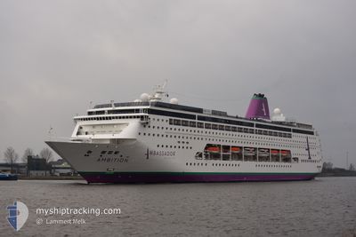
AMBITION
Passengers Ship
Current Trip
| Time Travelled | 1 day |
|---|---|
| Remaining Time | 8 h, 23 mins |
| Distance Travelled | 402.91 nm |
| Remaining Distance | 103.34 nm |
| AVG Speed | 13.1 Knots |
| MAX Speed | 15.8 Knots |
| AVG Wind | 8.4 knots |
| MAX Wind | 15.8 knots |
| MIN Temp | 10.4°C / 50.72°F |
| MAX Temp | 14.2°C / 57.56°F |
| Dybgang | 7 m |
| Position Modtaget | Nu |
Current Position
| Longitude | 5.10993° |
|---|---|
| Latitude | 59.36245° |
| Status | Under way using engine |
| Fart | 11.7 Knots |
| Kurs | 359.9° |
| Område | North Sea |
| Station | T-AIS |
| Position Modtaget | Nu |
Info
Information
The current position of AMBITION is in North Sea with coordinates 59.36245° / 5.10993° as reported on 2024-05-17 21:49 by AIS to our vessel tracker app. The vessel's current speed is 11.7 Knots and is heading at the port of EIDFJORD. The estimated time of arrival as calculated by MyShipTracking vessel tracking app is 2024-05-18 06:13 LT
The vessel AMBITION (IMO: 9172777, MMSI: 311001141) is a Passengers Ship that was built in 1999 ( 25 år gamle ). It's sailing under the flag of [BS] Bahamas.
In this page you can find informations about the vessels current position, last detected port calls, and current voyage information. If the vessels is not in coverage by AIS you will find the latest position.
The current position of AMBITION is detected by our AIS receivers and we are not responsible for the reliability of the data. The last position was recorded while the vessel was in Coverage by the Ais receivers of our vessel tracking app.
The current draught of AMBITION as reported by AIS is 7 meters
Weather
| Temperature | 11.7°C / 53.06°F |
|---|---|
| Wind Speed | 3 knots |
| Direction | 60° ENE |
| Pressure | 1017.8 hPa |
| Humidity | 77.8 % |
| Cloud Coverage | 100 % |
Featured Company
Last Port Calls
| Port | Arrival | Departure | Time In Port |
|---|---|---|---|
| 2024-05-16 09:10 | 2024-05-16 17:26 | 8 h | |
| 2024-05-14 09:50 | 2024-05-14 19:33 | 9 h | |
| 2024-05-13 07:17 | 2024-05-13 18:29 | 11 h | |
| 2024-05-11 06:07 | 2024-05-11 16:11 | 10 h | |
| 2024-05-09 06:10 | 2024-05-09 16:12 | 10 h | |
| 2024-05-08 05:08 | 2024-05-08 13:14 | 8 h | |
| 2024-05-07 06:14 | 2024-05-07 14:19 | 8 h | |
| 2024-05-06 06:05 | 2024-05-06 16:04 | 9 h | |
| 2024-05-03 10:18 | 2024-05-03 23:05 | 12 h | |
| 2024-05-01 21:20 | 2024-05-02 16:16 | 18 h |
Last Trips
| Origin | Departure | Destination | Arrival | Distance | |
|---|---|---|---|---|---|
| 2024-05-14 20:33 | 2024-05-16 10:10 | 585.29 nm | |||
| 2024-05-13 19:29 | 2024-05-14 10:50 | 220.60 nm | |||
| 2024-05-11 18:11 | 2024-05-13 08:17 | 397.39 nm | |||
| 2024-05-09 18:12 | 2024-05-11 08:07 | 361.36 nm | |||
| 2024-05-08 15:14 | 2024-05-09 08:10 | 255.70 nm | |||
| 2024-05-07 15:19 | 2024-05-08 07:08 | 209.35 nm | |||
| 2024-05-06 17:04 | 2024-05-07 07:14 | 191.94 nm | |||
| 2024-05-04 00:05 | 2024-05-06 07:05 | 779.33 nm | |||
| 2024-05-02 17:16 | 2024-05-03 11:18 | 221.85 nm | |||
| 2024-04-30 20:18 | 2024-05-01 22:20 | 334.05 nm |
Events
| Tid | Hændelsen | Detaljer | Position / Dest | Info |
|---|---|---|---|---|
| 2024-05-17 12:44 | Status er ændret | Under way using engine Default |
58.95226 / 2.21939
NO EDF
|
Fart: 14.1 kn Kurs: 87° |
| 2024-05-17 12:31 | Status er ændret | Default Under way using engine |
58.95005 / 2.12053
NO EDF
|
Fart: 14.2 kn Kurs: 85.9° |
| 2024-05-17 12:16 | Fundet i havområde | Norwegian part of the North Sea |
58.94693 / 2.00804
North Sea
NO EDF
|
Fart: 13.9 kn Kurs: 87° |
| 2024-05-17 12:16 | Status er ændret | Under way using engine Default |
58.94693 / 2.00804
NO EDF
|
Fart: 13.9 kn Kurs: 88° |
| 2024-05-17 12:16 | Indenfor Dækning |
58.94693 / 2.00804
North Sea
NO EDF
|
Fart: 13.9 kn Kurs: 87° |
|
| 2024-05-17 02:19 | Status er ændret | Default Under way using engine |
58.72318 / -2.55400
NO EDF
|
Fart: 14.6 kn Kurs: 86.2° |
| 2024-05-17 02:13 | Udenfor Dækning |
58.72177 / -2.59417
North Sea
NO EDF
|
Fart: 14.6 kn Kurs: 86.2° |
|
| 2024-05-17 02:07 | Status er ændret | Under way using engine Default |
58.71993 / -2.64416
NO EDF
|
Fart: 14.6 kn Kurs: 86° |
| 2024-05-17 02:07 | Status er ændret | Default Under way using engine |
58.71985 / -2.64636
NO EDF
|
Fart: 14.8 kn Kurs: 85.8° |
| 2024-05-17 00:29 | Ændre havområde | United Kingdom part of the North Sea United Kingdom part of the North Atlantic Ocean |
58.71176 / -3.40053
North Sea
NO EDF
|
Fart: 14.4 kn Kurs: 88.6° |