
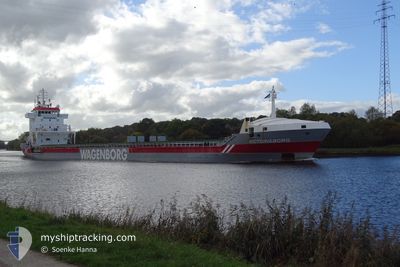
VICTORIABORG
General Cargo
Current Trip
| Time Travelled | 2 days |
|---|---|
| Remaining Time | --- |
| Distance Travelled | 720.79 nm |
| Remaining Distance | --- |
| AVG Speed | 11.2 Knots |
| MAX Speed | 12.4 Knots |
| AVG Wind | 8.9 knots |
| MAX Wind | 23 knots |
| MIN Temp | 17.2°C / 62.96°F |
| MAX Temp | 23.8°C / 74.84°F |
| Draught | 7.5 m |
| Position Received | 2 m ago |
Current Position
| Longitude | 13.47971° |
|---|---|
| Latitude | 36.82275° |
| Status | Under way using engine |
| Speed | 11.9 Knots |
| Course | 291.6° |
| Area | Mediterranean Sea - Eastern Basin |
| Station | T-AIS |
| Position Received | 2 m ago |
Info
Information
The current position of VICTORIABORG is in Mediterranean Sea - Eastern Basin with coordinates 36.82275° / 13.47971° as reported on 2024-05-20 13:05 by AIS to our vessel tracker app. The vessel's current speed is 11.9 Knots and is heading at the port of GRUNDARTANGI. The estimated time of arrival as calculated by MyShipTracking vessel tracking app is 2024-05-31 15:00 LT
The vessel VICTORIABORG (IMO: 9234276, MMSI: 246029000) is a General Cargo that was built in 2001 ( 23 years old ). It's sailing under the flag of [NL] Netherlands.
In this page you can find informations about the vessels current position, last detected port calls, and current voyage information. If the vessels is not in coverage by AIS you will find the latest position.
The current position of VICTORIABORG is detected by our AIS receivers and we are not responsible for the reliability of the data. The last position was recorded while the vessel was in Coverage by the Ais receivers of our vessel tracking app.
The current draught of VICTORIABORG as reported by AIS is 7.5 meters
Weather
| Temperature | 19.7°C / 67.46°F |
|---|---|
| Wind Speed | 20 knots |
| Direction | 126° SE |
| Pressure | 1006.2 hPa |
| Humidity | 89.5 % |
| Cloud Coverage | 11 % |
Featured Company
Last Port Calls
| Port | Arrival | Departure | Time In Port |
|---|---|---|---|
| 2024-05-15 13:41 | 2024-05-18 00:20 | 2 d | |
| 2024-05-11 10:48 | 2024-05-13 18:16 | 2 d | |
| 2024-05-06 21:08 | 2024-05-08 12:52 | 1 d | |
| 2024-04-13 23:30 | 2024-04-14 18:18 | 18 h | |
| 2024-03-29 17:45 | 2024-04-13 00:22 | 14 d | |
| 2024-03-26 14:17 | 2024-03-29 08:03 | 2 d | |
| 2024-03-19 22:25 | 2024-03-21 11:40 | 1 d | |
| 2024-03-17 17:45 | 2024-03-19 21:53 | 2 d | |
| 2024-03-07 22:24 |
Most Visited Ports (Last year)
| Port | Arrivals | |
|---|---|---|
| 3 | ||
| 3 | ||
| 2 | ||
| 2 | ||
| 2 | ||
| 2 |
Last Trips
| Origin | Departure | Destination | Arrival | Distance | |
|---|---|---|---|---|---|
| 2024-05-13 18:16 | 2024-05-15 13:41 | 208.29 nm | |||
| 2024-05-08 12:52 | 2024-05-11 10:48 | 729.95 nm | |||
| 2024-04-14 18:18 | 2024-05-06 21:08 | 4798.65 nm | |||
| 2024-04-13 00:22 | 2024-04-13 23:30 | 257.14 nm | |||
| 2024-03-29 08:03 | 2024-03-29 17:45 | 73.10 nm | |||
| 2024-03-21 11:40 | 2024-03-26 14:17 | 1256.00 nm | |||
| 2024-03-19 21:53 | 2024-03-19 22:25 | 1.75 nm | |||
| 2024-03-07 22:24 | 2024-03-17 17:45 | 1199.29 nm |
Events
| Time | Event | Details | Position / Dest | Info |
|---|---|---|---|---|
| 2024-05-20 13:05 | Status Changed | Under way using engine Default |
36.82275 / 13.47971
ISGRT
|
Speed: 11.8 kn Course: 290° |
| 2024-05-20 13:02 | Status Changed | Default Under way using engine |
36.81905 / 13.49193
ISGRT
|
Speed: 11.8 kn Course: 290.6° |
| 2024-05-20 11:41 | Status Changed | Under way using engine Default |
36.72221 / 13.79963
ISGRT
|
Speed: 11.7 kn Course: 292° |
| 2024-05-20 11:34 | Status Changed | Default Under way using engine |
36.71495 / 13.82306
ISGRT
|
Speed: 11.7 kn Course: 291.8° |
| 2024-05-20 11:22 | Status Changed | Under way using engine Default |
36.69857 / 13.87083
ISGRT
|
Speed: 11.6 kn Course: 293° |
| 2024-05-20 11:16 | Status Changed | Default Under way using engine |
36.69118 / 13.89181
ISGRT
|
Speed: 11.6 kn Course: 293.3° |
| 2024-05-20 10:07 | Status Changed | Under way using engine Default |
36.60401 / 14.15103
ISGRT
|
Speed: 11.8 kn Course: 291° |
| 2024-05-20 10:07 | IN Coverage |
36.60401 / 14.15103
Mediterranean Sea - Eastern Basin
ISGRT
|
Speed: 11.7 kn Course: 291.9° |
|
| 2024-05-19 19:01 | Status Changed | Default Under way using engine |
36.42740 / 17.68078
ISGRT
|
Speed: 11.6 kn Course: 273.1° |
| 2024-05-19 18:58 | OUT of Coverage |
36.42697 / 17.69029
Mediterranean Sea - Eastern Basin
ISGRT
|
Speed: 11.6 kn Course: 273.1° |