
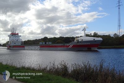
VICTORIABORG
General Cargo
Current Trip
ISGRT
| Time Travelled | 2 h, 16 mins |
|---|---|
| Remaining Time | --- |
| Distance Travelled | 16.65 nm |
| Remaining Distance | --- |
| AVG Speed | 9 Knots |
| MAX Speed | 10 Knots |
| AVG Wind | 20.2 knots |
| MAX Wind | 21.3 knots |
| MIN Temp | 4.8°C / 40.64°F |
| MAX Temp | 5.7°C / 42.26°F |
| Dybgang | 7.5 m |
| Position Modtaget | 8 d siden |
Current Position
| Longitude | -10.62760° |
|---|---|
| Latitude | 40.65304° |
| Status | Under way using engine |
| Fart | 10.8 Knots |
| Kurs | 337.8° |
| Område | North Atlantic Ocean |
| Station | T-AIS |
| Position Modtaget | 8 d siden |
Info
Information
The current position of VICTORIABORG is in North Atlantic Ocean with coordinates 40.65304° / -10.62760° as reported on 2024-05-25 17:59 by AIS to our vessel tracker app. The vessel's current speed is 10.8 Knots
The vessel VICTORIABORG (IMO: 9234276, MMSI: 246029000) is a General Cargo that was built in 2001 ( 23 år gamle ). It's sailing under the flag of [NL] Netherlands.
In this page you can find informations about the vessels current position, last detected port calls, and current voyage information. If the vessels is not in coverage by AIS you will find the latest position.
The current position of VICTORIABORG is detected by our AIS receivers and we are not responsible for the reliability of the data. The last position was recorded while the vessel was in Coverage by the Ais receivers of our vessel tracking app.
The current draught of VICTORIABORG as reported by AIS is 7.5 meters
Weather
| Temperature | 5.1°C / 41.18°F |
|---|---|
| Wind Speed | 21 knots |
| Direction | 296° WNW |
| Pressure | 1006 hPa |
| Humidity | 72.5 % |
| Cloud Coverage | 79 % |
Featured Company
Last Port Calls
| Port | Arrival | Departure | Time In Port |
|---|---|---|---|
| 2024-06-01 09:37 | 2024-06-02 23:11 | 1 d | |
| 2024-05-15 13:41 | 2024-05-18 00:20 | 2 d | |
| 2024-05-11 10:48 | 2024-05-13 18:16 | 2 d | |
| 2024-05-06 21:08 | 2024-05-08 12:52 | 1 d | |
| 2024-04-13 23:30 | 2024-04-14 18:18 | 18 h | |
| 2024-04-13 00:22 |
Most Visited Ports (Last year)
| Port | Arrivals | |
|---|---|---|
| 3 | ||
| 3 | ||
| 2 | ||
| 2 | ||
| 2 | ||
| 2 |
Last Trips
| Origin | Departure | Destination | Arrival | Distance | |
|---|---|---|---|---|---|
| 2024-05-18 00:20 | 2024-06-01 09:37 | 3664.79 nm | |||
| 2024-05-13 18:16 | 2024-05-15 13:41 | 208.29 nm | |||
| 2024-05-08 12:52 | 2024-05-11 10:48 | 729.95 nm | |||
| 2024-04-14 18:18 | 2024-05-06 21:08 | 4798.65 nm | |||
| 2024-04-13 00:22 | 2024-04-13 23:30 | 257.14 nm |
Events
| Tid | Hændelsen | Detaljer | Position / Dest | Info |
|---|---|---|---|---|
| 2024-06-02 23:28 | START Sejllads | 2.52 nm, South West of GRUNDARTANGI |
64.32166 / -21.82500
ISGRT
|
Fart: 9 kn Kurs: -1° |
| 2024-06-02 23:11 | Afsejlet fra sidste havn |
|
64.32166 / -21.82500
ISGRT
|
Fart: Kurs: 306° |
| 2024-06-01 09:43 | STOP Sejllads |
64.35667 / -21.77333
[IS] GRUNDARTANGI
|
Fart: Kurs: -1° |
|
| 2024-06-01 09:37 | Skibe i havn |
|
64.35644 / -21.77186
[IS] GRUNDARTANGI
|
Fart: 5.8 kn Kurs: 15° |
| 2024-06-01 08:20 | START Sejllads | 3.61 nm, North of REYKJAVIK |
64.20776 / -21.93576
ISGRT
|
Fart: 3.5 kn Kurs: 215° |
| 2024-06-01 03:13 | STOP Sejllads | 3.69 nm, North of REYKJAVIK |
64.21000 / -21.92833
ISGRT
|
Fart: Kurs: -1° |
| 2024-05-25 18:07 | Status er ændret | Default Under way using engine |
40.67451 / -10.63798
ISGRT
|
Fart: 10.8 kn Kurs: 337.8° |
| 2024-05-25 17:59 | Status er ændret | Under way using engine Default |
40.65304 / -10.62760
ISGRT
|
Fart: 10 kn Kurs: 340° |
| 2024-05-25 17:59 | Udenfor Dækning |
40.65304 / -10.62760
North Atlantic Ocean
ISGRT
|
Fart: 10.8 kn Kurs: 337.8° |
|
| 2024-05-25 17:50 | Indenfor Dækning |
40.65304 / -10.62760
North Atlantic Ocean
ISGRT
|
Fart: 10.8 kn Kurs: 337.8° |