
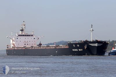
RONG MAY
Cargo
Current Trip
GIGIB>USDVT
| Time Travelled | 19 days |
|---|---|
| Remaining Time | --- |
| Distance Travelled | 5288.43 nm |
| Remaining Distance | --- |
| AVG Speed | 11.3 Knots |
| MAX Speed | 15.2 Knots |
| AVG Wind | 10.8 knots |
| MAX Wind | 32 knots |
| MIN Temp | 10°C / 50°F |
| MAX Temp | 25.2°C / 77.36°F |
| Draught | 8.8 m |
| Position Received | 7 h, 36 m ago |
Current Position
| Longitude | -69.85456° |
|---|---|
| Latitude | 28.96313° |
| Status | Under way using engine |
| Speed | 10.9 Knots |
| Course | 246.1° |
| Area | North Atlantic Ocean |
| Station | T-AIS |
| Position Received | 7 h, 36 m ago |
Info
Information
The current position of RONG MAY is in North Atlantic Ocean with coordinates 28.96313° / -69.85456° as reported on 2024-05-22 05:07 by AIS to our vessel tracker app. The vessel's current speed is 10.9 Knots
The vessel RONG MAY (IMO: 9774484, MMSI: 636017370) is a Cargo It's sailing under the flag of [LR] Liberia.
In this page you can find informations about the vessels current position, last detected port calls, and current voyage information. If the vessels is not in coverage by AIS you will find the latest position.
The current position of RONG MAY is detected by our AIS receivers and we are not responsible for the reliability of the data. The last position was recorded while the vessel was in Coverage by the Ais receivers of our vessel tracking app.
The current draught of RONG MAY as reported by AIS is 8.8 meters
Weather
| Temperature | 24.9°C / 76.82°F |
|---|---|
| Wind Speed | 7 knots |
| Direction | 180° S |
| Pressure | 1015 hPa |
| Humidity | 79.4 % |
| Cloud Coverage | 6 % |
Featured Company
Last Port Calls
| Port | Arrival | Departure | Time In Port |
|---|---|---|---|
| 2024-04-27 16:16 | 2024-05-02 14:59 | 4 d | |
| 2024-03-22 05:03 | 2024-03-26 18:51 | 4 d | |
| 2024-03-11 01:53 | 2024-03-19 09:11 | 8 d |
Last Trips
| Origin | Departure | Destination | Arrival | Distance | |
|---|---|---|---|---|---|
| 2024-03-26 13:51 | 2024-04-27 19:16 | 6722.65 nm | |||
| 2024-03-19 04:11 | 2024-03-22 00:03 | 299.65 nm | |||
| 2024-01-29 22:33 | 2024-03-10 20:53 | 9039.44 nm |
Events
| Time | Event | Details | Position / Dest | Info |
|---|---|---|---|---|
| 2024-05-22 05:21 | Status Changed | Default Under way using engine |
28.94660 / -69.89781
GIGIB>USDVT
|
Speed: 10.9 kn Course: 246.1° |
| 2024-05-22 05:07 | Status Changed | Under way using engine Default |
28.96313 / -69.85456
GIGIB>USDVT
|
Speed: 10.9 kn Course: 246° |
| 2024-05-22 05:07 | OUT of Coverage |
28.96313 / -69.85456
North Atlantic Ocean
GIGIB>USDVT
|
Speed: 10.9 kn Course: 246.1° |
|
| 2024-05-22 04:23 | Status Changed | Default Under way using engine |
29.01438 / -69.71287
GIGIB>USDVT
|
Speed: 11 kn Course: 248.1° |
| 2024-05-22 04:14 | Status Changed | Under way using engine Default |
29.02424 / -69.68496
GIGIB>USDVT
|
Speed: 11 kn Course: 246° |
| 2024-05-22 03:40 | Status Changed | Default Under way using engine |
29.06848 / -69.57471
GIGIB>USDVT
|
Speed: 11.2 kn Course: 240.7° |
| 2024-05-22 03:24 | Status Changed | Under way using engine Default |
29.09100 / -69.52822
GIGIB>USDVT
|
Speed: 11.4 kn Course: 243° |
| 2024-05-22 03:24 | IN Coverage |
29.09100 / -69.52822
North Atlantic Ocean
GIGIB>USDVT
|
Speed: 11.2 kn Course: 240.7° |
|
| 2024-05-17 00:30 | Status Changed | Default Under way using engine |
36.32881 / -42.90548
GIGIB>USDVT
|
Speed: 11.8 kn Course: 259.9° |
| 2024-05-17 00:22 | OUT of Coverage |
36.33353 / -42.87563
North Atlantic Ocean
GIGIB>USDVT
|
Speed: 11.8 kn Course: 259.9° |