
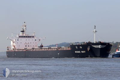
RONG MAY
Cargo
Current Trip
| Time Travelled | 44 days |
|---|---|
| Remaining Time | 36 days |
| Distance Travelled | 10493.17 nm |
| Remaining Distance | 9166.68 nm |
| AVG Speed | 10.8 Noeuds |
| MAX Speed | 15.2 Noeuds |
| AVG Wind | 11.1 knots |
| MAX Wind | 32 knots |
| MIN Temp | 10°C / 50°F |
| MAX Temp | 31.4°C / 88.52°F |
| Tirant d eau | 14.4 m |
| Position reçue | 9 d depuis |
Current Position
| Longitude | -65.39635° |
|---|---|
| Latitude | 19.52387° |
| Etat | Under way using engine |
| Vitesse | 11.2 Noeuds |
| Parcours | 91.1° |
| Zone | North Atlantic Ocean |
| Station | T-AIS |
| Position reçue | 9 d depuis |
Info
Information
The current position of RONG MAY is in North Atlantic Ocean with coordinates 19.52387° / -65.39635° as reported on 2024-06-06 06:38 by AIS to our vessel tracker app. The vessel's current speed is 11.2 Noeuds and is heading at the port of SINGAPORE. The estimated time of arrival as calculated by MyShipTracking vessel tracking app is 2024-07-22 07:22 LT
The vessel RONG MAY (IMO: 9774484, MMSI: 636017370) is a Cargo It's sailing under the flag of [LR] Liberia.
In this page you can find informations about the vessels current position, last detected port calls, and current voyage information. If the vessels is not in coverage by AIS you will find the latest position.
The current position of RONG MAY is detected by our AIS receivers and we are not responsible for the reliability of the data. The last position was recorded while the vessel was in Coverage by the Ais receivers of our vessel tracking app.
The current draught of RONG MAY as reported by AIS is 14.4 meters
Weather
| Temperature | 27.6°C / 81.68°F |
|---|---|
| Wind Speed | 15 knots |
| Direction | 129° SE |
| Pressure | 1012.4 hPa |
| Humidity | 77.8 % |
| Cloud Coverage | 8 % |
Featured Company
Events
| Heure | Evenement | Détails | Position/ Destination | Info |
|---|---|---|---|---|
| 2024-06-06 07:10 | Etat Changé | Default Under way using engine |
19.51851 / -65.29322
US DVT>SG SIN
|
Vitesse: 11.2 kn Parcours: 91.1° |
| 2024-06-06 06:38 | Hors de la zone couverte |
19.52387 / -65.39635
North Atlantic Ocean
|
Vitesse: 11.2 kn Parcours: 91.1° |
|
| 2024-06-06 06:33 | Dans la zone couverte |
19.52425 / -65.40840
North Atlantic Ocean
|
Vitesse: 11.2 kn Parcours: 91.9° |
|
| 2024-06-06 03:52 | Hors de la zone couverte |
19.55573 / -65.93539
North Atlantic Ocean
|
Vitesse: 10.7 kn Parcours: 95° |
|
| 2024-06-06 03:50 | Etat Changé | Under way using engine Default |
19.55621 / -65.94172
US DVT>SG SIN
|
Vitesse: 10.7 kn Parcours: 94° |
| 2024-06-06 03:50 | Dans la zone couverte |
19.55621 / -65.94172
North Atlantic Ocean
|
Vitesse: 10.7 kn Parcours: 93.8° |
|
| 2024-06-06 00:40 | Hors de la zone couverte |
19.57503 / -66.49817
North Atlantic Ocean
|
Vitesse: 9.2 kn Parcours: 89.9° |
|
| 2024-06-06 00:32 | Changement de zone | Puerto Rican part of the North Atlantic Ocean Cuban part of the North Atlantic Ocean |
19.57558 / -66.51973
North Atlantic Ocean
|
Vitesse: 9.2 kn Parcours: 92.9° |
| 2024-06-06 00:30 | Dans la zone couverte |
19.57558 / -66.51973
North Atlantic Ocean
|
Vitesse: 9.2 kn Parcours: 92.9° |