
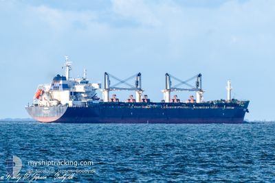
RINIA
Bulk Carrier
Current Trip
| Time Travelled | 7 days |
|---|---|
| Remaining Time | 7 h, 3 mins |
| Distance Travelled | 1765.23 nm |
| Remaining Distance | 84.93 nm |
| AVG Speed | 10.2 Knots |
| MAX Speed | 13.9 Knots |
| AVG Wind | 13 knots |
| MAX Wind | 24.4 knots |
| MIN Temp | 12.5°C / 54.5°F |
| MAX Temp | 25.5°C / 77.9°F |
| Draught | 10.2 m |
| Position Received | Now |
Current Position
| Longitude | 2.87399° |
|---|---|
| Latitude | 51.95344° |
| Status | Under way using engine |
| Speed | 10 Knots |
| Course | 44.4° |
| Area | North Sea |
| Station | T-AIS |
| Position Received | Now |
Info
Information
The current position of RINIA is in North Sea with coordinates 51.95344° / 2.87399° as reported on 2024-05-11 20:31 by AIS to our vessel tracker app. The vessel's current speed is 10 Knots and is heading at the port of AMSTERDAM. The estimated time of arrival as calculated by MyShipTracking vessel tracking app is 2024-05-12 03:35 LT
The vessel RINIA (IMO: 9594406, MMSI: 256308000) is a Bulk Carrier that was built in 2012 ( 12 years old ). It's sailing under the flag of [MT] Malta.
In this page you can find informations about the vessels current position, last detected port calls, and current voyage information. If the vessels is not in coverage by AIS you will find the latest position.
The current position of RINIA is detected by our AIS receivers and we are not responsible for the reliability of the data. The last position was recorded while the vessel was in Coverage by the Ais receivers of our vessel tracking app.
The current draught of RINIA as reported by AIS is 10.2 meters
Weather
| Temperature | 14°C / 57.2°F |
|---|---|
| Wind Speed | 14 knots |
| Direction | 77° ENE |
| Pressure | 1019.5 hPa |
| Humidity | 83.4 % |
| Cloud Coverage | 100 % |
Featured Company
Most Visited Ports (Last year)
| Port | Arrivals | |
|---|---|---|
| 1 | ||
| 1 | ||
| 1 | ||
| 1 | ||
| 1 | ||
| 1 |
Events
| Time | Event | Details | Position / Dest | Info |
|---|---|---|---|---|
| 2024-05-11 19:25 | Detected in Sea | Dutch part of the North Sea |
51.81293 / 2.65723
North Sea
NL AMS
|
Speed: 11.1 kn Course: 44° |
| 2024-05-11 17:25 | Detected in Sea | Belgian part of the North Sea |
51.51276 / 2.26297
North Sea
NL AMS
|
Speed: 12.3 kn Course: 36.6° |
| 2024-05-11 14:13 | Change Sea Area | French part of the North Sea French part of the English Channel |
51.01281 / 1.60719
North Sea
NL AMS
|
Speed: 13.8 kn Course: 44.1° |
| 2024-05-11 11:22 | ETA Changed | 2024/05/12 04:30 2024/05/12 02:00 |
50.53860 / 1.09574
NL AMS
|
Speed: 12 kn Course: 48.4° |
| 2024-05-11 10:52 | Change Sea Area | French part of the English Channel United Kingdom part of the English Channel |
50.48098 / .96779
English Channel
NL AMS
|
Speed: 12.2 kn Course: 71.2° |
| 2024-05-11 10:50 | Status Changed | Under way using engine Default |
50.47935 / .96026
NL AMS
|
Speed: 12.2 kn Course: 71° |
| 2024-05-11 10:32 | Status Changed | Default Under way using engine |
50.46106 / .87021
NL AMS
|
Speed: 12.3 kn Course: 74° |
| 2024-05-11 10:11 | Status Changed | Under way using engine Default |
50.44193 / .76091
NL AMS
|
Speed: 12.2 kn Course: 75° |
| 2024-05-11 10:08 | Status Changed | Default Under way using engine |
50.43938 / .74616
NL AMS
|
Speed: 12.2 kn Course: 74.8° |
| 2024-05-11 02:26 | Change Sea Area | United Kingdom part of the English Channel French part of the English Channel |
50.13749 / -1.10979
English Channel
NL AMS
|
Speed: 8.2 kn Course: 75.1° |