
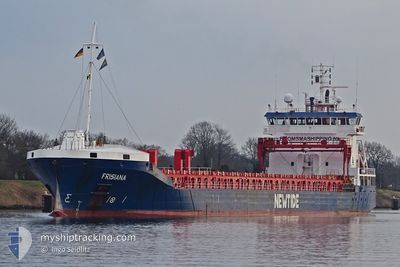
FRISIANA
General Cargo
Current Trip
| Time Travelled | 8 days |
|---|---|
| Remaining Time | 5 days |
| Distance Travelled | 2276.97 nm |
| Remaining Distance | 1290.06 nm |
| AVG Speed | 10.6 Knots |
| MAX Speed | 11.9 Knots |
| AVG Wind | 9.9 knots |
| MAX Wind | 19.1 knots |
| MIN Temp | 14.4°C / 57.92°F |
| MAX Temp | 22.5°C / 72.5°F |
| Draught | 7.2 m |
| Position Received | 3 d ago |
Current Position
| Longitude | -26.78026° |
|---|---|
| Latitude | 35.91967° |
| Status | Under way using engine |
| Speed | 10.9 Knots |
| Course | 237.9° |
| Area | North Atlantic Ocean |
| Station | T-AIS |
| Position Received | 3 d ago |
Info
Information
The current position of FRISIANA is in North Atlantic Ocean with coordinates 35.91967° / -26.78026° as reported on 2024-05-13 11:35 by AIS to our vessel tracker app. The vessel's current speed is 10.9 Knots and is heading at the port of BASSE TERRE. The estimated time of arrival as calculated by MyShipTracking vessel tracking app is 2024-05-22 03:18 LT
The vessel FRISIANA (IMO: 9385893, MMSI: 246602000) is a General Cargo that was built in 2010 ( 14 years old ). It's sailing under the flag of [NL] Netherlands.
In this page you can find informations about the vessels current position, last detected port calls, and current voyage information. If the vessels is not in coverage by AIS you will find the latest position.
The current position of FRISIANA is detected by our AIS receivers and we are not responsible for the reliability of the data. The last position was recorded while the vessel was in Coverage by the Ais receivers of our vessel tracking app.
The current draught of FRISIANA as reported by AIS is 7.2 meters
Weather
| Temperature | 22.1°C / 71.78°F |
|---|---|
| Wind Speed | 7 knots |
| Direction | 115° ESE |
| Pressure | 1020 hPa |
| Humidity | 79.7 % |
| Cloud Coverage | 62 % |
Featured Company
Last Port Calls
| Port | Arrival | Departure | Time In Port |
|---|---|---|---|
| 2024-05-02 15:51 | 2024-05-08 12:24 | 5 d | |
| 2024-04-25 17:12 | 2024-04-29 21:31 | 4 d | |
| 2024-04-16 21:00 | 2024-04-21 08:13 | 4 d | |
| 2024-04-13 02:46 | 2024-04-15 23:42 | 2 d | |
| 2024-04-01 15:44 | 2024-04-03 08:16 | 1 d | |
| 2024-03-25 07:46 | 2024-03-27 13:51 | 2 d | |
| 2024-03-15 09:16 | 2024-03-16 20:13 | 1 d | |
| 2024-03-10 09:19 | 2024-03-11 19:45 | 1 d | |
| 2024-03-07 00:00 | 2024-03-08 15:14 | 1 d | |
| 2024-03-03 04:27 | 2024-03-04 00:14 | 19 h |
Last Trips
| Origin | Departure | Destination | Arrival | Distance | |
|---|---|---|---|---|---|
| 2024-04-29 21:31 | 2024-05-02 15:51 | 648.97 nm | |||
| 2024-04-21 08:13 | 2024-04-25 17:12 | 1056.61 nm | |||
| 2024-04-15 23:42 | 2024-04-16 21:00 | 95.53 nm | |||
| 2024-04-03 08:16 | 2024-04-13 02:46 | 993.90 nm | |||
| 2024-03-27 13:51 | 2024-04-01 15:44 | 675.53 nm | |||
| 2024-03-16 20:13 | 2024-03-25 07:46 | 918.78 nm | |||
| 2024-03-11 19:45 | 2024-03-15 09:16 | 460.48 nm | |||
| 2024-03-08 15:14 | 2024-03-10 09:19 | 474.25 nm | |||
| 2024-03-04 00:14 | 2024-03-07 00:00 | 684.21 nm | |||
| 2024-02-29 17:05 | 2024-03-03 04:27 | 417.70 nm |
Events
| Time | Event | Details | Position / Dest | Info |
|---|---|---|---|---|
| 2024-05-14 10:44 | START Moving |
33.81578 / -30.88602
BASSE TERRE
|
Speed: 5.7 kn Course: 247° |
|
| 2024-05-14 10:06 | STOP Moving |
33.81791 / -30.88249
BASSE TERRE
|
Speed: 0.2 kn Course: 201° |
|
| 2024-05-13 11:46 | Status Changed | Default Under way using engine |
35.90202 / -26.81518
BASSE TERRE
|
Speed: 10.9 kn Course: 237.9° |
| 2024-05-13 11:35 | Status Changed | Under way using engine Default |
35.91967 / -26.78026
BASSE TERRE
|
Speed: 11 kn Course: 240° |
| 2024-05-13 11:35 | OUT of Coverage |
35.91967 / -26.78026
North Atlantic Ocean
BASSE TERRE
|
Speed: 10.9 kn Course: 237.9° |
|
| 2024-05-13 11:19 | Status Changed | Default Under way using engine |
35.94540 / -26.72940
BASSE TERRE
|
Speed: 10.6 kn Course: 239.7° |
| 2024-05-13 10:58 | Status Changed | Under way using engine Default |
35.97790 / -26.66546
BASSE TERRE
|
Speed: 11.5 kn Course: 239° |
| 2024-05-13 10:58 | IN Coverage |
35.97654 / -26.66815
North Atlantic Ocean
BASSE TERRE
|
Speed: 11.5 kn Course: 237.4° |
|
| 2024-05-13 09:34 | Status Changed | Default Under way using engine |
36.11762 / -26.38833
BASSE TERRE
|
Speed: 11 kn Course: 238° |
| 2024-05-13 09:13 | OUT of Coverage |
36.15198 / -26.32028
North Atlantic Ocean
BASSE TERRE
|
Speed: 11 kn Course: 238° |