
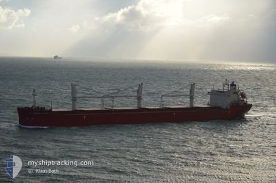
FEDERAL SATSUKI
Bulk Carrier
Current Trip
| Time Travelled | 1 h, 29 mins |
|---|---|
| Remaining Time | 2 days |
| Distance Travelled | 5.49 nm |
| Remaining Distance | 308.44 nm |
| AVG Speed | 5.6 Knots |
| MAX Speed | 6.2 Knots |
| AVG Wind | 3.1 knots |
| MAX Wind | 3.8 knots |
| MIN Temp | 14.3°C / 57.74°F |
| MAX Temp | 14.7°C / 58.46°F |
| Draught | 8.1 m |
| Position Received | Now |
Current Position
| Longitude | -73.56400° |
|---|---|
| Latitude | 45.40812° |
| Status | Under way using engine |
| Speed | 0.5 Knots |
| Course | 270° |
| Area | Gulf of St-Lawrence |
| Station | T-AIS |
| Position Received | Now |
Info
Information
The current position of FEDERAL SATSUKI is in Gulf of St-Lawrence with coordinates 45.40812° / -73.56400° as reported on 2024-05-17 05:51 by AIS to our vessel tracker app. The vessel's current speed is 0.5 Knots and is heading at the port of HAMILTON. The estimated time of arrival as calculated by MyShipTracking vessel tracking app is 2024-05-20 00:01 LT
The vessel FEDERAL SATSUKI (IMO: 9515101, MMSI: 538004642) is a Bulk Carrier that was built in 2012 ( 12 years old ). It's sailing under the flag of [MH] Marshall Is.
In this page you can find informations about the vessels current position, last detected port calls, and current voyage information. If the vessels is not in coverage by AIS you will find the latest position.
The current position of FEDERAL SATSUKI is detected by our AIS receivers and we are not responsible for the reliability of the data. The last position was recorded while the vessel was in Coverage by the Ais receivers of our vessel tracking app.
The current draught of FEDERAL SATSUKI as reported by AIS is 8.1 meters
Weather
| Temperature | 14.7°C / 58.46°F |
|---|---|
| Wind Speed | 3 knots |
| Direction | 60° ENE |
| Pressure | 1012.5 hPa |
| Humidity | 92.3 % |
| Cloud Coverage | 44 % |
Featured Company
Last Port Calls
| Port | Arrival | Departure | Time In Port |
|---|---|---|---|
| 2024-05-16 20:02 | 2024-05-17 00:23 | 4 h | |
| 2024-04-27 16:44 | 2024-05-04 07:28 | 6 d | |
| 2024-04-20 14:13 | 2024-04-24 12:02 | 3 d | |
| 2024-03-09 12:21 | 2024-03-14 20:02 | 5 d | |
| 2024-03-03 10:02 |
Most Visited Ports (Last year)
| Port | Arrivals | |
|---|---|---|
| 7 | ||
| 4 | ||
| 4 | ||
| 3 | ||
| 2 | ||
| 2 |
Last Trips
| Origin | Departure | Destination | Arrival | Distance | |
|---|---|---|---|---|---|
| 2024-05-04 07:28 | 2024-05-16 20:02 | 3514.96 nm | |||
| 2024-04-24 12:02 | 2024-04-27 16:44 | 507.87 nm | |||
| 2024-03-14 20:02 | 2024-04-20 14:13 | 2212.23 nm | |||
| 2024-03-03 10:02 | 2024-03-09 12:21 | 1472.67 nm |
Events
| Time | Event | Details | Position / Dest | Info |
|---|---|---|---|---|
| 2024-05-17 04:23 | PORT DEPARTURE |
|
45.46700 / -73.50359
CAHAM
|
Speed: 6.1 kn Course: 165° |
| 2024-05-17 04:08 | START Moving |
45.49094 / -73.51641
[CA] MONTREAL
|
Speed: 3.2 kn Course: 165° |
|
| 2024-05-17 03:42 | STOP Moving |
45.49467 / -73.51758
[CA] MONTREAL
|
Speed: 0.3 kn Course: 168° |
|
| 2024-05-17 02:40 | START Moving |
45.55237 / -73.52144
[CA] MONTREAL
|
Speed: 3.1 kn Course: 208° |
|
| 2024-05-17 01:56 | Status Changed | Under way using engine At anchor |
45.56112 / -73.51109
[CA] MONTREAL
|
Speed: 0.1 kn Course: 199° |
| 2024-05-17 00:17 | Status Changed | At anchor Under way using engine |
45.56124 / -73.51142
[CA] MONTREAL
|
Speed: 0.3 kn Course: 190° |
| 2024-05-17 00:03 | STOP Moving |
45.56088 / -73.51279
[CA] MONTREAL
|
Speed: 0.3 kn Course: 188° |
|
| 2024-05-17 00:02 | PORT ARRIVAL |
|
45.56097 / -73.51279
[CA] MONTREAL
|
Speed: 0.6 kn Course: 193° |
| 2024-05-16 21:27 | ETA Changed | 2024/05/18 13:00 2024/05/18 06:00 |
45.87686 / -73.25162
CAHAM
|
Speed: 10.2 kn Course: 213.6° |
| 2024-05-16 18:34 | Draught Changed | 8.1 8 |
46.21010 / -72.82269
CAHAM
|
Speed: 11.4 kn Course: 242.1° |