
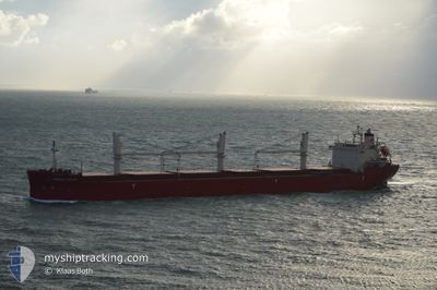
FEDERAL SATSUKI
Bulk Carrier
Current Trip
| Time Travelled | 7 days |
|---|---|
| Remaining Time | --- |
| Distance Travelled | 2109.73 nm |
| Remaining Distance | --- |
| AVG Speed | 12.4 Knopen |
| MAX Speed | 16.1 Knopen |
| AVG Wind | 12.1 knots |
| MAX Wind | 31 knots |
| MIN Temp | 7.1°C / 44.78°F |
| MAX Temp | 23.2°C / 73.76°F |
| Diepgang | 8.3 M |
| Positie ontvangen | 6 d geleden |
Current Position
| Lengtegraad | -68.64335° |
|---|---|
| Breedtegraat | 48.59250° |
| Status | Under way using engine |
| Snelheid | 11.2 Knopen |
| Koers | 57.3° |
| Gebied | Gulf of St-Lawrence |
| Station | T-AIS |
| Positie ontvangen | 6 d geleden |
Info
Information
The current position of FEDERAL SATSUKI is in Gulf of St-Lawrence with coordinates 48.59250° / -68.64335° as reported on 2024-06-07 05:24 by AIS to our vessel tracker app. The vessel's current speed is 11.2 Knopen and is heading at the port of DUBLIN. The estimated time of arrival as calculated by MyShipTracking vessel tracking app is 2024-06-16 20:00 LT
The vessel FEDERAL SATSUKI (IMO: 9515101, MMSI: 538004642) is a Bulk Carrier that was built in 2012 ( 12 Jaar oud ). It's sailing under the flag of [MH] Marshall Is.
In this page you can find informations about the vessels current position, last detected port calls, and current voyage information. If the vessels is not in coverage by AIS you will find the latest position.
The current position of FEDERAL SATSUKI is detected by our AIS receivers and we are not responsible for the reliability of the data. The last position was recorded while the vessel was in Coverage by the Ais receivers of our vessel tracking app.
The current draught of FEDERAL SATSUKI as reported by AIS is 8.3 meters
Weather
| Temperature | 12°C / 53.6°F |
|---|---|
| Wind Speed | 31 knots |
| Direction | 278° W |
| Pressure | 1012.1 hPa |
| Humidity | 78.9 % |
| Cloud Coverage | --- |
Featured Company
Most Visited Ports (Last year)
| Port | Arrivals | |
|---|---|---|
| 6 | ||
| 3 | ||
| 3 | ||
| 2 | ||
| 2 | ||
| 2 |
Last Trips
| Origin | Departure | Destination | Arrival | Distance | |
|---|---|---|---|---|---|
| 2024-06-04 05:15 | 2024-06-05 14:51 | 318.14 nm | |||
| 2024-05-17 00:23 | 2024-05-18 11:06 | 316.93 nm | |||
| 2024-05-04 07:28 | 2024-05-16 20:02 | 3514.96 nm | |||
| 2024-04-24 12:02 | 2024-04-27 16:44 | 507.87 nm | |||
| 2024-03-14 20:02 | 2024-04-20 14:13 | 2212.23 nm |
Events
| Tijd | Evenement | Details | Positie / Bestemming | Info |
|---|---|---|---|---|
| 2024-06-07 05:31 | Status Changed | Default Under way using engine |
48.60518 / -68.61362
IEDUB
|
Snelheid: 11.2 kn Koers: 57.3° |
| 2024-06-07 05:24 | Status Changed | Under way using engine Default |
48.59250 / -68.64335
IEDUB
|
Snelheid: 11.2 kn Koers: 59° |
| 2024-06-07 05:24 | Buitenbereik |
48.59250 / -68.64335
Gulf of St-Lawrence
IEDUB
|
Snelheid: 11.2 kn Koers: 57.3° |
|
| 2024-06-07 05:15 | Binnenbereik |
48.59250 / -68.64335
Gulf of St-Lawrence
IEDUB
|
Snelheid: 11.2 kn Koers: 57.3° |
|
| 2024-06-06 18:33 | Buitenbereik |
47.23135 / -70.57380
Gulf of St-Lawrence
IEDUB
|
Snelheid: 10.4 kn Koers: 39.4° |
|
| 2024-06-06 14:35 | Binnenbereik |
46.70435 / -71.49778
Gulf of St-Lawrence
IEDUB
|
Snelheid: 14.5 kn Koers: 69.7° |
|
| 2024-06-06 09:51 | Status Changed | Default Under way using engine |
46.27244 / -72.62382
IEDUB
|
Snelheid: 13.1 kn Koers: 93.3° |
| 2024-06-06 09:44 | Status Changed | Under way using engine Default |
46.26220 / -72.65831
IEDUB
|
Snelheid: 13.1 kn Koers: 93° |
| 2024-06-06 09:44 | Buitenbereik |
46.26220 / -72.65831
Gulf of St-Lawrence
IEDUB
|
Snelheid: 13.1 kn Koers: 93.3° |
|
| 2024-06-06 09:25 | Status Changed | Default Under way using engine |
46.24240 / -72.75081
IEDUB
|
Snelheid: 12.7 kn Koers: 58.7° |