
EGY SKY
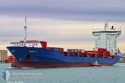
Container Ship
Current Trip
| Time Travelled | 1 day |
|---|---|
| Remaining Time | 1 h, 14 mins |
| Distance Travelled | 335.91 nm |
| Remaining Distance | 15.69 nm |
| AVG Speed | 10 Knots |
| MAX Speed | 11.5 Knots |
| AVG Wind | 7.7 knots |
| MAX Wind | 20.7 knots |
| MIN Temp | 11.1°C / 51.98°F |
| MAX Temp | 23.4°C / 74.12°F |
| Draught | 6.7 m |
| Position Received | 1 m ago |
Current Position
| Longitude | 28.49292° |
|---|---|
| Latitude | 40.82239° |
| Status | Under way using engine |
| Speed | 11.4 Knots |
| Course | 81° |
| Area | Sea of Marmara |
| Station | T-AIS |
| Position Received | 1 m ago |
Info
Information
The current position of EGY SKY is in Sea of Marmara with coordinates 40.82239° / 28.49292° as reported on 2024-05-20 10:48 by AIS to our vessel tracker app. The vessel's current speed is 11.4 Knots and is heading at the port of AMBARLI. The estimated time of arrival as calculated by MyShipTracking vessel tracking app is 2024-05-20 15:03 LT
The vessel EGY SKY (IMO: 9366483, MMSI: 622113177) is a Container Ship that was built in 2007 ( 17 years old ). It's sailing under the flag of [EG] Egypt.
In this page you can find informations about the vessels current position, last detected port calls, and current voyage information. If the vessels is not in coverage by AIS you will find the latest position.
The current position of EGY SKY is detected by our AIS receivers and we are not responsible for the reliability of the data. The last position was recorded while the vessel was in Coverage by the Ais receivers of our vessel tracking app.
The current draught of EGY SKY as reported by AIS is 6.7 meters
Weather
| Temperature | 17.9°C / 64.22°F |
|---|---|
| Wind Speed | 6 knots |
| Direction | 359° N |
| Pressure | 1014.3 hPa |
| Humidity | 71.2 % |
| Cloud Coverage | 97 % |
Featured Company
Last Port Calls
| Port | Arrival | Departure | Time In Port |
|---|---|---|---|
| 2024-05-18 07:40 | 2024-05-19 04:02 | 20 h | |
| 2024-05-15 12:29 | 2024-05-16 04:28 | 15 h | |
| 2024-05-13 09:54 | 2024-05-13 11:44 | 1 h | |
| 2024-05-13 04:29 | 2024-05-13 09:42 | 5 h | |
| 2024-05-13 01:52 | 2024-05-13 03:07 | 1 h | |
| 2024-05-12 23:03 | 2024-05-13 01:24 | 2 h | |
| 2024-05-12 15:52 | 2024-05-12 21:42 | 5 h | |
| 2024-05-11 08:18 | 2024-05-11 19:16 | 10 h | |
| 2024-05-06 15:30 | 2024-05-07 23:03 | 1 d | |
| 2024-05-03 06:40 | 2024-05-05 04:44 | 1 d |
Last Trips
| Origin | Departure | Destination | Arrival | Distance | |
|---|---|---|---|---|---|
| 2024-05-16 04:28 | 2024-05-18 07:40 | 566.53 nm | |||
| 2024-05-13 11:44 | 2024-05-15 12:29 | 366.24 nm | |||
| 2024-05-13 09:42 | 2024-05-13 09:54 | 1.93 nm | |||
| 2024-05-13 03:07 | 2024-05-13 04:29 | 3.37 nm | |||
| 2024-05-13 01:24 | 2024-05-13 01:52 | 12.09 nm | |||
| 2024-05-12 21:42 | 2024-05-12 23:03 | 10.82 nm | |||
| 2024-05-11 19:16 | 2024-05-12 15:52 | 135.37 nm | |||
| 2024-05-07 23:03 | 2024-05-11 08:18 | 1085.54 nm | |||
| 2024-05-05 04:44 | 2024-05-06 15:30 | 361.94 nm | |||
| 2024-05-02 16:10 | 2024-05-03 06:40 | 86.88 nm |
Events
| Time | Event | Details | Position / Dest | Info |
|---|---|---|---|---|
| 2024-05-20 04:09 | Status Changed | Under way using engine Default |
40.51703 / 27.02600
TRKMX
|
Speed: 10.3 kn Course: 66° |
| 2024-05-20 03:55 | IN Coverage |
40.51927 / 27.03289
Sea of Marmara
|
Speed: 10 kn Course: 67.5° |
|
| 2024-05-20 02:16 | Status Changed | Default Under way using engine |
40.37836 / 26.68270
TRKMX
|
Speed: 9.5 kn Course: 46.7° |
| 2024-05-20 02:01 | OUT of Coverage |
40.34936 / 26.65569
Sea of Marmara
|
Speed: 9.5 kn Course: 46.7° |
|
| 2024-05-19 22:23 | Change Sea Area | Turkish part of the Sea of Marmara Turkish part of the Aegean Sea |
40.01854 / 26.19356
Sea of Marmara
|
Speed: 5.7 kn Course: 73° |
| 2024-05-19 21:39 | Change Sea Area | Turkish part of the Aegean Sea Greek part of the Aegean Sea |
39.99431 / 26.08245
Aegean Sea
|
Speed: 8.4 kn Course: 74.6° |
| 2024-05-19 21:39 | Status Changed | Under way using engine Default |
39.99431 / 26.08245
TRKMX
|
Speed: 8.6 kn Course: 75° |
| 2024-05-19 21:20 | IN Coverage |
39.99431 / 26.08245
Aegean Sea
|
Speed: 8.4 kn Course: 74.6° |
|
| 2024-05-19 19:18 | Status Changed | Default Under way using engine |
39.75594 / 25.81206
TRKMX
|
Speed: 9.7 kn Course: 26.4° |
| 2024-05-19 19:11 | OUT of Coverage |
39.73739 / 25.80035
Aegean Sea
|
Speed: 9.7 kn Course: 26.4° |