
EGY SKY
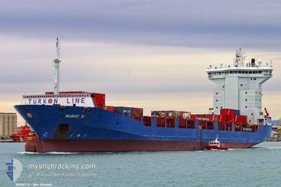
Container Ship
Current Trip
| Time Travelled | 1 day |
|---|---|
| Remaining Time | --- |
| Distance Travelled | 357.01 nm |
| Remaining Distance | --- |
| AVG Speed | 10.5 Knots |
| MAX Speed | 12.2 Knots |
| AVG Wind | 6.2 knots |
| MAX Wind | 14 knots |
| MIN Temp | 20.6°C / 69.08°F |
| MAX Temp | 32.4°C / 90.32°F |
| Dybgang | 6.8 m |
| Position Modtaget | Nu |
Current Position
| Longitude | 28.59107° |
|---|---|
| Latitude | 40.74447° |
| Status | Under way using engine |
| Fart | 0.2 Knots |
| Kurs | 257° |
| Område | Sea of Marmara |
| Station | T-AIS |
| Position Modtaget | Nu |
Info
Information
The current position of EGY SKY is in Sea of Marmara with coordinates 40.74447° / 28.59107° as reported on 2024-06-03 01:31 by AIS to our vessel tracker app. The vessel's current speed is 0.2 Knots
The vessel EGY SKY (IMO: 9366483, MMSI: 622113177) is a Container Ship that was built in 2007 ( 17 år gamle ). It's sailing under the flag of [EG] Egypt.
In this page you can find informations about the vessels current position, last detected port calls, and current voyage information. If the vessels is not in coverage by AIS you will find the latest position.
The current position of EGY SKY is detected by our AIS receivers and we are not responsible for the reliability of the data. The last position was recorded while the vessel was in Coverage by the Ais receivers of our vessel tracking app.
The current draught of EGY SKY as reported by AIS is 6.8 meters
Weather
| Temperature | 20.8°C / 69.44°F |
|---|---|
| Wind Speed | 4 knots |
| Direction | 76° ENE |
| Pressure | 1015.2 hPa |
| Humidity | 74.8 % |
| Cloud Coverage | --- |
Featured Company
Last Port Calls
| Port | Arrival | Departure | Time In Port |
|---|---|---|---|
| 2024-05-31 02:40 | 2024-06-01 15:02 | 1 d | |
| 2024-05-24 20:56 | 2024-05-26 19:25 | 1 d | |
| 2024-05-20 15:49 | 2024-05-21 05:27 | 13 h | |
| 2024-05-18 07:40 | 2024-05-19 04:02 | 20 h | |
| 2024-05-15 12:29 | 2024-05-16 04:28 | 15 h | |
| 2024-05-13 09:54 | 2024-05-13 11:44 | 1 h | |
| 2024-05-13 04:29 | 2024-05-13 09:42 | 5 h | |
| 2024-05-13 01:52 | 2024-05-13 03:07 | 1 h | |
| 2024-05-12 23:03 | 2024-05-13 01:24 | 2 h | |
| 2024-05-12 15:52 | 2024-05-12 21:42 | 5 h |
Last Trips
| Origin | Departure | Destination | Arrival | Distance | |
|---|---|---|---|---|---|
| 2024-05-26 19:25 | 2024-05-31 02:40 | 958.75 nm | |||
| 2024-05-21 05:27 | 2024-05-24 20:56 | 635.61 nm | |||
| 2024-05-19 04:02 | 2024-05-20 15:49 | 353.72 nm | |||
| 2024-05-16 04:28 | 2024-05-18 07:40 | 566.53 nm | |||
| 2024-05-13 11:44 | 2024-05-15 12:29 | 366.24 nm | |||
| 2024-05-13 09:42 | 2024-05-13 09:54 | 1.93 nm | |||
| 2024-05-13 03:07 | 2024-05-13 04:29 | 3.37 nm | |||
| 2024-05-13 01:24 | 2024-05-13 01:52 | 12.09 nm | |||
| 2024-05-12 21:42 | 2024-05-12 23:03 | 10.82 nm | |||
| 2024-05-11 19:16 | 2024-05-12 15:52 | 135.37 nm |
Events
| Tid | Hændelsen | Detaljer | Position / Dest | Info |
|---|---|---|---|---|
| 2024-06-02 21:56 | STOP Sejllads | 13.09 nm, South of AMBARLI |
40.74538 / 28.61947
TRMAD
|
Fart: 0.3 kn Kurs: 303° |
| 2024-06-02 13:54 | Status er ændret | Under way using engine Default |
40.52144 / 27.03743
TRMAD
|
Fart: 11.3 kn Kurs: 67° |
| 2024-06-02 13:54 | Indenfor Dækning |
40.52235 / 27.03998
Sea of Marmara
TRMAD
|
Fart: 11.3 kn Kurs: 64.4° |
|
| 2024-06-02 12:14 | Status er ændret | Default Under way using engine |
40.38426 / 26.68578
TRMAD
|
Fart: 9.9 kn Kurs: 38.2° |
| 2024-06-02 12:02 | Udenfor Dækning |
40.35805 / 26.66378
Sea of Marmara
TRMAD
|
Fart: 9.9 kn Kurs: 38.2° |
|
| 2024-06-02 08:48 | Ændre havområde | Turkish part of the Sea of Marmara Turkish part of the Aegean Sea |
40.01645 / 26.18829
Sea of Marmara
TRMAD
|
Fart: 6.6 kn Kurs: 74.8° |
| 2024-06-02 08:26 | Status er ændret | Under way using engine Default |
40.00202 / 26.12982
TRMAD
|
Fart: 4.4 kn Kurs: 66° |
| 2024-06-02 08:15 | Status er ændret | Default Under way using engine |
39.99557 / 26.11100
TRMAD
|
Fart: 2.8 kn Kurs: 76° |
| 2024-06-02 08:09 | Status er ændret | Under way using engine Default |
39.99475 / 26.10400
TRMAD
|
Fart: 1.9 kn Kurs: 67° |
| 2024-06-02 07:27 | Status er ændret | Default Under way using engine |
39.99217 / 26.07000
TRMAD
|
Fart: 4.7 kn Kurs: 75° |