
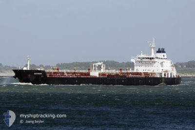
WONDER STAR
Oil/Chemical Tanker
Current Trip
| Time Travelled | 15 days |
|---|---|
| Remaining Time | 3 days |
| Distance Travelled | 2727.76 nm |
| Remaining Distance | 1138.30 nm |
| AVG Speed | 10.5 Knop |
| MAX Speed | 12.6 Knop |
| AVG Wind | 8.8 knots |
| MAX Wind | 17.9 knots |
| MIN Temp | 22.9°C / 73.22°F |
| MAX Temp | 29.6°C / 85.28°F |
| Djupgående | 7.5 m |
| Position mottagen | 24 d sen |
Current Position
| Longitud | -17.58258° |
|---|---|
| Latitude | 11.51895° |
| Status | Under way using engine |
| Fart | 10.3 Knop |
| Kurs | 148° |
| Område | North Atlantic Ocean |
| Station | T-AIS |
| Position mottagen | 24 d sen |
Info
Information
The current position of WONDER STAR is in North Atlantic Ocean with coordinates 11.51895° / -17.58258° as reported on 2024-05-08 05:38 by AIS to our vessel tracker app. The vessel's current speed is 10.3 Knop and is heading at the port of DAKAR. The estimated time of arrival as calculated by MyShipTracking vessel tracking app is 2024-06-05 23:41 LT
The vessel WONDER STAR (IMO: 9327425, MMSI: 636023490) is a Oil/Chemical Tanker that was built in 2006 ( 18 År gammal ). It's sailing under the flag of [LR] Liberia.
In this page you can find informations about the vessels current position, last detected port calls, and current voyage information. If the vessels is not in coverage by AIS you will find the latest position.
The current position of WONDER STAR is detected by our AIS receivers and we are not responsible for the reliability of the data. The last position was recorded while the vessel was in Coverage by the Ais receivers of our vessel tracking app.
The current draught of WONDER STAR as reported by AIS is 7.5 meters
Weather
| Temperature | 27.1°C / 80.78°F |
|---|---|
| Wind Speed | 10 knots |
| Direction | 213° SSW |
| Pressure | 1013.4 hPa |
| Humidity | 80.2 % |
| Cloud Coverage | 96 % |
Featured Company
Events
| Tid | Event | Detaljer | Position / Dest | Information |
|---|---|---|---|---|
| 2024-05-28 15:43 | STARTAR förflyttning | 4.62 nm, East of GOREE |
14.64217 / -17.32378
SN DKR
|
Fart: 3.8 kn Kurs: 175° |
| 2024-05-28 07:27 | STOPPAR förflyttning | 4.48 nm, South East of GOREE |
14.64042 / -17.32710
SN DKR
|
Fart: 0.2 kn Kurs: 9° |
| 2024-05-28 06:47 | STARTAR förflyttning | 5.15 nm, South of RUFISQUE |
14.63008 / -17.30730
SN DKR
|
Fart: 4 kn Kurs: 192° |
| 2024-05-26 13:11 | STOPPAR förflyttning | 5.47 nm, South East of GOREE |
14.62497 / -17.31595
SN DKR
|
Fart: Kurs: 9° |
| 2024-05-26 11:43 | STARTAR förflyttning | 5.39 nm, South of RUFISQUE |
14.62485 / -17.30400
SN DKR
|
Fart: 5.2 kn Kurs: 191° |
| 2024-05-26 06:05 | Djupgående ändrat | 7.5 9.2 |
14.62668 / -17.30717
SN DKR
|
Fart: 0.1 kn Kurs: 333° |
| 2024-05-26 06:05 | Destination ändrad | SN DKR TGLFW |
14.62668 / -17.30717
SN DKR
|
Fart: 0.1 kn Kurs: 333° |
| 2024-05-26 06:05 | ETA ändrat | 2024/05/25 20:00 2024/05/13 09:00 |
14.62668 / -17.30717
SN DKR
|
Fart: 0.1 kn Kurs: 333° |
| 2024-05-25 20:59 | STOPPAR förflyttning | 5.24 nm, South of RUFISQUE |
14.62903 / -17.30910
TGLFW
|
Fart: 0.3 kn Kurs: 72° |