
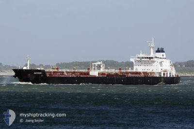
WONDER STAR
Oil/Chemical Tanker
Current Trip
TGLFW
| Time Travelled | 2 days |
|---|---|
| Remaining Time | --- |
| Distance Travelled | 311.02 nm |
| Remaining Distance | --- |
| AVG Speed | 10.3 Knopen |
| MAX Speed | 10.9 Knopen |
| AVG Wind | 10.3 knots |
| MAX Wind | 17.9 knots |
| MIN Temp | 27.2°C / 80.96°F |
| MAX Temp | 29°C / 84.2°F |
| Diepgang | 9.2 M |
| Positie ontvangen | 12 d geleden |
Current Position
| Lengtegraad | -17.58258° |
|---|---|
| Breedtegraat | 11.51895° |
| Status | Under way using engine |
| Snelheid | 10.3 Knopen |
| Koers | 148° |
| Gebied | North Atlantic Ocean |
| Station | T-AIS |
| Positie ontvangen | 12 d geleden |
Info
Information
The current position of WONDER STAR is in North Atlantic Ocean with coordinates 11.51895° / -17.58258° as reported on 2024-05-08 05:38 by AIS to our vessel tracker app. The vessel's current speed is 10.3 Knopen
The vessel WONDER STAR (IMO: 9327425, MMSI: 636023490) is a Oil/Chemical Tanker that was built in 2006 ( 18 Jaar oud ). It's sailing under the flag of [LR] Liberia.
In this page you can find informations about the vessels current position, last detected port calls, and current voyage information. If the vessels is not in coverage by AIS you will find the latest position.
The current position of WONDER STAR is detected by our AIS receivers and we are not responsible for the reliability of the data. The last position was recorded while the vessel was in Coverage by the Ais receivers of our vessel tracking app.
The current draught of WONDER STAR as reported by AIS is 9.2 meters
Weather
| Temperature | 28.5°C / 83.3°F |
|---|---|
| Wind Speed | 12 knots |
| Direction | 219° SW |
| Pressure | 1011.7 hPa |
| Humidity | 77.1 % |
| Cloud Coverage | 98 % |
Featured Company
Last Port Calls
| Port | Arrival | Departure | Time In Port |
|---|---|---|---|
| 2024-05-14 21:24 | 2024-05-17 21:36 | 3 d | |
| 2024-05-01 08:46 | 2024-05-02 09:28 | 1 d | |
| 2024-04-19 19:44 | 2024-04-21 16:42 | 1 d | |
| 2024-04-10 19:55 | 2024-04-11 18:34 | 22 h | |
| 2024-03-28 21:11 | 2024-03-29 17:17 | 20 h | |
| 2024-03-21 00:50 | 2024-03-22 04:50 | 1 d | |
| 2024-03-12 12:27 | 2024-03-13 18:46 | 1 d |
Last Trips
| Origin | Departure | Destination | Arrival | Distance | |
|---|---|---|---|---|---|
| 2024-05-02 09:28 | 2024-05-14 21:24 | 2081.75 nm | |||
| 2024-04-21 16:42 | 2024-05-01 08:46 | 1006.96 nm | |||
| 2024-04-11 18:34 | 2024-04-19 19:44 | 1009.04 nm | |||
| 2024-03-29 17:17 | 2024-04-10 19:55 | 1023.06 nm | |||
| 2024-03-22 04:50 | 2024-03-28 21:11 | 540.65 nm | |||
| 2024-03-13 18:46 | 2024-03-21 00:50 | 501.63 nm |
Events
| Tijd | Evenement | Details | Positie / Bestemming | Info |
|---|---|---|---|---|
| 2024-05-19 15:33 | Start beweging | 2.48 nm, South of LOME |
6.09648 / 1.29313
TGLFW
|
Snelheid: 4 kn Koers: 108° |
| 2024-05-17 22:08 | Stop beweging | 2.36 nm, South of LOME |
6.09825 / 1.29153
TGLFW
|
Snelheid: 0.2 kn Koers: 217° |
| 2024-05-17 21:36 | Vertrekhaven |
|
6.13480 / 1.29803
TGLFW
|
Snelheid: 3.8 kn Koers: 94° |
| 2024-05-17 21:32 | Start beweging |
6.13563 / 1.29185
[TG] LOME
|
Snelheid: 3.8 kn Koers: 94° |
|
| 2024-05-14 21:51 | Stop beweging |
6.13955 / 1.28958
[TG] LOME
|
Snelheid: 0.1 kn Koers: 181° |
|
| 2024-05-14 21:24 | Aankomsthaven |
|
6.13602 / 1.28917
[TG] LOME
|
Snelheid: 4.9 kn Koers: 280° |
| 2024-05-14 20:00 | Start beweging | 7.46 nm, South of LOME |
6.02067 / 1.33133
TGLFW
|
Snelheid: 3.7 kn Koers: 14° |
| 2024-05-13 10:08 | Stop beweging | 7.62 nm, South of LOME |
6.01785 / 1.33143
TGLFW
|
Snelheid: 0.1 kn Koers: 300° |