
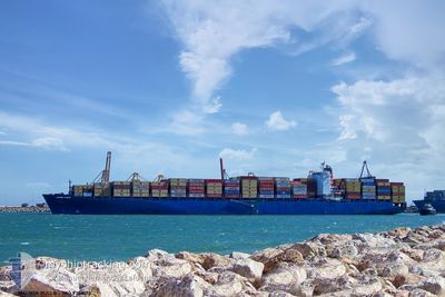
MAERSK PUELO
Container Ship
Current Trip
| Time Travelled | 1 day |
|---|---|
| Remaining Time | 5 h, 22 mins |
| Distance Travelled | 171.31 морская миля |
| Remaining Distance | 17.63 морская миля |
| AVG Speed | 6 Узлы |
| MAX Speed | 19.5 Узлы |
| AVG Wind | 13.3 knots |
| MAX Wind | 17.8 knots |
| MIN Temp | 25.9°C / 78.62°F |
| MAX Temp | 27.5°C / 81.5°F |
| Осадка | 13.4 м |
| Позиция Получена | 1 m тому назад |
Current Position
| Долгота | -79.83776° |
|---|---|
| Широта | 25.88629° |
| Статус | Under way using engine |
| Скорость | 2.9 Узлы |
| Курс | 342° |
| Район | North Atlantic Ocean |
| Станция | T-AIS |
| Позиция Получена | 1 m тому назад |
Info
Information
The current position of MAERSK PUELO is in North Atlantic Ocean with coordinates 25.88629° / -79.83776° as reported on 2024-06-03 14:41 by AIS to our vessel tracker app. The vessel's current speed is 2.9 Узлы and is heading at the port of MIAMI. The estimated time of arrival as calculated by MyShipTracking vessel tracking app is 2024-06-03 20:04 LT
The vessel MAERSK PUELO (IMO: 9306172, MMSI: 353117000) is a Container Ship that was built in 2006 ( 18 лет ). It's sailing under the flag of [PA] Panama.
In this page you can find informations about the vessels current position, last detected port calls, and current voyage information. If the vessels is not in coverage by AIS you will find the latest position.
The current position of MAERSK PUELO is detected by our AIS receivers and we are not responsible for the reliability of the data. The last position was recorded while the vessel was in Coverage by the Ais receivers of our vessel tracking app.
The current draught of MAERSK PUELO as reported by AIS is 13.4 meters
Weather
| Temperature | 26.5°C / 79.7°F |
|---|---|
| Wind Speed | 12 knots |
| Direction | 74° ENE |
| Pressure | 1015.4 hPa |
| Humidity | 75 % |
| Cloud Coverage | 25 % |
Featured Company
Last Port Calls
| Port | Arrival | Departure | Time In Port |
|---|---|---|---|
| 2024-06-02 00:04 | 2024-06-02 12:08 | 12 h | |
| 2024-05-22 11:07 | 2024-05-23 03:01 | 15 h | |
| 2024-05-19 17:01 | 2024-05-20 06:59 | 13 h | |
| 2024-05-17 19:52 | 2024-05-18 15:19 | 19 h | |
| 2024-05-15 12:56 | 2024-05-16 00:38 | 11 h | |
| 2024-05-09 15:34 | 2024-05-11 08:06 | 1 d | |
| 2024-05-05 09:14 | 2024-05-07 08:01 | 1 d | |
| 2024-04-30 18:25 | 2024-05-01 17:40 | 23 h | |
| 2024-04-25 17:20 | 2024-04-26 08:06 | 14 h | |
| 2024-04-13 05:32 | 2024-04-14 07:43 | 1 d |
Last Trips
| Origin | Departure | Destination | Arrival | Distance | |
|---|---|---|---|---|---|
| 2024-05-23 04:01 | 2024-06-01 20:04 | 3700.86 морская миля | |||
| 2024-05-20 08:59 | 2024-05-22 12:07 | 350.82 морская миля | |||
| 2024-05-18 17:19 | 2024-05-19 19:01 | 403.92 морская миля | |||
| 2024-05-16 02:38 | 2024-05-17 21:52 | 195.55 морская миля | |||
| 2024-05-11 10:06 | 2024-05-15 14:56 | 466.80 морская миля | |||
| 2024-05-07 10:01 | 2024-05-09 17:34 | 378.24 морская миля | |||
| 2024-05-01 19:40 | 2024-05-05 11:14 | 331.06 морская миля | |||
| 2024-04-26 10:06 | 2024-04-30 20:25 | 1073.82 морская миля | |||
| 2024-04-14 02:43 | 2024-04-25 19:20 | 4683.10 морская миля | |||
| 2024-04-10 13:58 | 2024-04-13 00:32 | 473.91 морская миля |
Events
| Время | Событие | Детали | Позиция / Направление | Информация |
|---|---|---|---|---|
| 2024-06-02 22:29 | ETA изменился | 2024/06/04 14:00 2024/06/05 18:00 |
26.00344 / -79.92968
USMIA
|
Скорость: 5.1 kn Курс: 175.5° |
| 2024-06-02 15:52 | Изменение морского района | United States part of the North Atlantic Ocean Bahamas part of the North Atlantic Ocean |
25.77842 / -79.71740
North Atlantic Ocean
USMIA
|
Скорость: 17.1 kn Курс: 237.5° |
| 2024-06-02 14:45 | Осадка изменилась | 13.4 13 |
25.97587 / -79.42504
USMIA
|
Скорость: 18.1 kn Курс: 229.1° |
| 2024-06-02 14:45 | Пункт назначения изменился | USMIA BSFPO |
25.97587 / -79.42504
USMIA
|
Скорость: 18.1 kn Курс: 229.1° |
| 2024-06-02 14:45 | ETA изменился | 2024/06/05 18:00 |
25.97587 / -79.42504
USMIA
|
Скорость: 18.1 kn Курс: 229.1° |
| 2024-06-02 14:28 | Статус изменился | Under way using engine Default |
26.03148 / -79.35535
BSFPO
|
Скорость: 19.6 kn Курс: 228° |
| 2024-06-02 14:28 | В покрытии |
26.03148 / -79.35535
North Atlantic Ocean
|
Скорость: 18.8 kn Курс: 229.5° |
|
| 2024-06-02 12:08 | ПОРТ ОТПРАВЛЕНИЯ |
|
26.51540 / -78.77776
BSFPO
|
Скорость: 3.4 kn Курс: 202° |
| 2024-06-02 11:52 | Начало движения |
26.52482 / -78.76611
[BS] FREEPORT (BS)
|
Скорость: 3.5 kn Курс: 232° |
|
| 2024-06-02 00:48 | Окончание движения |
26.53031 / -78.76299
[BS] FREEPORT (BS)
|
Скорость: 0.3 kn Курс: 221° |