
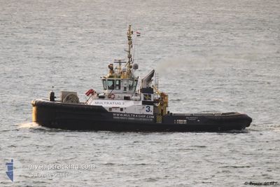
MULTRATUG 3
Tug
Current Trip
| Time Travelled | 6 days |
|---|---|
| Remaining Time | 9 h, 11 mins |
| Distance Travelled | 1248.19 nm |
| Remaining Distance | 182.83 nm |
| AVG Speed | 7.9 Knopen |
| MAX Speed | 10.4 Knopen |
| AVG Wind | 13.3 knots |
| MAX Wind | 20.1 knots |
| MIN Temp | 12.2°C / 53.96°F |
| MAX Temp | 17.1°C / 62.78°F |
| Diepgang | 6.5 M |
| Positie ontvangen | 13 h, 35 m geleden |
Current Position
| Lengtegraad | -9.79494° |
|---|---|
| Breedtegraat | 37.68367° |
| Status | Under way using engine |
| Snelheid | 9.6 Knopen |
| Koers | 167.1° |
| Gebied | North Atlantic Ocean |
| Station | T-AIS |
| Positie ontvangen | 13 h, 35 m geleden |
Info
Information
The current position of MULTRATUG 3 is in North Atlantic Ocean with coordinates 37.68367° / -9.79494° as reported on 2024-05-18 20:26 by AIS to our vessel tracker app. The vessel's current speed is 9.6 Knopen and is heading at the port of CADIZ. The estimated time of arrival as calculated by MyShipTracking vessel tracking app is 2024-05-19 21:13 LT
The vessel MULTRATUG 3 (IMO: 9537408, MMSI: 244890607) is a Tug that was built in 2010 ( 14 Jaar oud ). It's sailing under the flag of [NL] Netherlands.
In this page you can find informations about the vessels current position, last detected port calls, and current voyage information. If the vessels is not in coverage by AIS you will find the latest position.
The current position of MULTRATUG 3 is detected by our AIS receivers and we are not responsible for the reliability of the data. The last position was recorded while the vessel was in Coverage by the Ais receivers of our vessel tracking app.
The current draught of MULTRATUG 3 as reported by AIS is 6.5 meters
Weather
| Temperature | 16.1°C / 60.98°F |
|---|---|
| Wind Speed | 10 knots |
| Direction | 315° NW |
| Pressure | 1014.7 hPa |
| Humidity | 77.1 % |
| Cloud Coverage | 6 % |
Featured Company
Last Port Calls
| Port | Arrival | Departure | Time In Port |
|---|---|---|---|
| 2024-05-10 16:29 | 2024-05-13 00:18 | 2 d | |
| 2024-04-28 07:03 | 2024-05-03 14:00 | 5 d | |
| 2024-04-23 10:27 | 2024-04-24 12:59 | 1 d | |
| 2024-04-18 02:00 | 2024-04-18 14:02 | 12 h | |
| 2024-04-18 00:33 | 2024-04-18 01:13 | 40 m | |
| 2024-04-13 13:07 | 2024-04-17 23:02 | 4 d | |
| 2024-04-12 18:27 | 2024-04-13 12:22 | 17 h | |
| 2024-04-12 12:15 | 2024-04-12 17:44 | 5 h | |
| 2024-04-12 09:01 | 2024-04-12 11:31 | 2 h | |
| 2024-04-12 08:06 | 2024-04-12 08:44 | 38 m |
Most Visited Ports (Last year)
| Port | Arrivals | |
|---|---|---|
| 93 | ||
| 39 | ||
| 16 | ||
| 8 | ||
| 5 | ||
| 4 |
Last Trips
| Origin | Departure | Destination | Arrival | Distance | |
|---|---|---|---|---|---|
| 2024-05-03 14:00 | 2024-05-10 16:29 | 591.72 nm | |||
| 2024-04-24 12:59 | 2024-04-28 07:03 | 330.15 nm | |||
| 2024-04-18 14:02 | 2024-04-23 10:27 | 671.72 nm | |||
| 2024-04-18 01:13 | 2024-04-18 02:00 | 7.13 nm | |||
| 2024-04-17 23:02 | 2024-04-18 00:33 | 7.84 nm | |||
| 2024-04-13 12:22 | 2024-04-13 13:07 | 4.98 nm | |||
| 2024-04-12 17:44 | 2024-04-12 18:27 | 4.82 nm | |||
| 2024-04-12 11:31 | 2024-04-12 12:15 | 5.71 nm | |||
| 2024-04-12 08:44 | 2024-04-12 09:01 | 3.08 nm | |||
| 2024-04-12 07:30 | 2024-04-12 08:06 | 3.01 nm |
Events
| Tijd | Evenement | Details | Positie / Bestemming | Info |
|---|---|---|---|---|
| 2024-05-18 20:34 | Status Changed | Default Under way using engine |
37.66169 / -9.78849
ESCAD
|
Snelheid: 9.6 kn Koers: 167.1° |
| 2024-05-18 20:26 | Status Changed | Under way using engine Default |
37.68367 / -9.79494
ESCAD
|
Snelheid: 9.8 kn Koers: 166° |
| 2024-05-18 20:26 | Buitenbereik |
37.68367 / -9.79494
North Atlantic Ocean
ESCAD
|
Snelheid: 9.6 kn Koers: 167.1° |
|
| 2024-05-18 19:59 | Status Changed | Default Under way using engine |
37.75333 / -9.81667
ESCAD
|
Snelheid: 9.2 kn Koers: 164.9° |
| 2024-05-18 14:27 | Status Changed | Under way using engine Default |
38.60254 / -10.05478
ESCAD
|
Snelheid: 9.3 kn Koers: 167° |
| 2024-05-18 13:53 | Status Changed | Default Under way using engine |
38.68500 / -10.07667
ESCAD
|
Snelheid: 9 kn Koers: 167.4° |
| 2024-05-18 12:35 | Status Changed | Under way using engine Default |
38.88639 / -10.07704
ESCAD
|
Snelheid: 9.4 kn Koers: 182° |
| 2024-05-18 12:30 | Status Changed | Default Under way using engine |
38.89978 / -10.07622
ESCAD
|
Snelheid: 9.4 kn Koers: 185.4° |
| 2024-05-18 08:17 | ETA Changed | 2024/05/19 22:00 2024/05/19 18:00 |
39.55344 / -10.05612
ESCAD
|
Snelheid: 9.4 kn Koers: 179° |
| 2024-05-18 08:01 | Gevonden in zee | Portuguese part of the North Atlantic Ocean |
39.59242 / -10.05665
North Atlantic Ocean
ESCAD
|
Snelheid: 9.6 kn Koers: 177.9° |