
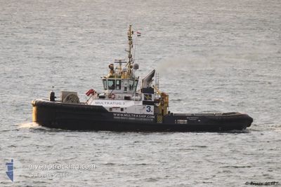
MULTRATUG 3
Tug
Current Trip
FR LRH TOW
| Time Travelled | 6 days |
|---|---|
| Remaining Time | --- |
| Distance Travelled | 804.96 nm |
| Remaining Distance | --- |
| AVG Speed | 4.5 Noeuds |
| MAX Speed | 7.4 Noeuds |
| AVG Wind | 16.8 knots |
| MAX Wind | 24 knots |
| MIN Temp | 13.9°C / 57.02°F |
| MAX Temp | 18.6°C / 65.48°F |
| Tirant d eau | 6.5 m |
| Position reçue | 1 d depuis |
Current Position
| Longitude | -8.85693° |
|---|---|
| Latitude | 43.67901° |
| Etat | Under way using engine |
| Vitesse | 5.7 Noeuds |
| Parcours | 66.1° |
| Zone | North Atlantic Ocean |
| Station | T-AIS |
| Position reçue | 1 d depuis |
Info
Information
The current position of MULTRATUG 3 is in North Atlantic Ocean with coordinates 43.67901° / -8.85693° as reported on 2024-05-26 04:43 by AIS to our vessel tracker app. The vessel's current speed is 5.7 Noeuds
The vessel MULTRATUG 3 (IMO: 9537408, MMSI: 244890607) is a Tug that was built in 2010 ( 14 Age ). It's sailing under the flag of [NL] Netherlands.
In this page you can find informations about the vessels current position, last detected port calls, and current voyage information. If the vessels is not in coverage by AIS you will find the latest position.
The current position of MULTRATUG 3 is detected by our AIS receivers and we are not responsible for the reliability of the data. The last position was recorded while the vessel was in Coverage by the Ais receivers of our vessel tracking app.
The current draught of MULTRATUG 3 as reported by AIS is 6.5 meters
Weather
| Temperature | 14.5°C / 58.1°F |
|---|---|
| Wind Speed | 10 knots |
| Direction | 241° WSW |
| Pressure | 1023.6 hPa |
| Humidity | 72.6 % |
| Cloud Coverage | 25 % |
Featured Company
Last Port Calls
| Port | Arrival | Departure | Time In Port |
|---|---|---|---|
| 2024-05-20 13:36 | 2024-05-21 17:20 | 1 d | |
| 2024-05-19 21:47 | 2024-05-20 13:12 | 15 h | |
| 2024-05-10 16:29 | 2024-05-13 00:18 | 2 d | |
| 2024-04-28 07:03 | 2024-05-03 14:00 | 5 d | |
| 2024-04-23 10:27 | 2024-04-24 12:59 | 1 d | |
| 2024-04-18 02:00 | 2024-04-18 14:02 | 12 h | |
| 2024-04-18 00:33 | 2024-04-18 01:13 | 40 m | |
| 2024-04-13 13:07 | 2024-04-17 23:02 | 4 d | |
| 2024-04-12 18:27 | 2024-04-13 12:22 | 17 h | |
| 2024-04-12 12:15 | 2024-04-12 17:44 | 5 h |
Most Visited Ports (Last year)
| Port | Arrivals | |
|---|---|---|
| 93 | ||
| 39 | ||
| 16 | ||
| 8 | ||
| 5 | ||
| 4 |
Last Trips
| Origin | Departure | Destination | Arrival | Distance | |
|---|---|---|---|---|---|
| 2024-05-20 13:12 | 2024-05-20 13:36 | 2.00 nm | |||
| 2024-05-13 00:18 | 2024-05-19 21:47 | 1344.10 nm | |||
| 2024-05-03 14:00 | 2024-05-10 16:29 | 591.72 nm | |||
| 2024-04-24 12:59 | 2024-04-28 07:03 | 330.15 nm | |||
| 2024-04-18 14:02 | 2024-04-23 10:27 | 671.72 nm | |||
| 2024-04-18 01:13 | 2024-04-18 02:00 | 7.13 nm | |||
| 2024-04-17 23:02 | 2024-04-18 00:33 | 7.84 nm | |||
| 2024-04-13 12:22 | 2024-04-13 13:07 | 4.98 nm | |||
| 2024-04-12 17:44 | 2024-04-12 18:27 | 4.82 nm | |||
| 2024-04-12 11:31 | 2024-04-12 12:15 | 5.71 nm |
Events
| Heure | Evenement | Détails | Position/ Destination | Info |
|---|---|---|---|---|
| 2024-05-26 04:56 | Etat Changé | Default Under way using engine |
43.68667 / -8.83167
FR LRH TOW
|
Vitesse: 5.7 kn Parcours: 66.1° |
| 2024-05-26 04:43 | Hors de la zone couverte |
43.67901 / -8.85693
North Atlantic Ocean
FR LRH TOW
|
Vitesse: 5.7 kn Parcours: 66.1° |
|
| 2024-05-26 04:35 | Etat Changé | Under way using engine Default |
43.67323 / -8.87221
FR LRH TOW
|
Vitesse: 5 kn Parcours: 61° |
| 2024-05-26 04:29 | Etat Changé | Default Under way using engine |
43.66833 / -8.88333
FR LRH TOW
|
Vitesse: 5.5 kn Parcours: 63.6° |
| 2024-05-26 03:51 | Etat Changé | Under way using engine Default |
43.63992 / -8.95643
FR LRH TOW
|
Vitesse: 5 kn Parcours: 60° |
| 2024-05-26 03:44 | Etat Changé | Default Under way using engine |
43.63500 / -8.96833
FR LRH TOW
|
Vitesse: 5.4 kn Parcours: 61° |
| 2024-05-26 02:43 | Etat Changé | Under way using engine Default |
43.58718 / -9.08974
FR LRH TOW
|
Vitesse: 6 kn Parcours: 59° |
| 2024-05-26 02:41 | Etat Changé | Default Under way using engine |
43.58500 / -9.09333
FR LRH TOW
|
Vitesse: 6 kn Parcours: 56.6° |
| 2024-05-26 00:41 | Etat Changé | Under way using engine Default |
43.50094 / -9.32282
FR LRH TOW
|
Vitesse: 5 kn Parcours: 62° |
| 2024-05-26 00:38 | Dans la zone couverte |
43.50225 / -9.31899
North Atlantic Ocean
FR LRH TOW
|
Vitesse: 5.5 kn Parcours: 65.7° |