
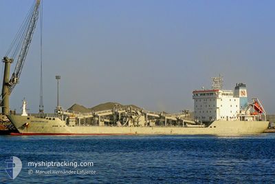
BLUE CIMENT 1
Cement Carrier
Current Trip
| Time Travelled | 12 days |
|---|---|
| Remaining Time | 4 days |
| Distance Travelled | 2986.47 nm |
| Remaining Distance | 1102.90 nm |
| AVG Speed | 10.3 Knopen |
| MAX Speed | 14.8 Knopen |
| AVG Wind | 11 knots |
| MAX Wind | 30.9 knots |
| MIN Temp | 8.4°C / 47.12°F |
| MAX Temp | 21.2°C / 70.16°F |
| Diepgang | 6 M |
| Positie ontvangen | 46 m geleden |
Current Position
| Lengtegraad | 14.60097° |
|---|---|
| Breedtegraat | 36.46430° |
| Status | Under way using engine |
| Snelheid | 10.2 Knopen |
| Koers | 109.5° |
| Gebied | Mediterranean Sea - Eastern Basin |
| Station | T-AIS |
| Positie ontvangen | 46 m geleden |
Info
Information
The current position of BLUE CIMENT 1 is in Mediterranean Sea - Eastern Basin with coordinates 36.46430° / 14.60097° as reported on 2024-05-18 05:58 by AIS to our vessel tracker app. The vessel's current speed is 10.2 Knopen and is heading at the port of ISKENDERUN. The estimated time of arrival as calculated by MyShipTracking vessel tracking app is 2024-05-22 23:08 LT
The vessel BLUE CIMENT 1 (IMO: 9372640, MMSI: 636020268) is a Cement Carrier that was built in 2007 ( 17 Jaar oud ). It's sailing under the flag of [LR] Liberia.
In this page you can find informations about the vessels current position, last detected port calls, and current voyage information. If the vessels is not in coverage by AIS you will find the latest position.
The current position of BLUE CIMENT 1 is detected by our AIS receivers and we are not responsible for the reliability of the data. The last position was recorded while the vessel was in Coverage by the Ais receivers of our vessel tracking app.
The current draught of BLUE CIMENT 1 as reported by AIS is 6 meters
Weather
| Temperature | 20.1°C / 68.18°F |
|---|---|
| Wind Speed | 1 knots |
| Direction | 226° SW |
| Pressure | 1014 hPa |
| Humidity | 78.7 % |
| Cloud Coverage | 100 % |
Featured Company
Events
| Tijd | Evenement | Details | Positie / Bestemming | Info |
|---|---|---|---|---|
| 2024-05-18 05:59 | Status Changed | Default Under way using engine |
36.46321 / 14.60486
NOBVK>>TRISK
|
Snelheid: 10.2 kn Koers: 109.5° |
| 2024-05-18 05:45 | Status Changed | Under way using engine Default |
36.47614 / 14.55742
NOBVK>>TRISK
|
Snelheid: 10.2 kn Koers: 107° |
| 2024-05-18 05:03 | Status Changed | Default Under way using engine |
36.50976 / 14.41890
NOBVK>>TRISK
|
Snelheid: 10.1 kn Koers: 106.4° |
| 2024-05-17 22:03 | Status Changed | Under way using engine Default |
36.85305 / 13.03362
NOBVK>>TRISK
|
Snelheid: 9.7 kn Koers: 105° |
| 2024-05-17 21:49 | Status Changed | Default Under way using engine |
36.86402 / 12.98466
NOBVK>>TRISK
|
Snelheid: 9.8 kn Koers: 108.1° |
| 2024-05-17 16:32 | Wijzig zee gebeid | Italian part of the Mediterranean Sea - Eastern Basin Tunisian part of the Mediterranean Sea - Eastern Basin |
37.12438 / 11.94917
Mediterranean Sea - Eastern Basin
NOBVK>>TRISK
|
Snelheid: 9.5 kn Koers: 105.7° |
| 2024-05-17 13:41 | Wijzig zee gebeid | Tunisian part of the Mediterranean Sea - Eastern Basin Tunisian part of the Mediterranean Sea - Western Basin |
37.26281 / 11.38835
Mediterranean Sea - Eastern Basin
NOBVK>>TRISK
|
Snelheid: 10.4 kn Koers: 114.5° |
| 2024-05-17 12:46 | ETA Changed | 2024/05/23 12:00 2024/05/24 07:00 |
37.34931 / 11.21835
NOBVK>>TRISK
|
Snelheid: 10.6 kn Koers: 122.6° |
| 2024-05-17 12:07 | Status Changed | Under way using engine Default |
37.41071 / 11.09512
NOBVK>>TRISK
|
Snelheid: 10.5 kn Koers: 117° |
| 2024-05-17 11:47 | Status Changed | Default Under way using engine |
37.43833 / 11.03167
NOBVK>>TRISK
|
Snelheid: 10.4 kn Koers: 98.6° |