
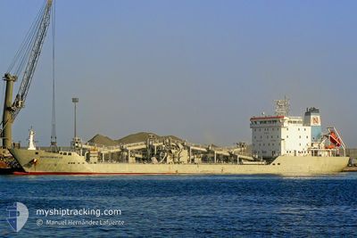
BLUE CIMENT 1
Cement Carrier
Current Trip
| Time Travelled | 18 days |
|---|---|
| Remaining Time | --- |
| Distance Travelled | 3894.73 nm |
| Remaining Distance | --- |
| AVG Speed | 8.5 Knots |
| MAX Speed | 11 Knots |
| AVG Wind | 11.9 knots |
| MAX Wind | 28 knots |
| MIN Temp | 11.8°C / 53.24°F |
| MAX Temp | 28°C / 82.4°F |
| Dybgang | 8.3 m |
| Position Modtaget | 3 m siden |
Current Position
| Longitude | 11.68169° |
|---|---|
| Latitude | 57.57573° |
| Status | At anchor |
| Fart | |
| Kurs | 160° |
| Område | Kattegat |
| Station | T-AIS |
| Position Modtaget | 3 m siden |
Info
Information
The current position of BLUE CIMENT 1 is in Kattegat with coordinates 57.57573° / 11.68169° as reported on 2024-06-16 13:18 by AIS to our vessel tracker app. The vessel's current speed is 0 Knots
The vessel BLUE CIMENT 1 (IMO: 9372640, MMSI: 636020268) is a Cement Carrier that was built in 2007 ( 17 år gamle ). It's sailing under the flag of [LR] Liberia.
In this page you can find informations about the vessels current position, last detected port calls, and current voyage information. If the vessels is not in coverage by AIS you will find the latest position.
The current position of BLUE CIMENT 1 is detected by our AIS receivers and we are not responsible for the reliability of the data. The last position was recorded while the vessel was in Coverage by the Ais receivers of our vessel tracking app.
The current draught of BLUE CIMENT 1 as reported by AIS is 8.3 meters
Weather
| Temperature | 15.7°C / 60.26°F |
|---|---|
| Wind Speed | 17 knots |
| Direction | 149° SSE |
| Pressure | 1008.2 hPa |
| Humidity | 73.3 % |
| Cloud Coverage | 100 % |
Featured Company
Last Trips
| Origin | Departure | Destination | Arrival | Distance | |
|---|---|---|---|---|---|
| 2024-05-25 12:56 | 2024-05-25 14:53 | 16.31 nm | |||
| 2024-05-06 03:30 | 2024-05-23 15:32 | 4042.24 nm | |||
| 2024-04-10 13:53 | 2024-05-01 12:42 | 3917.60 nm | |||
| 2024-04-02 18:47 | 2024-04-09 08:25 | 1092.00 nm |
Events
| Tid | Hændelsen | Detaljer | Position / Dest | Info |
|---|---|---|---|---|
| 2024-06-16 06:15 | Status er ændret | At anchor Under way using engine |
57.57545 / 11.68254
TRCEY>SEGOT
|
Fart: 0.6 kn Kurs: 183° |
| 2024-06-16 06:05 | STOP Sejllads | 3.06 nm, West of VRANGO |
57.57355 / 11.68300
TRCEY>SEGOT
|
Fart: 0.3 kn Kurs: 170° |
| 2024-06-16 03:14 | Fundet i havområde | Swedish part of the Kattegat |
57.67917 / 11.18331
Kattegat
TRCEY>SEGOT
|
Fart: 6.2 kn Kurs: 103.6° |
| 2024-06-16 01:26 | Ændre havområde | Danish part of the Kattegat Danish part of the Skaggerak |
57.78310 / 10.87514
Kattegat
TRCEY>SEGOT
|
Fart: 6.3 kn Kurs: 132.6° |
| 2024-06-15 17:44 | ETA er ændret | 2024/06/16 06:00 2024/06/16 08:00 |
57.68274 / 9.36465
TRCEY>SEGOT
|
Fart: 7.2 kn Kurs: 55.9° |
| 2024-06-15 12:22 | Fundet i havområde | Danish part of the Skaggerak |
57.26564 / 8.36864
Skaggerak
TRCEY>SEGOT
|
Fart: 7.4 kn Kurs: 56.4° |
| 2024-06-15 02:00 | Dybgangen er ændret | 8.3 8.5 |
56.20152 / 7.08718
TRCEY>SEGOT
|
Fart: 7 kn Kurs: 43.3° |
| 2024-06-15 02:00 | Destination er ændret | TRCEY>SEGOT TRCEY>DKSKA |
56.20152 / 7.08718
TRCEY>SEGOT
|
Fart: 7 kn Kurs: 43.3° |
| 2024-06-14 21:39 | Status er ændret | Under way using engine Default |
55.80882 / 6.46096
TRCEY>DKSKA
|
Fart: 7.3 kn Kurs: 34° |
| 2024-06-14 21:32 | Status er ændret | Default Under way using engine |
55.79821 / 6.44778
TRCEY>DKSKA
|
Fart: 7.3 kn Kurs: 33.3° |