
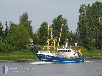
HEIMDALL
Fishing Vessel
Current Trip
FISHING GROUND
| Time Travelled | 5 days |
|---|---|
| Remaining Time | --- |
| Distance Travelled | 11.57 nm |
| Remaining Distance | --- |
| AVG Speed | 12.1 Noeuds |
| MAX Speed | 12.5 Noeuds |
| AVG Wind | 11.6 knots |
| MAX Wind | 19 knots |
| MIN Temp | 13.9°C / 57.02°F |
| MAX Temp | 15.8°C / 60.44°F |
| Tirant d eau | 3 m |
| Position reçue | 2 d depuis |
Current Position
| Longitude | 8.56538° |
|---|---|
| Latitude | 53.97536° |
| Etat | Engaged in Fishing |
| Vitesse | 3.1 Noeuds |
| Parcours | 96° |
| Zone | North Sea |
| Station | T-AIS |
| Position reçue | 2 d depuis |
Info
Information
The current position of HEIMDALL is in North Sea with coordinates 53.97536° / 8.56538° as reported on 2024-05-14 23:34 by AIS to our vessel tracker app. The vessel's current speed is 3.1 Noeuds
The vessel HEIMDALL (IMO: 8432340, MMSI: 211670320) is a Fishing Vessel that was built in 1987 ( 37 Age ). It's sailing under the flag of [DE] Germany.
In this page you can find informations about the vessels current position, last detected port calls, and current voyage information. If the vessels is not in coverage by AIS you will find the latest position.
The current position of HEIMDALL is detected by our AIS receivers and we are not responsible for the reliability of the data. The last position was recorded while the vessel was in Coverage by the Ais receivers of our vessel tracking app.
The current draught of HEIMDALL as reported by AIS is 3 meters
Weather
| Temperature | 15.8°C / 60.44°F |
|---|---|
| Wind Speed | 19 knots |
| Direction | 100° E |
| Pressure | 1009.7 hPa |
| Humidity | 73.4 % |
| Cloud Coverage | --- |
Featured Company
Most Visited Ports (Last year)
| Port | Arrivals | |
|---|---|---|
| 8 | ||
| 4 | ||
| 2 | ||
| 1 | ||
| 1 | ||
| 1 |
Events
| Heure | Evenement | Détails | Position/ Destination | Info |
|---|---|---|---|---|
| 2024-05-14 23:34 | Hors de la zone couverte |
53.97536 / 8.56538
North Sea
|
Vitesse: 3.1 kn Parcours: 96.6° |
|
| 2024-05-14 23:15 | Dans la zone couverte |
53.97726 / 8.53900
North Sea
|
Vitesse: 3 kn Parcours: 97° |
|
| 2024-05-14 05:28 | Hors de la zone couverte |
53.98068 / 8.50214
North Sea
|
Vitesse: 2.7 kn Parcours: 178.3° |
|
| 2024-05-14 05:28 | Dans la zone couverte |
53.98068 / 8.50214
North Sea
|
Vitesse: 2.7 kn Parcours: 178.3° |
|
| 2024-05-11 18:05 | Hors de la zone couverte |
53.91468 / 8.68248
North Sea
FISHING GROUND
|
Vitesse: 12.5 kn Parcours: 335.1° |
|
| 2024-05-11 17:52 | PORT DE DEPART |
|
53.87987 / 8.70322
FISHING GROUND
|
Vitesse: 8.2 kn Parcours: 323° |
| 2024-05-11 17:44 | Démarrage |
53.86817 / 8.71095
[DE] CUXHAVEN
|
Vitesse: 4.2 kn Parcours: 17° |
|
| 2024-05-11 17:27 | Arret |
53.86637 / 8.71056
[DE] CUXHAVEN
|
Vitesse: 0.1 kn Parcours: 6° |
|
| 2024-05-11 17:23 | Démarrage |
53.86335 / 8.70991
[DE] CUXHAVEN
|
Vitesse: 4.8 kn Parcours: 357° |
|
| 2024-05-11 16:55 | Changement de destination | FISHING GROUND CUXHAVEN |
53.86146 / 8.71082
[DE] CUXHAVEN
|
Vitesse: Parcours: 129° |