
ZEBRA
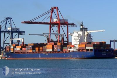
Container Ship
Current Trip
| Time Travelled | 3 h, 43 mins |
|---|---|
| Remaining Time | --- |
| Distance Travelled | 62.21 nm |
| Remaining Distance | --- |
| AVG Speed | 17.7 Knots |
| MAX Speed | 19 Knots |
| AVG Wind | 6.5 knots |
| MAX Wind | 8 knots |
| MIN Temp | 26.9°C / 80.42°F |
| MAX Temp | 27.2°C / 80.96°F |
| Draught | 11.3 m |
| Position Received | 14 d ago |
Current Position
| Longitude | --- |
|---|---|
| Latitude | --- |
| Status | Under way using engine |
| Speed | 14.1 Knots |
| Course | 122.2° |
| Area | North Atlantic Ocean |
| Station | T-AIS |
| Position Received | 14 d ago |
Info
Information
The current position of ZEBRA is in North Atlantic Ocean with coordinates 10.02973° / -16.89124° as reported on 2025-11-28 08:20 by AIS to our vessel tracker app. The vessel's current speed is 14.1 Knots and is heading at the port of NASSIT.
The vessel ZEBRA (IMO: 9231157, MMSI: 636020157) is a Container Ship that was built in 2001 ( 24 years old ). It's sailing under the flag of [LR] Liberia.
In this page you can find informations about the vessels current position, last detected port calls, and current voyage information. If the vessels is not in coverage by AIS you will find the latest position.
The current position of ZEBRA is detected by our AIS receivers and we are not responsible for the reliability of the data. The last position was recorded while the vessel was in Coverage by the Ais receivers of our vessel tracking app.
The current draught of ZEBRA as reported by AIS is 11.3 meters
Weather
| Temperature | 27.2°C / 80.96°F |
|---|---|
| Wind Speed | 6 knots |
| Direction | 254° WSW |
| Pressure | 1010 hPa |
| Humidity | 68.7 % |
| Cloud Coverage | 100 % |
Featured Company
Most Visited Ports (Last year)
| Port | Arrivals | |
|---|---|---|
| 4 | ||
| 3 | ||
| 3 | ||
| 3 | ||
| 2 | ||
| 2 |
Events
| Time | Event | Details | Position / Dest | Info |
|---|---|---|---|---|
| 2025-12-12 15:27 | START Moving | 0.56 nm, West of CONAKRY |
9.50450 / -13.72567
ESALG>SLFNA
|
Speed: 5.6 kn Course: -1° |
| 2025-12-12 15:27 | PORT DEPARTURE |
|
9.50450 / -13.72567
ESALG>SLFNA
|
Speed: 3.5 kn Course: -1° |
| 2025-12-09 21:59 | STOP Moving |
9.50920 / -13.72451
[GN] CONAKRY
|
Speed: 0.2 kn Course: -1° |
|
| 2025-12-09 21:59 | PORT ARRIVAL |
|
9.50920 / -13.72451
[GN] CONAKRY
|
Speed: 1.2 kn Course: -1° |
| 2025-12-09 17:31 | START Moving | 17.32 nm, South of KASSA |
9.20760 / -13.85470
ESALG>SLFNA
|
Speed: 4.9 kn Course: -1° |
| 2025-12-04 22:29 | STOP Moving | 17.48 nm, South of KASSA |
9.20563 / -13.85724
ESALG>SLFNA
|
Speed: 0.3 kn Course: -1° |
| 2025-12-04 13:21 | START Moving | 0.47 nm, East of NASSIT |
8.49500 / -13.22833
ESALG>SLFNA
|
Speed: 4 kn Course: -1° |
| 2025-12-04 13:15 | PORT DEPARTURE |
|
8.49333 / -13.22166
ESALG>SLFNA
|
Speed: Course: -1° |
| 2025-12-03 16:37 | PORT ARRIVAL |
|
8.49487 / -13.21750
[SL] KISSY
|
Speed: 1.4 kn Course: -1° |
| 2025-12-03 14:12 | STOP Moving | 1 nm, North East of NASSIT |
8.50167 / -13.22166
ESALG>SLFNA
|
Speed: Course: -1° |