
YM WORLD
Cargo D
Current Trip
| Time Travelled | 2 days |
|---|---|
| Remaining Time | 4 h, 45 mins |
| Distance Travelled | 501.34 nm |
| Remaining Distance | 59.70 nm |
| AVG Speed | 10.2 Knots |
| MAX Speed | 14.3 Knots |
| AVG Wind | 9 knots |
| MAX Wind | 31 knots |
| MIN Temp | 14.8°C / 58.64°F |
| MAX Temp | 20.7°C / 69.26°F |
| Draught | 12 m |
| Position Received | 2 d ago |
Current Position
| Longitude | 128.97672° |
|---|---|
| Latitude | 34.46350° |
| Status | Under way using engine |
| Speed | 11.2 Knots |
| Course | 212.4° |
| Area | Japan Sea |
| Station | T-AIS |
| Position Received | 2 d ago |
Info
Information
The current position of YM WORLD is in Japan Sea with coordinates 34.46350° / 128.97672° as reported on 2024-05-04 16:34 by AIS to our vessel tracker app. The vessel's current speed is 11.2 Knots and is heading at the port of NINGBO. The estimated time of arrival as calculated by MyShipTracking vessel tracking app is 2024-05-07 02:06 LT
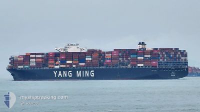
The vessel YM WORLD (IMO: 9684653, MMSI: 477478800) is a Cargo D It's sailing under the flag of [HK] Hong Kong.
In this page you can find informations about the vessels current position, last detected port calls, and current voyage information. If the vessels is not in coverage by AIS you will find the latest position.
The current position of YM WORLD is detected by our AIS receivers and we are not responsible for the reliability of the data. The last position was recorded while the vessel was in Coverage by the Ais receivers of our vessel tracking app.
The current draught of YM WORLD as reported by AIS is 12 meters
Weather
| Temperature | 17.5°C / 63.5°F |
|---|---|
| Wind Speed | 7 knots |
| Direction | 230° SW |
| Pressure | 1015.2 hPa |
| Humidity | 87 % |
| Cloud Coverage | 100 % |
Featured Company
Last Port Calls
| Port | Arrival | Departure | Time In Port |
|---|---|---|---|
| 2024-05-03 15:13 | 2024-05-04 12:43 | 21 h | |
| 2024-04-21 09:51 | 2024-04-22 01:04 | 15 h | |
| 2024-04-14 13:12 | 2024-04-15 21:51 | 1 d | |
| 2024-03-02 07:36 | 2024-03-03 20:37 | 1 d |
Most Visited Ports (Last year)
| Port | Arrivals | |
|---|---|---|
| 6 | ||
| 6 | ||
| 5 | ||
| 4 | ||
| 4 | ||
| 3 |
Last Trips
| Origin | Departure | Destination | Arrival | Distance | |
|---|---|---|---|---|---|
| 2024-04-22 09:04 | 2024-05-04 00:13 | 1313.73 nm | |||
| 2024-04-16 05:51 | 2024-04-21 17:51 | 1629.38 nm | |||
| 2024-03-03 23:37 | 2024-04-14 21:12 | 12948.33 nm | |||
| 2024-02-28 21:31 | 2024-03-02 10:36 | 632.75 nm |
Events
| Time | Event | Details | Position / Dest | Info |
|---|---|---|---|---|
| 2024-05-06 19:20 | START Moving |
29.51753 / 123.06679
CNNBO
|
Speed: 3.5 kn Course: 315° |
|
| 2024-05-06 18:04 | STOP Moving |
29.52683 / 123.07154
CNNBO
|
Speed: 0.3 kn Course: 345° |
|
| 2024-05-06 17:32 | START Moving |
29.50805 / 123.07121
CNNBO
|
Speed: 3.8 kn Course: 31° |
|
| 2024-05-06 11:10 | STOP Moving |
29.55437 / 123.01195
CNNBO
|
Speed: 0.3 kn Course: 124° |
|
| 2024-05-04 16:40 | Status Changed | Default Under way using engine |
34.44722 / 128.96576
CNNBO
|
Speed: 11.2 kn Course: 212.4° |
| 2024-05-04 16:34 | OUT of Coverage |
34.46350 / 128.97672
Japan Sea
|
Speed: 11.2 kn Course: 212.4° |
|
| 2024-05-04 15:47 | Status Changed | Under way using engine Default |
34.59874 / 129.00218
CNNBO
|
Speed: 10.6 kn Course: 170° |
| 2024-05-04 15:44 | Status Changed | Default Under way using engine |
34.60754 / 129.00040
CNNBO
|
Speed: 10.6 kn Course: 168.9° |
| 2024-05-04 15:35 | Status Changed | Under way using engine Default |
34.63459 / 128.99458
CNNBO
|
Speed: 10.5 kn Course: 164° |
| 2024-05-04 15:33 | Status Changed | Default Under way using engine |
34.64161 / 128.99213
CNNBO
|
Speed: 10.6 kn Course: 169.2° |