
YM TRAVEL
Cargo A
Current Trip
| Time Travelled | 1 day |
|---|---|
| Remaining Time | 22 h, 39 mins |
| Distance Travelled | 475.56 nm |
| Remaining Distance | 368.24 nm |
| AVG Speed | 13 Knots |
| MAX Speed | 15.6 Knots |
| AVG Wind | 27.7 knots |
| MAX Wind | 37 knots |
| MIN Temp | -0.4°C / 31.28°F |
| MAX Temp | 11.2°C / 52.16°F |
| Draught | 10.5 m |
| Position Received | 1 d ago |
Current Position
| Longitude | --- |
|---|---|
| Latitude | --- |
| Status | Under way using engine |
| Speed | 8.2 Knots |
| Course | 119.7° |
| Area | North Atlantic Ocean |
| Station | T-AIS |
| Position Received | 1 d ago |
Info
Information
The current position of YM TRAVEL is in North Atlantic Ocean with coordinates 36.81249° / -75.76231° as reported on 2025-12-14 10:23 by AIS to our vessel tracker app. The vessel's current speed is 8.2 Knots and is heading at the port of HALIFAX. The estimated time of arrival as calculated by MyShipTracking vessel tracking app is 2025-12-16 15:03 LT
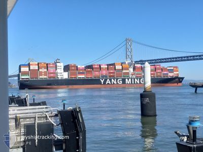
The vessel YM TRAVEL (IMO: 9878503, MMSI: 563232300) is a Cargo A It's sailing under the flag of [SG] Singapore.
In this page you can find informations about the vessels current position, last detected port calls, and current voyage information. If the vessels is not in coverage by AIS you will find the latest position.
The current position of YM TRAVEL is detected by our AIS receivers and we are not responsible for the reliability of the data. The last position was recorded while the vessel was in Coverage by the Ais receivers of our vessel tracking app.
The current draught of YM TRAVEL as reported by AIS is 10.5 meters
Weather
| Temperature | 1.6°C / 34.88°F |
|---|---|
| Wind Speed | 28 knots |
| Direction | 301° WNW |
| Pressure | 1015.5 hPa |
| Humidity | 67.1 % |
| Cloud Coverage | 100 % |
Featured Company
Last Port Calls
| Port | Arrival | Departure | Time In Port |
|---|---|---|---|
| 2025-12-13 10:28 | 2025-12-14 02:42 | 16 h | |
| 2025-12-09 20:58 | 2025-12-11 03:27 | 1 d | |
| 2025-12-05 17:20 | 2025-12-08 02:48 | 2 d | |
| 2025-11-28 22:19 | 2025-11-29 18:23 | 20 h | |
| 2025-11-06 15:56 | 2025-11-08 00:52 | 1 d | |
| 2025-11-01 19:56 | 2025-11-02 08:16 | 12 h | |
| 2025-10-28 20:00 | 2025-10-29 14:44 | 18 h | |
| 2025-10-17 10:32 | 2025-10-19 02:10 | 1 d |
Last Trips
| Origin | Departure | Destination | Arrival | Distance | |
|---|---|---|---|---|---|
| 2025-12-11 03:27 | 2025-12-13 10:28 | 473.79 nm | |||
| 2025-12-08 02:48 | 2025-12-09 20:58 | 133.98 nm | |||
| 2025-11-29 18:23 | 2025-12-05 17:20 | 1620.61 nm | |||
| 2025-11-08 00:52 | 2025-11-28 22:19 | 8583.20 nm | |||
| 2025-11-02 08:16 | 2025-11-06 15:56 | 717.44 nm | |||
| 2025-10-29 14:44 | 2025-11-01 19:56 | 786.70 nm | |||
| 2025-10-19 02:10 | 2025-10-28 20:00 | 2282.11 nm | |||
| 2025-09-16 10:55 | 2025-10-17 10:32 | 11890.07 nm |
Events
| Time | Event | Details | Position / Dest | Info |
|---|---|---|---|---|
| 2025-12-14 10:31 | Status Changed | Default Under way using engine |
36.80837 / -75.73907
CAHAL
|
Speed: 8.2 kn Course: 119.7° |
| 2025-12-14 10:23 | Status Changed | Under way using engine Default |
36.81249 / -75.76231
CAHAL
|
Speed: 8.4 kn Course: 120° |
| 2025-12-14 10:23 | OUT of Coverage |
36.81249 / -75.76231
North Atlantic Ocean
CAHAL
|
Speed: 8.2 kn Course: 119.7° |
|
| 2025-12-14 10:19 | Status Changed | Default Under way using engine |
36.81724 / -75.77245
CAHAL
|
Speed: 9.2 kn Course: 121° |
| 2025-12-14 10:13 | Status Changed | Under way using engine Default |
36.82406 / -75.78697
CAHAL
|
Speed: 9.3 kn Course: 121° |
| 2025-12-14 10:11 | Status Changed | Default Under way using engine |
36.82743 / -75.79386
CAHAL
|
Speed: 9.2 kn Course: 120.2° |
| 2025-12-14 10:05 | Status Changed | Under way using engine Default |
36.83561 / -75.81073
CAHAL
|
Speed: 9.5 kn Course: 121° |
| 2025-12-14 10:03 | Status Changed | Default Under way using engine |
36.83814 / -75.81595
CAHAL
|
Speed: 9.1 kn Course: 121.2° |
| 2025-12-14 09:58 | Status Changed | Under way using engine Default |
36.84523 / -75.83043
CAHAL
|
Speed: 9.1 kn Course: 122° |
| 2025-12-14 09:55 | Status Changed | Default Under way using engine |
36.84851 / -75.83710
CAHAL
|
Speed: 9.6 kn Course: 120.2° |