
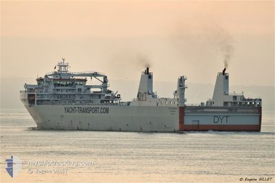
YACHT SERVANT
Cargo
Current Trip
| Time Travelled | 12 days |
|---|---|
| Remaining Time | 1 day |
| Distance Travelled | 3946.39 nm |
| Remaining Distance | 654.54 nm |
| AVG Speed | 12.8 Knots |
| MAX Speed | 18.2 Knots |
| AVG Wind | 19.1 knots |
| MAX Wind | 37 knots |
| MIN Temp | 13.9°C / 57.02°F |
| MAX Temp | 24.7°C / 76.46°F |
| Draught | 4.6 m |
| Position Received | 4 h, 34 m ago |
Current Position
| Longitude | --- |
|---|---|
| Latitude | --- |
| Status | Under way using engine |
| Speed | 12.6 Knots |
| Course | 83.4° |
| Area | Alboran Sea |
| Station | T-AIS |
| Position Received | 4 h, 34 m ago |
Info
Information
The current position of YACHT SERVANT is in Alboran Sea with coordinates 36.13303° / -4.26944° as reported on 2026-01-04 12:34 by AIS to our vessel tracker app. The vessel's current speed is 12.6 Knots and is heading at the port of FOS. The estimated time of arrival as calculated by MyShipTracking vessel tracking app is 2026-01-06 13:19 LT
The vessel YACHT SERVANT (IMO: 9890812, MMSI: 246132000) is a Cargo It's sailing under the flag of [NL] Netherlands.
In this page you can find informations about the vessels current position, last detected port calls, and current voyage information. If the vessels is not in coverage by AIS you will find the latest position.
The current position of YACHT SERVANT is detected by our AIS receivers and we are not responsible for the reliability of the data. The last position was recorded while the vessel was in Coverage by the Ais receivers of our vessel tracking app.
The current draught of YACHT SERVANT as reported by AIS is 4.6 meters
Weather
| Temperature | 14.9°C / 58.82°F |
|---|---|
| Wind Speed | 20 knots |
| Direction | 88° E |
| Pressure | 1000 hPa |
| Humidity | 89.4 % |
| Cloud Coverage | 99 % |
Featured Company
Last Port Calls
| Port | Arrival | Departure | Time In Port |
|---|---|---|---|
| 2025-12-21 19:10 | 2025-12-22 22:33 | 1 d | |
| 2025-12-17 17:07 | 2025-12-18 23:15 | 1 d | |
| 2025-11-24 07:27 | 2025-11-28 12:29 | 4 d | |
| 2025-11-05 18:21 | 2025-11-07 00:37 | 1 d | |
| 2025-11-05 17:28 | 2025-11-05 17:54 | 25 m |
Most Visited Ports (Last year)
| Port | Arrivals | |
|---|---|---|
| 4 | ||
| 3 | ||
| 3 | ||
| 2 | ||
| 1 | ||
| 1 |
Last Trips
| Origin | Departure | Destination | Arrival | Distance | |
|---|---|---|---|---|---|
| 2025-12-18 23:15 | 2025-12-21 19:10 | 193.60 nm | |||
| 2025-11-28 12:29 | 2025-12-17 17:07 | 5492.00 nm | |||
| 2025-11-07 00:37 | 2025-11-24 07:27 | 5188.75 nm | |||
| 2025-11-05 17:54 | 2025-11-05 18:21 | 0.86 nm | |||
| 2025-10-22 16:53 | 2025-11-05 17:28 | 4364.97 nm |
Events
| Time | Event | Details | Position / Dest | Info |
|---|---|---|---|---|
| 2026-01-04 12:43 | Status Changed | Default Under way using engine |
36.13708 / -4.23386
FRFOS
|
Speed: 12.6 kn Course: 83.4° |
| 2026-01-04 12:34 | Status Changed | Under way using engine Default |
36.13303 / -4.26944
FRFOS
|
Speed: 12.6 kn Course: 84° |
| 2026-01-04 12:34 | OUT of Coverage |
36.13303 / -4.26944
Alboran Sea
FRFOS
|
Speed: 12.6 kn Course: 83.4° |
|
| 2026-01-04 11:52 | Status Changed | Default Under way using engine |
36.11437 / -4.44895
FRFOS
|
Speed: 12.6 kn Course: 84° |
| 2026-01-04 10:15 | Status Changed | Under way using engine Default |
36.04875 / -4.86577
FRFOS
|
Speed: 12.7 kn Course: 81° |
| 2026-01-04 09:58 | Status Changed | Default Under way using engine |
36.04032 / -4.93809
FRFOS
|
Speed: 12.8 kn Course: 80.9° |
| 2026-01-04 09:51 | Status Changed | Under way using engine Default |
36.03661 / -4.96939
FRFOS
|
Speed: 12.8 kn Course: 82° |
| 2026-01-04 09:46 | Status Changed | Default Under way using engine |
36.03391 / -4.99123
FRFOS
|
Speed: 13.4 kn Course: 80.9° |
| 2026-01-04 08:46 | Change Sea Area | Spanish part of the Alboran Sea Spanish part of the Strait of Gibraltar |
35.99623 / -5.31046
Alboran Sea
FRFOS
|
Speed: 17.6 kn Course: 76.3° |
| 2026-01-04 08:35 | Change Sea Area | Spanish part of the Strait of Gibraltar Moroccan part of the Strait of Gibraltar |
35.97792 / -5.37714
Strait of Gibraltar
FRFOS
|
Speed: 18 kn Course: 69.4° |