
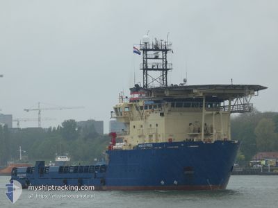
WIND OF PRIDE
Multi Purpose Offshore Vessel
Current Trip
SEA TRIAL
| Time Travelled | 4 h, 1 mins |
|---|---|
| Remaining Time | --- |
| Distance Travelled | 4.19 nm |
| Remaining Distance | --- |
| AVG Speed | 7.7 Knots |
| MAX Speed | 8.5 Knots |
| AVG Wind | 16 knots |
| MAX Wind | 16.1 knots |
| MIN Temp | 14.8°C / 58.64°F |
| MAX Temp | 15°C / 59°F |
| Draught | 5.4 m |
| Position Received | 1 m ago |
Current Position
| Longitude | -2.74838° |
|---|---|
| Latitude | 48.71620° |
| Status | Under way using engine |
| Speed | 6.9 Knots |
| Course | 190.9° |
| Area | English Channel |
| Station | T-AIS |
| Position Received | 1 m ago |
Info
Information
The current position of WIND OF PRIDE is in English Channel with coordinates 48.71620° / -2.74838° as reported on 2024-05-14 16:47 by AIS to our vessel tracker app. The vessel's current speed is 6.9 Knots
The vessel WIND OF PRIDE (IMO: 9282144, MMSI: 228371900) is a Multi Purpose Offshore Vessel that was built in 2006 ( 18 years old ). It's sailing under the flag of [FR] France.
In this page you can find informations about the vessels current position, last detected port calls, and current voyage information. If the vessels is not in coverage by AIS you will find the latest position.
The current position of WIND OF PRIDE is detected by our AIS receivers and we are not responsible for the reliability of the data. The last position was recorded while the vessel was in Coverage by the Ais receivers of our vessel tracking app.
The current draught of WIND OF PRIDE as reported by AIS is 5.4 meters
Weather
| Temperature | 15°C / 59°F |
|---|---|
| Wind Speed | 16 knots |
| Direction | 196° SSW |
| Pressure | 997.9 hPa |
| Humidity | 72.5 % |
| Cloud Coverage | 68 % |
Featured Company
Last Port Calls
| Port | Arrival | Departure | Time In Port |
|---|---|---|---|
| 2024-05-14 14:48 | |||
| 2024-04-25 20:52 | |||
| 2024-03-18 10:25 | 2024-03-29 14:36 | 11 d | |
| 2024-03-16 19:28 |
Most Visited Ports (Last year)
| Port | Arrivals | |
|---|---|---|
| 6 | ||
| 5 | ||
| 2 | ||
| 2 | ||
| 2 | ||
| 2 |
Last Trips
| Origin | Departure | Destination | Arrival | Distance | |
|---|---|---|---|---|---|
| 2024-03-16 19:28 | 2024-03-18 10:25 | 315.12 nm |
Events
| Time | Event | Details | Position / Dest | Info |
|---|---|---|---|---|
| 2024-05-14 16:26 | Draught Changed | 5.4 5.8 |
48.75217 / -2.73411
SEA TRIAL
|
Speed: 4.7 kn Course: 195° |
| 2024-05-14 16:26 | Destination Changed | SEA TRIAL FR SML |
48.75217 / -2.73411
SEA TRIAL
|
Speed: 4.7 kn Course: 195° |
| 2024-05-14 16:26 | ETA Changed | 2024/05/14 15:00 2025/04/26 18:15 |
48.75217 / -2.73411
SEA TRIAL
|
Speed: 4.7 kn Course: 195° |
| 2024-05-14 16:07 | IN Coverage |
48.78328 / -2.70412
English Channel
|
Speed: 7.8 kn Course: 244.8° |
|
| 2024-05-14 12:48 | PORT DEPARTURE |
|
48.78375 / -2.70172
FR SML
|
Speed: Course: 164° |
| 2024-05-13 00:53 | OUT of Coverage |
48.64728 / -2.02073
English Channel
[FR] SAINT MALO
|
Speed: Course: 30.5° |
|
| 2024-05-13 00:53 | IN Coverage |
48.64728 / -2.02073
English Channel
[FR] SAINT MALO
|
Speed: Course: 30.5° |
|
| 2024-05-12 15:47 | OUT of Coverage |
48.64722 / -2.02064
English Channel
[FR] SAINT MALO
|
Speed: Course: 30.5° |
|
| 2024-05-12 14:53 | IN Coverage |
48.64724 / -2.02071
English Channel
[FR] SAINT MALO
|
Speed: Course: 30.5° |
|
| 2024-05-12 13:53 | OUT of Coverage |
48.64731 / -2.02060
English Channel
[FR] SAINT MALO
|
Speed: Course: 30.5° |