
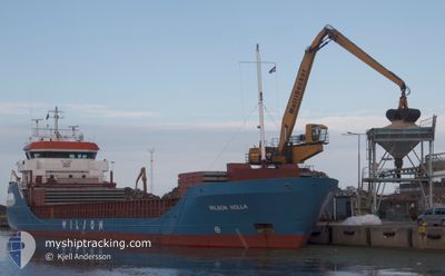
WILSON HOLLA
General Cargo
Current Trip
| Time Travelled | 1 day |
|---|---|
| Remaining Time | 4 h, 18 mins |
| Distance Travelled | 275.11 nm |
| Remaining Distance | 53.47 nm |
| AVG Speed | 11.3 Knots |
| MAX Speed | 12.4 Knots |
| AVG Wind | 8.9 knots |
| MAX Wind | 19 knots |
| MIN Temp | 9.5°C / 49.1°F |
| MAX Temp | 12.3°C / 54.14°F |
| Draught | 4.5 m |
| Position Received | 2 m ago |
Current Position
| Longitude | 4.80184° |
|---|---|
| Latitude | 59.57270° |
| Status | Under way using engine |
| Speed | 8.3 Knots |
| Course | 194° |
| Area | North Sea |
| Station | T-AIS |
| Position Received | 2 m ago |
Info
Information
The current position of WILSON HOLLA is in North Sea with coordinates 59.57270° / 4.80184° as reported on 2024-05-14 05:17 by AIS to our vessel tracker app. The vessel's current speed is 8.3 Knots and is heading at the port of STAVANGER. The estimated time of arrival as calculated by MyShipTracking vessel tracking app is 2024-05-14 11:38 LT
The vessel WILSON HOLLA (IMO: 9229130, MMSI: 314455000) is a General Cargo that was built in 2002 ( 22 years old ). It's sailing under the flag of [BB] Barbados.
In this page you can find informations about the vessels current position, last detected port calls, and current voyage information. If the vessels is not in coverage by AIS you will find the latest position.
The current position of WILSON HOLLA is detected by our AIS receivers and we are not responsible for the reliability of the data. The last position was recorded while the vessel was in Coverage by the Ais receivers of our vessel tracking app.
The current draught of WILSON HOLLA as reported by AIS is 4.5 meters
Weather
| Temperature | 11.7°C / 53.06°F |
|---|---|
| Wind Speed | 19 knots |
| Direction | 133° SE |
| Pressure | 1012.5 hPa |
| Humidity | 60.9 % |
| Cloud Coverage | 56 % |
Featured Company
Last Port Calls
| Port | Arrival | Departure | Time In Port |
|---|---|---|---|
| 2024-05-12 13:03 | 2024-05-13 07:16 | 18 h | |
| 2024-04-30 19:35 | 2024-05-09 16:07 | 8 d | |
| 2024-04-29 14:25 | 2024-04-30 18:54 | 1 d | |
| 2024-04-18 11:34 | 2024-04-19 18:24 | 1 d | |
| 2024-04-09 19:58 | 2024-04-09 20:36 | 38 m | |
| 2024-04-02 22:43 | 2024-04-09 15:13 | 6 d | |
| 2024-04-01 16:47 | 2024-04-02 20:18 | 1 d | |
| 2024-04-01 10:03 | 2024-04-01 10:26 | 22 m | |
| 2024-03-21 15:21 | 2024-03-27 01:16 | 5 d | |
| 2024-03-10 17:20 | 2024-03-12 19:23 | 2 d |
Most Visited Ports (Last year)
| Port | Arrivals | |
|---|---|---|
| 6 | ||
| 4 | ||
| 3 | ||
| 2 | ||
| 2 | ||
| 2 |
Last Trips
| Origin | Departure | Destination | Arrival | Distance | |
|---|---|---|---|---|---|
| 2024-05-09 16:07 | 2024-05-12 13:03 | 690.11 nm | |||
| 2024-04-30 18:54 | 2024-04-30 19:35 | 5.42 nm | |||
| 2024-04-19 18:24 | 2024-04-29 14:25 | 1722.96 nm | |||
| 2024-04-09 20:36 | 2024-04-18 11:34 | 1315.59 nm | |||
| 2024-04-09 15:13 | 2024-04-09 19:58 | 49.04 nm | |||
| 2024-04-02 20:18 | 2024-04-02 22:43 | 24.02 nm | |||
| 2024-04-01 10:26 | 2024-04-01 16:47 | 65.06 nm | |||
| 2024-03-27 01:16 | 2024-04-01 10:03 | 1312.83 nm | |||
| 2024-03-12 19:23 | 2024-03-21 15:21 | 1082.54 nm | |||
| 2024-03-09 19:37 | 2024-03-10 17:20 | 165.65 nm |
Events
| Time | Event | Details | Position / Dest | Info |
|---|---|---|---|---|
| 2024-05-13 21:25 | Change Sea Area | Norwegian part of the North Sea Norwegian part of the Norwegian Sea |
60.99663 / 4.30992
North Sea
NOSVG
|
Speed: 10.4 kn Course: 188.9° |
| 2024-05-13 09:49 | ETA Changed | 2024/05/14 14:00 2024/05/14 16:00 |
62.91784 / 6.43546
NOSVG
|
Speed: 12.1 kn Course: 232.1° |
| 2024-05-13 06:35 | ETA Changed | 2024/05/14 16:00 2024/05/14 14:00 |
63.24744 / 7.58869
NOSVG
|
Speed: 11.3 kn Course: 259.9° |
| 2024-05-13 05:26 | ETA Changed | 2024/05/14 14:00 2024/05/14 16:00 |
63.09519 / 7.68659
NOSVG
|
Speed: 11.5 kn Course: 351.9° |
| 2024-05-13 05:16 | PORT DEPARTURE |
|
63.06204 / 7.67866
NOSVG
|
Speed: 11.1 kn Course: 42° |
| 2024-05-13 05:13 | START Moving |
63.05795 / 7.66336
[NO] AVEROY
|
Speed: 6.1 kn Course: 67° |
|
| 2024-05-13 05:05 | Draught Changed | 4.5 6.3 |
63.05639 / 7.65824
[NO] AVEROY
|
Speed: Course: 358° |
| 2024-05-13 05:05 | Destination Changed | NOSVG NOAVE |
63.05639 / 7.65824
[NO] AVEROY
|
Speed: Course: 358° |
| 2024-05-13 05:05 | ETA Changed | 2024/05/14 16:00 2024/05/12 10:00 |
63.05639 / 7.65824
[NO] AVEROY
|
Speed: Course: 358° |
| 2024-05-13 05:05 | Status Changed | Under way using engine Moored |
63.05639 / 7.65824
[NO] AVEROY
|
Speed: Course: 1° |