
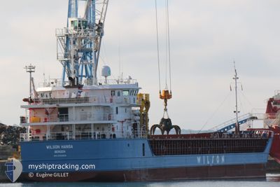
WILSON HANSA
General Cargo
Current Trip
DZAAE
| Time Travelled | 1 day |
|---|---|
| Remaining Time | --- |
| Distance Travelled | 374.51 nm |
| Remaining Distance | --- |
| AVG Speed | 8.5 Knots |
| MAX Speed | 10 Knots |
| AVG Wind | 11.7 knots |
| MAX Wind | 23.9 knots |
| MIN Temp | 15.7°C / 60.26°F |
| MAX Temp | 18.3°C / 64.94°F |
| Draught | 3.6 m |
| Position Received | 5 d ago |
Current Position
| Longitude | 11.62323° |
|---|---|
| Latitude | 38.18485° |
| Status | Under way using engine |
| Speed | 7.2 Knots |
| Course | 249.8° |
| Area | Tyrrhenian Sea |
| Station | T-AIS |
| Position Received | 5 d ago |
Info
Information
The current position of WILSON HANSA is in Tyrrhenian Sea with coordinates 38.18485° / 11.62323° as reported on 2024-04-25 03:30 by AIS to our vessel tracker app. The vessel's current speed is 7.2 Knots
The vessel WILSON HANSA (IMO: 9583859, MMSI: 257755000) is a General Cargo that was built in 2013 ( 11 years old ). It's sailing under the flag of [NO] Norway.
In this page you can find informations about the vessels current position, last detected port calls, and current voyage information. If the vessels is not in coverage by AIS you will find the latest position.
The current position of WILSON HANSA is detected by our AIS receivers and we are not responsible for the reliability of the data. The last position was recorded while the vessel was in Coverage by the Ais receivers of our vessel tracking app.
The current draught of WILSON HANSA as reported by AIS is 3.6 meters
Weather
| Temperature | 16.9°C / 62.42°F |
|---|---|
| Wind Speed | 19 knots |
| Direction | 243° WSW |
| Pressure | 1014.5 hPa |
| Humidity | 74.7 % |
| Cloud Coverage | 6 % |
Featured Company
Last Port Calls
| Port | Arrival | Departure | Time In Port |
|---|---|---|---|
| 2024-04-26 06:34 | 2024-04-28 17:15 | 2 d | |
| 2024-04-19 08:26 | 2024-04-24 13:29 | 5 d | |
| 2024-04-01 21:09 | 2024-04-05 08:34 | 3 d | |
| 2024-03-27 20:29 | 2024-03-28 17:18 | 20 h | |
| 2024-03-22 15:24 | 2024-03-23 22:15 | 1 d | |
| 2024-03-21 14:20 | 2024-03-22 10:10 | 19 h | |
| 2024-03-13 18:23 | 2024-03-14 17:57 | 23 h | |
| 2024-03-10 10:32 | 2024-03-12 18:12 | 2 d | |
| 2024-02-26 04:15 | 2024-02-26 12:23 | 8 h | |
| 2024-02-21 19:34 | 2024-02-22 16:29 | 20 h |
Last Trips
| Origin | Departure | Destination | Arrival | Distance | |
|---|---|---|---|---|---|
| 2024-04-24 15:29 | 2024-04-26 07:34 | 312.80 nm | |||
| 2024-04-05 10:34 | 2024-04-19 10:26 | 2504.88 nm | |||
| 2024-03-28 18:18 | 2024-04-01 23:09 | 156.97 nm | |||
| 2024-03-23 23:15 | 2024-03-27 21:29 | 851.23 nm | |||
| 2024-03-22 11:10 | 2024-03-22 16:24 | 50.93 nm | |||
| 2024-03-14 18:57 | 2024-03-21 15:20 | 1554.24 nm | |||
| 2024-03-12 19:12 | 2024-03-13 19:23 | 252.28 nm | |||
| 2024-02-26 13:23 | 2024-03-10 11:32 | 1949.42 nm | |||
| 2024-02-22 17:29 | 2024-02-26 05:15 | 732.70 nm | |||
| 2024-02-19 20:14 | 2024-02-21 20:34 | 7.81 nm |
Events
| Time | Event | Details | Position / Dest | Info |
|---|---|---|---|---|
| 2024-04-28 17:15 | PORT DEPARTURE |
|
36.93709 / 7.85576
DZAAE
|
Speed: Course: 269° |
| 2024-04-26 06:48 | STOP Moving |
36.89477 / 7.76667
[DZ] ANNABA
|
Speed: Course: 266° |
|
| 2024-04-26 06:34 | PORT ARRIVAL |
|
36.89540 / 7.76684
[DZ] ANNABA
|
Speed: 3.2 kn Course: 301° |
| 2024-04-26 06:08 | START Moving | 0.22 nm, South East of ANNABA |
36.90243 / 7.78181
DZAAE
|
Speed: 3.2 kn Course: 301° |
| 2024-04-26 03:46 | STOP Moving | 1.62 nm, North East of ANNABA |
36.91818 / 7.80785
DZAAE
|
Speed: 0.1 kn Course: 230° |
| 2024-04-25 03:40 | Status Changed | Default Under way using engine |
38.17757 / 11.60027
DZAAE
|
Speed: 7.2 kn Course: 249.8° |
| 2024-04-25 03:30 | OUT of Coverage |
38.18485 / 11.62323
Tyrrhenian Sea
DZAAE
|
Speed: 7.2 kn Course: 249.8° |
|
| 2024-04-24 20:09 | Status Changed | Under way using engine Default |
38.28902 / 12.67273
DZAAE
|
Speed: 8.9 kn Course: 269° |
| 2024-04-24 19:56 | Status Changed | Default Under way using engine |
38.28956 / 12.71135
DZAAE
|
Speed: 9.1 kn Course: 268.8° |
| 2024-04-24 14:08 | Status Changed | Under way using engine Default |
38.08279 / 13.68333
DZAAE
|
Speed: 10.2 kn Course: 338° |