
WILSON DIRDAL
General Cargo
Current Trip
| Time Travelled | 9 days |
|---|---|
| Remaining Time | 1 h, 12 mins |
| Distance Travelled | 1095.16 nm |
| Remaining Distance | 9.74 nm |
| AVG Speed | 7.4 Knots |
| MAX Speed | 10.7 Knots |
| AVG Wind | 13.2 knots |
| MAX Wind | 24 knots |
| MIN Temp | 6.6°C / 43.88°F |
| MAX Temp | 18°C / 64.4°F |
| Draught | 4.5 m |
| Position Received | 2 m ago |
Current Position
| Longitude | --- |
|---|---|
| Latitude | --- |
| Status | Under way using engine |
| Speed | 1.1 Knots |
| Course | 20° |
| Area | North Atlantic Ocean |
| Station | T-AIS |
| Position Received | 2 m ago |
Info
Information
The current position of WILSON DIRDAL is in North Atlantic Ocean with coordinates 38.36487° / -8.93586° as reported on 2025-12-05 19:25 by AIS to our vessel tracker app. The vessel's current speed is 1.1 Knots and is heading at the port of SETUBAL. The estimated time of arrival as calculated by MyShipTracking vessel tracking app is 2025-12-05 20:40 LT
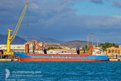
The vessel WILSON DIRDAL (IMO: 9409637, MMSI: 255915955) is a General Cargo that was built in 2010 ( 15 years old ). It's sailing under the flag of [PT] Portugal.
In this page you can find informations about the vessels current position, last detected port calls, and current voyage information. If the vessels is not in coverage by AIS you will find the latest position.
The current position of WILSON DIRDAL is detected by our AIS receivers and we are not responsible for the reliability of the data. The last position was recorded while the vessel was in Coverage by the Ais receivers of our vessel tracking app.
The current draught of WILSON DIRDAL as reported by AIS is 4.5 meters
Weather
| Temperature | 16.4°C / 61.52°F |
|---|---|
| Wind Speed | 11 knots |
| Direction | 260° W |
| Pressure | 1023.2 hPa |
| Humidity | 92.3 % |
| Cloud Coverage | 16 % |
Featured Company
Last Port Calls
| Port | Arrival | Departure | Time In Port |
|---|---|---|---|
| 2025-11-26 12:25 | 2025-11-26 13:08 | 43 m | |
| 2025-11-18 00:51 | 2025-11-19 18:39 | 1 d | |
| 2025-11-10 23:40 | 2025-11-11 19:42 | 20 h | |
| 2025-11-01 03:45 | 2025-11-04 18:58 | 3 d | |
| 2025-10-25 19:56 | 2025-10-25 22:54 | 2 h | |
| 2025-10-22 20:27 | 2025-10-23 18:37 | 22 h | |
| 2025-10-18 00:34 | |||
| 2025-10-10 06:19 | 2025-10-13 21:55 | 3 d | |
| 2025-10-07 20:11 | 2025-10-08 23:09 | 1 d |
Last Trips
| Origin | Departure | Destination | Arrival | Distance | |
|---|---|---|---|---|---|
| 2025-11-19 18:39 | 2025-11-26 12:25 | 130.40 nm | |||
| 2025-11-11 19:42 | 2025-11-18 00:51 | 963.57 nm | |||
| 2025-11-04 18:58 | 2025-11-10 23:40 | 1169.97 nm | |||
| 2025-10-25 22:54 | 2025-11-01 03:45 | 1312.64 nm | |||
| 2025-10-23 18:37 | 2025-10-25 19:56 | 404.80 nm | |||
| 2025-10-18 00:34 | 2025-10-22 20:27 | 750.58 nm | |||
| 2025-10-08 23:09 | 2025-10-10 06:19 | 197.23 nm | |||
| 2025-09-29 09:54 | 2025-10-07 20:11 | 1632.89 nm |
Events
| Time | Event | Details | Position / Dest | Info |
|---|---|---|---|---|
| 2025-12-05 11:57 | START Moving | 9.77 nm, South of SETUBAL |
38.35476 / -8.93693
PT SET
|
Speed: 4.8 kn Course: 359° |
| 2025-12-05 11:08 | STOP Moving | 10.06 nm, South of SETUBAL |
38.34862 / -8.93385
PT SET
|
Speed: 0.3 kn Course: 217° |
| 2025-12-05 11:00 | START Moving | 10.35 nm, South of SETUBAL |
38.34276 / -8.93137
PT SET
|
Speed: 3.2 kn Course: 359° |
| 2025-12-05 08:56 | STOP Moving | 8.61 nm, South West of SETUBAL |
38.37934 / -8.94546
PT SET
|
Speed: 0.3 kn Course: 132° |
| 2025-12-05 08:26 | START Moving | 9.29 nm, South West of SETUBAL |
38.36297 / -8.93540
PT SET
|
Speed: 3.2 kn Course: 309° |
| 2025-12-05 07:25 | STOP Moving | 8.95 nm, South West of SETUBAL |
38.37227 / -8.94357
PT SET
|
Speed: 0.3 kn Course: 241° |
| 2025-12-05 06:50 | IN Coverage |
38.36867 / -8.91975
North Atlantic Ocean
PT SET
|
Speed: 2.1 kn Course: 270.7° |
|
| 2025-12-05 05:43 | OUT of Coverage |
38.37225 / -8.90645
North Atlantic Ocean
PT SET
|
Speed: 1.3 kn Course: 178.7° |
|
| 2025-12-05 00:05 | ETA Changed | 2025/12/05 02:15 2025/12/05 02:00 |
38.39768 / -9.38297
PT SET
|
Speed: 10.1 kn Course: 106.7° |
| 2025-12-04 22:04 | Draught Changed | 4.5 5.5 |
38.49806 / -9.79407
PT SET
|
Speed: 9.6 kn Course: 122.1° |