
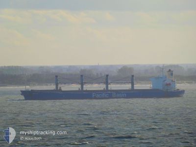
WHITE BAY
Bulk Carrier
Current Trip
NEW HAVEN USA
| Time Travelled | 9 days |
|---|---|
| Remaining Time | --- |
| Distance Travelled | 2174.43 nm |
| Remaining Distance | --- |
| AVG Speed | 10.7 Knots |
| MAX Speed | 15 Knots |
| AVG Wind | 17.2 knots |
| MAX Wind | 27 knots |
| MIN Temp | -6°C / 21.2°F |
| MAX Temp | 27.1°C / 80.78°F |
| Draught | 5.8 m |
| Position Received | 2 d ago |
Current Position
| Longitude | --- |
|---|---|
| Latitude | --- |
| Status | Under way using engine |
| Speed | 11.8 Knots |
| Course | 176.3° |
| Area | Caribbean Sea |
| Station | T-AIS |
| Position Received | 2 d ago |
Info
Information
The current position of WHITE BAY is in Caribbean Sea with coordinates 11.74692° / -74.90378° as reported on 2025-02-28 22:33 by AIS to our vessel tracker app. The vessel's current speed is 11.8 Knots
The vessel WHITE BAY (IMO: 9274460, MMSI: 477942100) is a Bulk Carrier that was built in 2004 ( 21 years old ). It's sailing under the flag of [HK] Hong Kong.
In this page you can find informations about the vessels current position, last detected port calls, and current voyage information. If the vessels is not in coverage by AIS you will find the latest position.
The current position of WHITE BAY is detected by our AIS receivers and we are not responsible for the reliability of the data. The last position was recorded while the vessel was in Coverage by the Ais receivers of our vessel tracking app.
The current draught of WHITE BAY as reported by AIS is 5.8 meters
Weather
| Temperature | 26.2°C / 79.16°F |
|---|---|
| Wind Speed | 20 knots |
| Direction | 72° ENE |
| Pressure | 1010.3 hPa |
| Humidity | 75.8 % |
| Cloud Coverage | 100 % |
Featured Company
Events
| Time | Event | Details | Position / Dest | Info |
|---|---|---|---|---|
| 2025-02-28 22:55 | Status Changed | Default Under way using engine |
11.67651 / -74.90051
NEW HAVEN USA
|
Speed: 11.8 kn Course: 176.3° |
| 2025-02-28 22:33 | Status Changed | Under way using engine Default |
11.74692 / -74.90378
NEW HAVEN USA
|
Speed: 11.7 kn Course: 179° |
| 2025-02-28 22:33 | OUT of Coverage |
11.74692 / -74.90378
Caribbean Sea
|
Speed: 11.8 kn Course: 176.3° |
|
| 2025-02-28 22:22 | Status Changed | Default Under way using engine |
11.78590 / -74.90601
NEW HAVEN USA
|
Speed: 11.5 kn Course: 176° |
| 2025-02-28 21:12 | Status Changed | Under way using engine Default |
12.01172 / -74.91300
NEW HAVEN USA
|
Speed: 11.8 kn Course: 178° |
| 2025-02-28 21:00 | Status Changed | Default Under way using engine |
12.05332 / -74.91322
NEW HAVEN USA
|
Speed: 11.9 kn Course: 177.3° |
| 2025-02-28 20:34 | Status Changed | Under way using engine Default |
12.13823 / -74.91918
NEW HAVEN USA
|
Speed: 11.6 kn Course: 179° |
| 2025-02-28 20:14 | Status Changed | Default Under way using engine |
12.20220 / -74.92436
NEW HAVEN USA
|
Speed: 11.5 kn Course: 174.1° |
| 2025-02-28 19:55 | Change Sea Area | Colombian part of the Caribbean Sea United States part of the North Atlantic Ocean |
12.26302 / -74.92778
Caribbean Sea
|
Speed: 11.5 kn Course: 178.1° |
| 2025-02-28 19:55 | Status Changed | Under way using engine Default |
12.26302 / -74.92778
NEW HAVEN USA
|
Speed: 11.2 kn Course: 177° |