
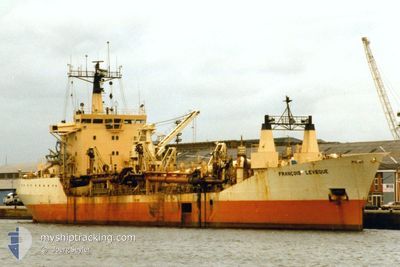
WESTFORD
Trailing Suction Hopper Dredger
Current Trip
| Time Travelled | 4 h, 5 mins |
|---|---|
| Remaining Time | --- |
| Distance Travelled | 39.38 nm |
| Remaining Distance | --- |
| AVG Speed | 10.9 Knots |
| MAX Speed | 10.9 Knots |
| AVG Wind | 5.9 knots |
| MAX Wind | 6.3 knots |
| MIN Temp | 17.7°C / 63.86°F |
| MAX Temp | 18.9°C / 66.02°F |
| Draught | 5.6 m |
| Position Received | Now |
Current Position
| Longitude | --- |
|---|---|
| Latitude | --- |
| Status | Restricted manoeuverability |
| Speed | 10.9 Knots |
| Course | 115.2° |
| Area | Mediterranean Sea - Eastern Basin |
| Station | T-AIS |
| Position Received | Now |
Info
Information
The current position of WESTFORD is in Mediterranean Sea - Eastern Basin with coordinates 32.88092° / 34.94327° as reported on 2025-12-14 17:30 by AIS to our vessel tracker app. The vessel's current speed is 10.9 Knots
The vessel WESTFORD (IMO: 7360162, MMSI: 312421000) is a Trailing Suction Hopper Dredger that was built in 1974 ( 51 years old ). It's sailing under the flag of [BZ] Belize.
In this page you can find informations about the vessels current position, last detected port calls, and current voyage information. If the vessels is not in coverage by AIS you will find the latest position.
The current position of WESTFORD is detected by our AIS receivers and we are not responsible for the reliability of the data. The last position was recorded while the vessel was in Coverage by the Ais receivers of our vessel tracking app.
The current draught of WESTFORD as reported by AIS is 5.6 meters
Weather
| Temperature | 18.9°C / 66.02°F |
|---|---|
| Wind Speed | 6 knots |
| Direction | 10° N |
| Pressure | 1018.1 hPa |
| Humidity | 55.2 % |
| Cloud Coverage | --- |
Featured Company
Last Port Calls
| Port | Arrival | Departure | Time In Port |
|---|---|---|---|
| 2025-12-14 12:53 | 2025-12-14 15:26 | 2 h | |
| 2025-12-14 05:28 | 2025-12-14 08:16 | 2 h | |
| 2025-12-13 21:44 | 2025-12-14 00:36 | 2 h | |
| 2025-12-13 14:39 | 2025-12-13 16:53 | 2 h | |
| 2025-12-13 06:56 | 2025-12-13 09:32 | 2 h | |
| 2025-12-12 23:27 | 2025-12-13 01:55 | 2 h | |
| 2025-12-12 15:29 | 2025-12-12 18:32 | 3 h | |
| 2025-12-12 08:34 | 2025-12-12 14:58 | 6 h | |
| 2025-12-12 03:00 | 2025-12-12 08:04 | 5 h | |
| 2025-12-11 20:55 | 2025-12-12 02:27 | 5 h |
Last Trips
| Origin | Departure | Destination | Arrival | Distance | |
|---|---|---|---|---|---|
| 2025-12-14 08:16 | 2025-12-14 12:53 | 47.58 nm | |||
| 2025-12-14 00:36 | 2025-12-14 05:28 | 47.06 nm | |||
| 2025-12-13 16:53 | 2025-12-13 21:44 | 46.69 nm | |||
| 2025-12-13 09:32 | 2025-12-13 14:39 | 43.51 nm | |||
| 2025-12-13 01:55 | 2025-12-13 06:56 | 46.46 nm | |||
| 2025-12-12 18:32 | 2025-12-12 23:27 | 46.66 nm | |||
| 2025-12-12 14:58 | 2025-12-12 15:29 | 1.72 nm | |||
| 2025-12-12 08:04 | 2025-12-12 08:34 | 2.22 nm | |||
| 2025-12-12 02:27 | 2025-12-12 03:00 | 1.98 nm | |||
| 2025-12-11 20:12 | 2025-12-11 20:55 | 4.45 nm |
Events
| Time | Event | Details | Position / Dest | Info |
|---|---|---|---|---|
| 2025-12-14 16:00 | Status Changed | Restricted manoeuverability Default |
32.93083 / 34.63500
ILHFA
|
Speed: 10.4 kn Course: 94° |
| 2025-12-14 15:42 | Status Changed | Default Restricted manoeuverability |
32.93354 / 34.59993
ILHFA
|
Speed: 4.9 kn Course: 274° |
| 2025-12-14 15:39 | Status Changed | Restricted manoeuverability Default |
32.93271 / 34.60343
ILHFA
|
Speed: 10.6 kn Course: 264° |
| 2025-12-14 15:19 | Status Changed | Default Restricted manoeuverability |
32.93224 / 34.66791
ILHFA
|
Speed: 10.5 kn Course: 268.1° |
| 2025-12-14 13:26 | PORT DEPARTURE |
|
32.83187 / 35.02248
ILHFA
|
Speed: 9.6 kn Course: 355° |
| 2025-12-14 13:22 | START Moving |
32.82301 / 35.02341
[IL] HAIFA
|
Speed: 4.1 kn Course: 349° |
|
| 2025-12-14 11:15 | STOP Moving |
32.82120 / 35.02267
[IL] HAIFA
|
Speed: 0.3 kn Course: 79° |
|
| 2025-12-14 10:53 | PORT ARRIVAL |
|
32.83065 / 35.02051
[IL] HAIFA
|
Speed: 10.9 kn Course: 186.9° |
| 2025-12-14 08:47 | Status Changed | Restricted manoeuverability Default |
32.93315 / 34.60232
ILHFA
|
Speed: Course: 85° |
| 2025-12-14 08:47 | START Moving |
32.93315 / 34.60232
ILHFA
|
Speed: 6.1 kn Course: 87.7° |