
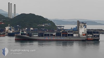
WAN HAI 331
Cargo B
Current Trip
| Time Travelled | 3 h, 39 mins |
|---|---|
| Remaining Time | 2 days |
| Distance Travelled | 55.06 nm |
| Remaining Distance | 871.90 nm |
| AVG Speed | 16 Knots |
| MAX Speed | 17.7 Knots |
| AVG Wind | 10.3 knots |
| MAX Wind | 14 knots |
| MIN Temp | 13.4°C / 56.12°F |
| MAX Temp | 15.9°C / 60.62°F |
| Draught | 9.6 m |
| Position Received | 1 h, 0 m ago |
Current Position
| Longitude | --- |
|---|---|
| Latitude | --- |
| Status | Under way using engine |
| Speed | 16.7 Knots |
| Course | 182.2° |
| Area | Philippine Sea |
| Station | T-AIS |
| Position Received | 1 h, 0 m ago |
Info
Information
The current position of WAN HAI 331 is in Philippine Sea with coordinates 34.05812° / 134.95045° as reported on 2025-12-11 09:14 by AIS to our vessel tracker app. The vessel's current speed is 16.7 Knots and is heading at the port of KEELUNG. The estimated time of arrival as calculated by MyShipTracking vessel tracking app is 2025-12-14 01:31 LT
The vessel WAN HAI 331 (IMO: 9951355, MMSI: 563185700) is a Cargo B It's sailing under the flag of [SG] Singapore.
In this page you can find informations about the vessels current position, last detected port calls, and current voyage information. If the vessels is not in coverage by AIS you will find the latest position.
The current position of WAN HAI 331 is detected by our AIS receivers and we are not responsible for the reliability of the data. The last position was recorded while the vessel was in Coverage by the Ais receivers of our vessel tracking app.
The current draught of WAN HAI 331 as reported by AIS is 9.6 meters
Weather
| Temperature | 15.9°C / 60.62°F |
|---|---|
| Wind Speed | 2 knots |
| Direction | 357° N |
| Pressure | 1016.4 hPa |
| Humidity | 56.4 % |
| Cloud Coverage | 95 % |
Featured Company
Last Port Calls
| Port | Arrival | Departure | Time In Port |
|---|---|---|---|
| 2025-12-11 07:28 | 2025-12-11 15:36 | 8 h | |
| 2025-12-09 12:49 | 2025-12-10 11:33 | 22 h | |
| 2025-12-08 12:07 | 2025-12-09 03:34 | 15 h | |
| 2025-12-07 14:39 | 2025-12-07 22:49 | 8 h | |
| 2025-12-06 11:01 | 2025-12-07 05:53 | 18 h | |
| 2025-11-27 09:39 | 2025-11-28 23:02 | 1 d | |
| 2025-11-25 09:10 | 2025-11-26 18:52 | 1 d | |
| 2025-11-18 08:10 | 2025-11-19 00:29 | 16 h | |
| 2025-11-16 08:24 | 2025-11-16 23:37 | 15 h | |
| 2025-11-11 12:49 | 2025-11-12 01:58 | 13 h |
Last Trips
| Origin | Departure | Destination | Arrival | Distance | |
|---|---|---|---|---|---|
| 2025-12-10 11:33 | 2025-12-11 07:28 | 259.70 nm | |||
| 2025-12-09 03:34 | 2025-12-09 12:49 | 132.57 nm | |||
| 2025-12-07 22:49 | 2025-12-08 12:07 | 119.58 nm | |||
| 2025-12-07 05:53 | 2025-12-07 14:39 | 17.44 nm | |||
| 2025-11-28 23:02 | 2025-12-06 11:01 | 2941.77 nm | |||
| 2025-11-26 18:52 | 2025-11-27 09:39 | 197.27 nm | |||
| 2025-11-19 00:29 | 2025-11-25 09:10 | 1708.39 nm | |||
| 2025-11-16 23:37 | 2025-11-18 08:10 | 493.54 nm | |||
| 2025-11-12 01:58 | 2025-11-16 08:24 | 1090.25 nm | |||
| 2025-11-10 21:57 | 2025-11-11 12:49 | 240.52 nm |
Events
| Time | Event | Details | Position / Dest | Info |
|---|---|---|---|---|
| 2025-12-11 09:21 | Status Changed | Default Under way using engine |
34.02918 / 134.94005
TWKEL
|
Speed: 16.7 kn Course: 182.2° |
| 2025-12-11 09:11 | Status Changed | Under way using engine Default |
34.07253 / 134.95193
TWKEL
|
Speed: 16.1 kn Course: 185° |
| 2025-12-11 09:09 | Status Changed | Default Under way using engine |
34.08205 / 134.95287
TWKEL
|
Speed: 14.9 kn Course: 184° |
| 2025-12-11 08:51 | Status Changed | Under way using engine Default |
34.15681 / 134.95881
TWKEL
|
Speed: 14.3 kn Course: 175° |
| 2025-12-11 08:45 | Status Changed | Default Under way using engine |
34.17833 / 134.95717
TWKEL
|
Speed: 14.2 kn Course: 181.4° |
| 2025-12-11 08:39 | Status Changed | Under way using engine Default |
34.20069 / 134.95740
TWKEL
|
Speed: 15.7 kn Course: 180° |
| 2025-12-11 08:37 | Status Changed | Default Under way using engine |
34.21149 / 134.95755
TWKEL
|
Speed: 9 kn Course: 219.8° |
| 2025-12-11 08:28 | Change Sea Area | Japanese part of the Philippine Sea Japanese part of the Inland Sea |
34.23910 / 134.96236
Philippine Sea
TWKEL
|
Speed: 8.2 kn Course: 216.4° |
| 2025-12-11 08:28 | Status Changed | Under way using engine Default |
34.23970 / 134.96290
TWKEL
|
Speed: 9.9 kn Course: 183° |
| 2025-12-11 08:17 | Status Changed | Default Under way using engine |
34.27687 / 134.96985
TWKEL
|
Speed: 16.6 kn Course: 187.1° |