
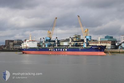
WADOWICE II
Bulk Carrier
Current Trip
| Time Travelled | 3 days |
|---|---|
| Remaining Time | --- |
| Distance Travelled | 265.03 nm |
| Remaining Distance | 41.90 nm |
| AVG Speed | 10.5 Knots |
| MAX Speed | 14.1 Knots |
| AVG Wind | 9.2 knots |
| MAX Wind | 19 knots |
| MIN Temp | 14.2°C / 57.56°F |
| MAX Temp | 18.7°C / 65.66°F |
| Draught | 6.1 m |
| Position Received | 5 m ago |
Current Position
| Longitude | 3.34458° |
|---|---|
| Latitude | 51.83163° |
| Status | At anchor |
| Speed | |
| Course | 202° |
| Area | North Sea |
| Station | T-AIS |
| Position Received | 5 m ago |
Info
Information
The current position of WADOWICE II is in North Sea with coordinates 51.83163° / 3.34458° as reported on 2024-07-27 09:41 by AIS to our vessel tracker app. The vessel's current speed is 0 Knots and is heading at the port of TERNEUZEN. The estimated time of arrival as calculated by MyShipTracking vessel tracking app is 2024-07-27 08:00 LT
The vessel WADOWICE II (IMO: 9488102, MMSI: 311024300) is a Bulk Carrier that was built in 2010 ( 14 years old ). It's sailing under the flag of [BS] Bahamas.
In this page you can find informations about the vessels current position, last detected port calls, and current voyage information. If the vessels is not in coverage by AIS you will find the latest position.
The current position of WADOWICE II is detected by our AIS receivers and we are not responsible for the reliability of the data. The last position was recorded while the vessel was in Coverage by the Ais receivers of our vessel tracking app.
The current draught of WADOWICE II as reported by AIS is 6.1 meters
Weather
| Temperature | 17.8°C / 64.04°F |
|---|---|
| Wind Speed | 12 knots |
| Direction | 224° SW |
| Pressure | 1013.2 hPa |
| Humidity | 82 % |
| Cloud Coverage | 43 % |
Featured Company
Most Visited Ports (Last year)
| Port | Arrivals | |
|---|---|---|
| 3 | ||
| 2 | ||
| 2 | ||
| 2 | ||
| 1 | ||
| 1 |
Last Trips
| Origin | Departure | Destination | Arrival | Distance | |
|---|---|---|---|---|---|
| 2024-07-12 19:45 | 2024-07-21 01:54 | 1807.72 nm | |||
| 2024-06-30 20:52 | 2024-07-11 18:55 | 308.38 nm | |||
| 2024-06-15 04:45 | 2024-06-25 08:27 | 1864.43 nm | |||
| 2024-05-25 13:16 | 2024-06-10 19:29 | 2323.19 nm | |||
| 2024-04-22 16:30 | 2024-05-20 14:09 | 2341.20 nm |
Events
| Time | Event | Details | Position / Dest | Info |
|---|---|---|---|---|
| 2024-07-27 07:32 | Status Changed | At anchor Default |
51.83162 / 3.34472
NL TNZ
|
Speed: Course: 210° |
| 2024-07-27 07:26 | Status Changed | Default At anchor |
51.83161 / 3.34475
NL TNZ
|
Speed: Course: 210° |
| 2024-07-27 05:41 | STOP Moving | 18.02 nm, North West of BURGHSLUIS |
51.83141 / 3.34461
NL TNZ
|
Speed: Course: 224° |
| 2024-07-27 05:32 | Status Changed | At anchor Under way using engine |
51.83018 / 3.34139
NL TNZ
|
Speed: 2.3 kn Course: 105° |
| 2024-07-27 01:44 | Change Sea Area | Dutch part of the North Sea United Kingdom part of the North Sea |
51.97767 / 2.62288
North Sea
NL TNZ
|
Speed: 13.6 kn Course: 175.2° |
| 2024-07-26 22:25 | Status Changed | Under way using engine Default |
52.64935 / 2.20927
NL TNZ
|
Speed: 13.7 kn Course: 133° |
| 2024-07-26 22:23 | Status Changed | Default Under way using engine |
52.65417 / 2.20096
NL TNZ
|
Speed: 13.6 kn Course: 133° |
| 2024-07-26 22:09 | Status Changed | Under way using engine Default |
52.68958 / 2.13767
NL TNZ
|
Speed: 13.7 kn Course: 133° |
| 2024-07-26 21:59 | Status Changed | Default Under way using engine |
52.71609 / 2.09092
NL TNZ
|
Speed: 13.6 kn Course: 131.5° |
| 2024-07-26 14:16 | ETA Changed | 2024/07/27 06:00 2024/07/27 16:00 |
53.81804 / .86072
NL TNZ
|
Speed: 9.8 kn Course: 178.1° |