
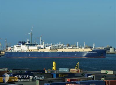
VLADIMIR VORONIN
Tanker D
Current Trip
FOR ORDERS
| Time Travelled | 4 days |
|---|---|
| Remaining Time | --- |
| Distance Travelled | 1541.65 nm |
| Remaining Distance | --- |
| AVG Speed | 15.4 Knots |
| MAX Speed | 18.7 Knots |
| AVG Wind | 14.3 knots |
| MAX Wind | 34.5 knots |
| MIN Temp | -29.7°C / -21.46°F |
| MAX Temp | 7.2°C / 44.96°F |
| Draught | 11.9 m |
| Position Received | 1 m ago |
Current Position
| Longitude | --- |
|---|---|
| Latitude | --- |
| Status | Under way using engine |
| Speed | 16.1 Knots |
| Course | 205.6° |
| Area | Norwegian Sea |
| Station | T-AIS |
| Position Received | 1 m ago |
Info
Information
The current position of VLADIMIR VORONIN is in Norwegian Sea with coordinates 68.00363° / 9.69736° as reported on 2025-12-20 21:13 by AIS to our vessel tracker app. The vessel's current speed is 16.1 Knots
The vessel VLADIMIR VORONIN (IMO: 9750737, MMSI: 311000632) is a Tanker D It's sailing under the flag of [BS] Bahamas.
In this page you can find informations about the vessels current position, last detected port calls, and current voyage information. If the vessels is not in coverage by AIS you will find the latest position.
The current position of VLADIMIR VORONIN is detected by our AIS receivers and we are not responsible for the reliability of the data. The last position was recorded while the vessel was in Coverage by the Ais receivers of our vessel tracking app.
The current draught of VLADIMIR VORONIN as reported by AIS is 11.9 meters
Weather
| Temperature | 6.7°C / 44.06°F |
|---|---|
| Wind Speed | 18 knots |
| Direction | 328° NNW |
| Pressure | 1010.6 hPa |
| Humidity | 77.1 % |
| Cloud Coverage | 78 % |
Featured Company
Events
| Time | Event | Details | Position / Dest | Info |
|---|---|---|---|---|
| 2025-12-20 19:17 | Status Changed | Under way using engine Default |
68.40334 / 10.54518
FOR ORDERS
|
Speed: 15 kn Course: 230° |
| 2025-12-20 19:06 | Status Changed | Default Under way using engine |
68.43500 / 10.64667
FOR ORDERS
|
Speed: 15.5 kn Course: 230° |
| 2025-12-20 17:52 | Status Changed | Under way using engine Default |
68.64945 / 11.33928
FOR ORDERS
|
Speed: 16.2 kn Course: 226° |
| 2025-12-20 17:50 | Status Changed | Default Under way using engine |
68.65495 / 11.35446
FOR ORDERS
|
Speed: 16.4 kn Course: 225.2° |
| 2025-12-19 22:34 | Change Sea Area | Norwegian part of the Norwegian Sea Norwegian part of the Barentsz Sea |
71.96343 / 24.00172
Norwegian Sea
FOR ORDERS
|
Speed: 17.4 kn Course: 246.5° |
| 2025-12-19 20:17 | Draught Changed | 11.9 11 |
72.24403 / 25.96806
FOR ORDERS
|
Speed: 16.8 kn Course: 242.2° |
| 2025-12-19 20:17 | ETA Changed | 2025/12/23 23:01 2025/12/14 13:00 |
72.24403 / 25.96806
FOR ORDERS
|
Speed: 16.8 kn Course: 242.2° |
| 2025-12-19 19:49 | Detected in Sea | Norwegian part of the Barentsz Sea |
72.29878 / 26.33678
Barentsz Sea
|
Speed: 17.5 kn Course: 242.8° |
| 2025-12-19 19:49 | Status Changed | Under way using engine Default |
72.29878 / 26.33678
FOR ORDERS
|
Speed: 17 kn Course: 243° |
| 2025-12-19 19:49 | IN Coverage |
72.29878 / 26.33678
Barentsz Sea
|
Speed: 17.5 kn Course: 242.8° |