
VIVIT AMERICAS LNG
Tanker
Current Trip
| Time Travelled | 57 days |
|---|---|
| Remaining Time | --- |
| Distance Travelled | 9907.74 nm |
| Remaining Distance | --- |
| AVG Speed | 13.4 Knots |
| MAX Speed | 18.7 Knots |
| AVG Wind | 14.6 knots |
| MAX Wind | 35.5 knots |
| MIN Temp | 3.6°C / 38.48°F |
| MAX Temp | 30.3°C / 86.54°F |
| Draught | 9.8 m |
| Position Received | 2 d ago |
Current Position
| Longitude | --- |
|---|---|
| Latitude | --- |
| Status | Under way using engine |
| Speed | 13.3 Knots |
| Course | 284.6° |
| Area | Singapore Strait |
| Station | T-AIS |
| Position Received | 2 d ago |
Info
Information
The current position of VIVIT AMERICAS LNG is in Singapore Strait with coordinates 1.21919° / 103.51519° as reported on 2025-03-02 02:32 by AIS to our vessel tracker app. The vessel's current speed is 13.3 Knots and is heading at the port of COVE POINT. The estimated time of arrival as calculated by MyShipTracking vessel tracking app is 2025-04-04 00:01 LT
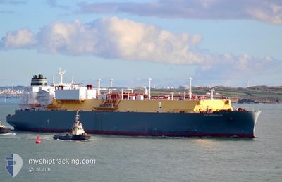
The vessel VIVIT AMERICAS LNG (IMO: 9864667, MMSI: 215574000) is a Tanker It's sailing under the flag of [MT] Malta.
In this page you can find informations about the vessels current position, last detected port calls, and current voyage information. If the vessels is not in coverage by AIS you will find the latest position.
The current position of VIVIT AMERICAS LNG is detected by our AIS receivers and we are not responsible for the reliability of the data. The last position was recorded while the vessel was in Coverage by the Ais receivers of our vessel tracking app.
The current draught of VIVIT AMERICAS LNG as reported by AIS is 9.8 meters
Weather
| Temperature | 25.1°C / 77.18°F |
|---|---|
| Wind Speed | 14 knots |
| Direction | 279° W |
| Pressure | 1009.2 hPa |
| Humidity | 88.5 % |
| Cloud Coverage | 100 % |
Featured Company
Last Port Calls
| Port | Arrival | Departure | Time In Port |
|---|---|---|---|
| 2025-01-04 07:03 | 2025-01-05 08:43 | 1 d |
Most Visited Ports (Last year)
| Port | Arrivals | |
|---|---|---|
| 3 | ||
| 3 | ||
| 1 | ||
| 1 | ||
| 1 | ||
| 1 |
Last Trips
| Origin | Departure | Destination | Arrival | Distance | |
|---|---|---|---|---|---|
| 2024-12-22 12:43 | 2025-01-04 07:03 | 3251.37 nm |
Events
| Time | Event | Details | Position / Dest | Info |
|---|---|---|---|---|
| 2025-03-02 02:38 | Status Changed | Default Under way using engine |
1.22499 / 103.49456
USCP6
|
Speed: 13.3 kn Course: 284.6° |
| 2025-03-02 02:32 | Status Changed | Under way using engine Default |
1.21919 / 103.51519
USCP6
|
Speed: 13.2 kn Course: 284° |
| 2025-03-02 02:32 | OUT of Coverage |
1.21919 / 103.51519
Singapore Strait
|
Speed: 13.3 kn Course: 284.6° |
|
| 2025-03-02 02:29 | Status Changed | Default Under way using engine |
1.21688 / 103.52432
USCP6
|
Speed: 13.5 kn Course: 284° |
| 2025-03-02 02:11 | Change Sea Area | Malaysian part of the Singapore Strait Indonesian part of the Singapore Strait |
1.20023 / 103.59191
Singapore Strait
|
Speed: 14.1 kn Course: 282.5° |
| 2025-03-02 01:47 | Change Sea Area | Indonesian part of the Singapore Strait Singaporean part of the Singapore Strait |
1.17179 / 103.68121
Singapore Strait
|
Speed: 13.9 kn Course: 299.6° |
| 2025-03-01 23:58 | Change Sea Area | Singaporean part of the Singapore Strait Indonesian part of the Singapore Strait |
1.26050 / 104.00621
Singapore Strait
|
Speed: 13.1 kn Course: 267.6° |
| 2025-03-01 23:44 | Change Sea Area | Indonesian part of the Singapore Strait Singaporean part of the Singapore Strait |
1.27045 / 104.04877
Singapore Strait
|
Speed: 10.6 kn Course: 253.4° |
| 2025-03-01 23:41 | Change Sea Area | Singaporean part of the Singapore Strait Malaysian part of the Singapore Strait |
1.27242 / 104.05744
Singapore Strait
|
Speed: 10.7 kn Course: 265.3° |
| 2025-03-01 23:14 | Status Changed | Under way using engine Default |
1.28481 / 104.14985
USCP6
|
Speed: 12.9 kn Course: 261° |