
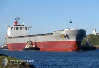
VITTORIA
Bulk Carrier
Current Trip
T.KAMPEH
| Time Travelled | 30 days |
|---|---|
| Remaining Time | --- |
| Distance Travelled | 5485.60 nm |
| Remaining Distance | --- |
| AVG Speed | 10.8 Knots |
| MAX Speed | 13.8 Knots |
| AVG Wind | 9.4 knots |
| MAX Wind | 23 knots |
| MIN Temp | 23.3°C / 73.94°F |
| MAX Temp | 30.5°C / 86.9°F |
| Draught | 7.5 m |
| Position Received | 7 d ago |
Current Position
| Longitude | --- |
|---|---|
| Latitude | --- |
| Status | Under way using engine |
| Speed | 10.7 Knots |
| Course | 83.8° |
| Area | Singapore Strait |
| Station | T-AIS |
| Position Received | 7 d ago |
Info
Information
The current position of VITTORIA is in Singapore Strait with coordinates 1.25142° / 104.11189° as reported on 2025-02-25 00:28 by AIS to our vessel tracker app. The vessel's current speed is 10.7 Knots
The vessel VITTORIA (IMO: 9620645, MMSI: 354314000) is a Bulk Carrier that was built in 2013 ( 12 years old ). It's sailing under the flag of [PA] Panama.
In this page you can find informations about the vessels current position, last detected port calls, and current voyage information. If the vessels is not in coverage by AIS you will find the latest position.
The current position of VITTORIA is detected by our AIS receivers and we are not responsible for the reliability of the data. The last position was recorded while the vessel was in Coverage by the Ais receivers of our vessel tracking app.
The current draught of VITTORIA as reported by AIS is 7.5 meters
Weather
| Temperature | 26°C / 78.8°F |
|---|---|
| Wind Speed | 8 knots |
| Direction | 5° N |
| Pressure | 1009.1 hPa |
| Humidity | 85.6 % |
| Cloud Coverage | 100 % |
Featured Company
Last Trips
Events
| Time | Event | Details | Position / Dest | Info |
|---|---|---|---|---|
| 2025-03-04 10:34 | START Moving | 9.03 nm, West of MENTOK |
-2.11622 / 105.01788
T.KAMPEH
|
Speed: 4 kn Course: 340° |
| 2025-02-26 10:21 | STOP Moving | 8.9 nm, West of MENTOK |
-2.12555 / 105.02325
T.KAMPEH
|
Speed: 0.3 kn Course: 246° |
| 2025-02-26 09:04 | START Moving | 12.24 nm, West of MENTOK |
-2.01613 / 104.96670
T.KAMPEH
|
Speed: 4.2 kn Course: 128° |
| 2025-02-26 01:39 | STOP Moving | 11.98 nm, West of MENTOK |
-2.02241 / 104.96944
T.KAMPEH
|
Speed: 0.3 kn Course: 295° |
| 2025-02-25 00:33 | Status Changed | Default Under way using engine |
1.25453 / 104.12972
T.KAMPEH
|
Speed: 10.7 kn Course: 83.8° |
| 2025-02-25 00:28 | OUT of Coverage |
1.25142 / 104.11189
Singapore Strait
T.KAMPEH
|
Speed: 10.7 kn Course: 83.8° |
|
| 2025-02-24 20:47 | Draught Changed | 7.5 12.9 |
1.08523 / 103.57489
T.KAMPEH
|
Speed: 9.6 kn Course: 121.3° |
| 2025-02-24 20:47 | Destination Changed | T.KAMPEH MYPKG |
1.08523 / 103.57489
T.KAMPEH
|
Speed: 9.6 kn Course: 121.3° |
| 2025-02-24 20:47 | ETA Changed | 2025/02/26 12:00 2025/02/19 22:00 |
1.08523 / 103.57489
T.KAMPEH
|
Speed: 9.6 kn Course: 121.3° |
| 2025-02-24 19:46 | Change Sea Area | Indonesian part of the Singapore Strait Indonesian part of the Malacca Strait |
1.16996 / 103.43542
Singapore Strait
|
Speed: 9.1 kn Course: 122.1° |