
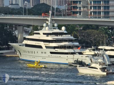
VICTORIOUS
Other Type
Current Trip
YALIKAVAC
| Time Travelled | 5 days |
|---|---|
| Remaining Time | --- |
| Distance Travelled | 1669.71 nm |
| Remaining Distance | --- |
| AVG Speed | 12.9 Knots |
| MAX Speed | 14.5 Knots |
| AVG Wind | 9.9 knots |
| MAX Wind | 19 knots |
| MIN Temp | 14.1°C / 57.38°F |
| MAX Temp | 20.3°C / 68.54°F |
| Draught | 4.4 m |
| Position Received | 6 m ago |
Current Position
| Longitude | 27.28235° |
|---|---|
| Latitude | 37.11290° |
| Status | At anchor |
| Speed | 0.1 Knots |
| Course | 214° |
| Area | Aegean Sea |
| Station | T-AIS |
| Position Received | 6 m ago |
Info
Information
The current position of VICTORIOUS is in Aegean Sea with coordinates 37.11290° / 27.28235° as reported on 2024-05-03 23:55 by AIS to our vessel tracker app. The vessel's current speed is 0.1 Knots
The vessel VICTORIOUS (IMO: 1009912, MMSI: 319222400) is a Other Type It's sailing under the flag of [KY] Cayman Is.
In this page you can find informations about the vessels current position, last detected port calls, and current voyage information. If the vessels is not in coverage by AIS you will find the latest position.
The current position of VICTORIOUS is detected by our AIS receivers and we are not responsible for the reliability of the data. The last position was recorded while the vessel was in Coverage by the Ais receivers of our vessel tracking app.
The current draught of VICTORIOUS as reported by AIS is 4.4 meters
Weather
| Temperature | 18.4°C / 65.12°F |
|---|---|
| Wind Speed | 19 knots |
| Direction | 273° W |
| Pressure | 1007.4 hPa |
| Humidity | 65.9 % |
| Cloud Coverage | 11 % |
Featured Company
Last Port Calls
| Port | Arrival | Departure | Time In Port |
|---|---|---|---|
| 2024-04-25 05:23 | 2024-04-28 09:32 | 3 d | |
| 2024-04-12 16:15 | 2024-04-12 16:41 | 25 m | |
| 2024-03-13 10:12 |
Last Trips
| Origin | Departure | Destination | Arrival | Distance | |
|---|---|---|---|---|---|
| 2024-04-12 12:41 | 2024-04-25 07:23 | 3817.38 nm | |||
| 2024-03-13 06:12 | 2024-04-12 12:15 | 44.02 nm |
Events
| Time | Event | Details | Position / Dest | Info |
|---|---|---|---|---|
| 2024-05-03 19:19 | STOP Moving | 6.83 nm, North of TURGUTREIS |
37.11313 / 27.28179
YALIKAVAC
|
Speed: Course: 205° |
| 2024-05-03 18:28 | Status Changed | At anchor Under way using engine |
37.11256 / 27.28187
YALIKAVAC
|
Speed: 0.8 kn Course: 248° |
| 2024-05-03 18:08 | Change Sea Area | Turkish part of the Aegean Sea Greek part of the Aegean Sea |
37.10685 / 27.25491
Aegean Sea
|
Speed: 9.2 kn Course: 94.9° |
| 2024-05-03 18:06 | IN Coverage |
37.10685 / 27.25491
Aegean Sea
|
Speed: 9.2 kn Course: 94.9° |
|
| 2024-05-03 16:26 | OUT of Coverage |
37.36813 / 26.91736
Aegean Sea
|
Speed: 13.8 kn Course: 130.9° |
|
| 2024-05-03 09:17 | ETA Changed | 2024/05/03 06:00 2024/05/04 09:30 |
38.25285 / 25.13620
YALIKAVAC
|
Speed: 14.3 kn Course: 108.4° |
| 2024-05-03 09:10 | Destination Changed | YALIKAVAC Y |
38.26291 / 25.10624
YALIKAVAC
|
Speed: 14.4 kn Course: 112.8° |
| 2024-05-03 09:08 | Destination Changed | Y TK KOCAELI |
38.26763 / 25.09385
Y
|
Speed: 14.3 kn Course: 112.8° |
| 2024-05-02 21:32 | Destination Changed | TK KOCAELI KOCAELI |
36.43470 / 23.23513
TK KOCAELI
|
Speed: 13.2 kn Course: 63.3° |
| 2024-05-02 20:48 | Change Sea Area | Greek part of the Aegean Sea Greek part of the Mediterranean Sea - Eastern Basin |
36.40061 / 23.04415
Aegean Sea
KOCAELI
|
Speed: 13.1 kn Course: 100.6° |