
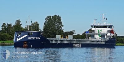
VERTOM CYTA
Cargo
Current Trip
| Time Travelled | 7 h, 29 mins |
|---|---|
| Remaining Time | 3 days |
| Distance Travelled | 62.09 nm |
| Remaining Distance | 669.20 nm |
| AVG Speed | 10.1 Knots |
| MAX Speed | 13.7 Knots |
| AVG Wind | 5.1 knots |
| MAX Wind | 10.6 knots |
| MIN Temp | 12°C / 53.6°F |
| MAX Temp | 14.3°C / 57.74°F |
| Draught | 6.2 m |
| Position Received | Now |
Current Position
| Longitude | 2.34933° |
|---|---|
| Latitude | 51.35914° |
| Status | Under way using engine |
| Speed | 8 Knots |
| Course | 255.6° |
| Area | North Sea |
| Station | T-AIS |
| Position Received | Now |
Info
Information
The current position of VERTOM CYTA is in North Sea with coordinates 51.35914° / 2.34933° as reported on 2024-05-06 22:13 by AIS to our vessel tracker app. The vessel's current speed is 8 Knots and is heading at the port of BORDEAUX. The estimated time of arrival as calculated by MyShipTracking vessel tracking app is 2024-05-10 00:07 LT
The vessel VERTOM CYTA (IMO: 9938731, MMSI: 244928000) is a Cargo It's sailing under the flag of [NL] Netherlands.
In this page you can find informations about the vessels current position, last detected port calls, and current voyage information. If the vessels is not in coverage by AIS you will find the latest position.
The current position of VERTOM CYTA is detected by our AIS receivers and we are not responsible for the reliability of the data. The last position was recorded while the vessel was in Coverage by the Ais receivers of our vessel tracking app.
The current draught of VERTOM CYTA as reported by AIS is 6.2 meters
Weather
| Temperature | 11.9°C / 53.42°F |
|---|---|
| Wind Speed | 5 knots |
| Direction | 286° WNW |
| Pressure | 1012.1 hPa |
| Humidity | 86.6 % |
| Cloud Coverage | 92 % |
Featured Company
Last Port Calls
| Port | Arrival | Departure | Time In Port |
|---|---|---|---|
| 2024-05-04 14:56 | 2024-05-06 14:45 | 1 d | |
| 2024-05-04 14:24 | 2024-05-04 14:40 | 16 m | |
| 2024-04-19 22:52 | 2024-04-22 07:37 | 2 d | |
| 2024-04-17 17:35 | 2024-04-19 11:11 | 1 d | |
| 2024-04-11 17:52 | 2024-04-16 11:45 | 4 d | |
| 2024-03-18 07:51 | 2024-03-23 16:07 | 5 d | |
| 2024-03-11 20:30 | 2024-03-12 18:42 | 22 h |
Most Visited Ports (Last year)
| Port | Arrivals | |
|---|---|---|
| 5 | ||
| 4 | ||
| 4 | ||
| 3 | ||
| 2 | ||
| 2 |
Last Trips
| Origin | Departure | Destination | Arrival | Distance | |
|---|---|---|---|---|---|
| 2024-05-04 16:40 | 2024-05-04 16:56 | 1.16 nm | |||
| 2024-04-22 09:37 | 2024-05-04 16:24 | 912.10 nm | |||
| 2024-04-19 13:11 | 2024-04-20 00:52 | 79.00 nm | |||
| 2024-04-16 13:45 | 2024-04-17 19:35 | 284.84 nm | |||
| 2024-03-23 17:07 | 2024-04-11 19:52 | 2899.99 nm | |||
| 2024-03-12 19:42 | 2024-03-18 08:51 | 381.78 nm | |||
| 2024-02-21 05:09 | 2024-03-11 21:30 | 3097.06 nm |
Events
| Time | Event | Details | Position / Dest | Info |
|---|---|---|---|---|
| 2024-05-06 18:32 | Change Sea Area | Belgian part of the North Sea Dutch part of the North Sea |
51.40861 / 3.32910
North Sea
FRBOD
|
Speed: 10.9 kn Course: 272.9° |
| 2024-05-06 16:29 | START Moving | 0.68 nm, North West of TERNEUZEN |
51.32953 / 3.81595
FRBOD
|
Speed: 3.3 kn Course: 338° |
| 2024-05-06 15:51 | STOP Moving | 0.52 nm, North West of TERNEUZEN |
51.32712 / 3.81781
FRBOD
|
Speed: 0.3 kn Course: 332° |
| 2024-05-06 15:06 | START Moving | 1.11 nm, North of SLUISKIL |
51.28900 / 3.83714
FRBOD
|
Speed: 3.2 kn Course: 346° |
| 2024-05-06 14:45 | PORT DEPARTURE |
|
51.28442 / 3.83888
FRBOD
|
Speed: 1.2 kn Course: 348° |
| 2024-05-06 14:21 | Status Changed | Under way using engine Moored |
51.27491 / 3.84425
[NL] SLUISKIL
|
Speed: Course: 332° |
| 2024-05-06 13:36 | Draught Changed | 6.2 5.7 |
51.27491 / 3.84426
[NL] SLUISKIL
|
Speed: Course: 332° |
| 2024-05-06 13:36 | ETA Changed | 2024/05/09 18:00 2024/05/09 20:00 |
51.27491 / 3.84426
[NL] SLUISKIL
|
Speed: Course: 332° |
| 2024-05-06 07:42 | Status Changed | Moored Default |
51.27493 / 3.84425
[NL] SLUISKIL
|
Speed: Course: 331° |
| 2024-05-06 07:39 | Status Changed | Default Moored |
51.27490 / 3.84425
[NL] SLUISKIL
|
Speed: Course: 331° |