
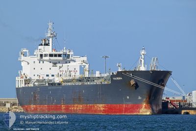
VALSESIA
Oil/Chemical Tanker
Current Trip
| Time Travelled | 2 days |
|---|---|
| Remaining Time | 2 days |
| Distance Travelled | 613.07 nm |
| Remaining Distance | 763.22 nm |
| AVG Speed | 12.4 Knots |
| MAX Speed | 13.3 Knots |
| AVG Wind | 8.4 knots |
| MAX Wind | 18 knots |
| MIN Temp | 12.8°C / 55.04°F |
| MAX Temp | 17°C / 62.6°F |
| Draught | 7.2 m |
| Position Received | 6 h, 42 m ago |
Current Position
| Longitude | --- |
|---|---|
| Latitude | --- |
| Status | Under way using engine |
| Speed | 12.4 Knots |
| Course | 112° |
| Area | Mediterranean Sea - Eastern Basin |
| Station | T-AIS |
| Position Received | 6 h, 42 m ago |
Info
Information
The current position of VALSESIA is in Mediterranean Sea - Eastern Basin with coordinates 37.43990° / 12.45307° as reported on 2026-01-04 16:17 by AIS to our vessel tracker app. The vessel's current speed is 12.4 Knots and is heading at the port of THESSALONIKI. The estimated time of arrival as calculated by MyShipTracking vessel tracking app is 2026-01-07 12:43 LT
The vessel VALSESIA (IMO: 9385178, MMSI: 215063000) is a Oil/Chemical Tanker that was built in 2008 ( 18 years old ). It's sailing under the flag of [MT] Malta.
In this page you can find informations about the vessels current position, last detected port calls, and current voyage information. If the vessels is not in coverage by AIS you will find the latest position.
The current position of VALSESIA is detected by our AIS receivers and we are not responsible for the reliability of the data. The last position was recorded while the vessel was in Coverage by the Ais receivers of our vessel tracking app.
The current draught of VALSESIA as reported by AIS is 7.2 meters
Weather
| Temperature | 17.1°C / 62.78°F |
|---|---|
| Wind Speed | 15 knots |
| Direction | 124° SE |
| Pressure | 1007.8 hPa |
| Humidity | 85 % |
| Cloud Coverage | 100 % |
Featured Company
Last Port Calls
| Port | Arrival | Departure | Time In Port |
|---|---|---|---|
| 2025-12-31 02:04 | 2026-01-02 22:06 | 2 d | |
| 2025-12-20 03:02 | 2025-12-23 22:53 | 3 d | |
| 2025-12-09 10:53 | 2025-12-10 13:55 | 1 d | |
| 2025-11-28 18:57 | 2025-11-29 22:41 | 1 d | |
| 2025-11-14 07:40 | 2025-11-15 12:40 | 1 d |
Most Visited Ports (Last year)
| Port | Arrivals | |
|---|---|---|
| 5 | ||
| 5 | ||
| 4 | ||
| 3 | ||
| 3 | ||
| 2 |
Last Trips
| Origin | Departure | Destination | Arrival | Distance | |
|---|---|---|---|---|---|
| 2025-12-23 22:53 | 2025-12-31 02:04 | 987.72 nm | |||
| 2025-12-10 13:55 | 2025-12-20 03:02 | 1221.87 nm | |||
| 2025-11-29 22:41 | 2025-12-09 10:53 | 1707.84 nm | |||
| 2025-11-15 12:40 | 2025-11-28 18:57 | 1751.57 nm | |||
| 2025-10-28 09:42 | 2025-11-14 07:40 | 1650.21 nm |
Events
| Time | Event | Details | Position / Dest | Info |
|---|---|---|---|---|
| 2026-01-04 16:20 | Status Changed | Default Under way using engine |
37.43514 / 12.46685
GR SKG
|
Speed: 12.4 kn Course: 112° |
| 2026-01-04 16:17 | OUT of Coverage |
37.43990 / 12.45307
Mediterranean Sea - Eastern Basin
GR SKG
|
Speed: 12.4 kn Course: 112° |
|
| 2026-01-04 14:32 | Change Sea Area | Italian part of the Mediterranean Sea - Eastern Basin Italian part of the Mediterranean Sea - Western Basin |
37.58942 / 12.03422
Mediterranean Sea - Eastern Basin
GR SKG
|
Speed: 12.5 kn Course: 114° |
| 2026-01-04 13:43 | Status Changed | Under way using engine Default |
37.66195 / 11.84413
GR SKG
|
Speed: 12.4 kn Course: 114° |
| 2026-01-04 13:33 | Status Changed | Default Under way using engine |
37.67767 / 11.80170
GR SKG
|
Speed: 12.5 kn Course: 113° |
| 2026-01-04 11:49 | Status Changed | Under way using engine Default |
37.82473 / 11.38475
GR SKG
|
Speed: 12.5 kn Course: 115° |
| 2026-01-04 11:37 | IN Coverage |
37.82450 / 11.38542
Mediterranean Sea - Western Basin
GR SKG
|
Speed: 12.5 kn Course: 115° |
|
| 2026-01-04 10:49 | Status Changed | Default Under way using engine |
37.91839 / 11.14535
GR SKG
|
Speed: 12.9 kn Course: 113° |
| 2026-01-04 10:42 | OUT of Coverage |
37.92862 / 11.11735
Mediterranean Sea - Western Basin
GR SKG
|
Speed: 12.9 kn Course: 113° |
|
| 2026-01-04 10:05 | Change Sea Area | Italian part of the Mediterranean Sea - Western Basin Tunisian part of the Mediterranean Sea - Western Basin |
37.97757 / 10.96150
Mediterranean Sea - Western Basin
GR SKG
|
Speed: 12.7 kn Course: 110° |