
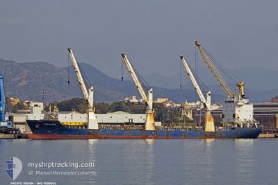
UML VICTORIA
General Cargo
Current Trip
| Time Travelled | 2 days |
|---|---|
| Remaining Time | 7 h, 52 mins |
| Distance Travelled | 675.73 nm |
| Remaining Distance | 79.70 nm |
| AVG Speed | 10.8 Knots |
| MAX Speed | 12 Knots |
| AVG Wind | 13.3 knots |
| MAX Wind | 31.8 knots |
| MIN Temp | 12.6°C / 54.68°F |
| MAX Temp | 15.7°C / 60.26°F |
| Draught | 8 m |
| Position Received | 2 m ago |
Current Position
| Longitude | --- |
|---|---|
| Latitude | --- |
| Status | Under way using engine |
| Speed | 9.8 Knots |
| Course | 35.8° |
| Area | Mediterranean Sea - Western Basin |
| Station | T-AIS |
| Position Received | 2 m ago |
Info
Information
The current position of UML VICTORIA is in Mediterranean Sea - Western Basin with coordinates 43.29438° / 8.17131° as reported on 2025-12-22 08:05 by AIS to our vessel tracker app. The vessel's current speed is 9.8 Knots and is heading at the port of GENOVA. The estimated time of arrival as calculated by MyShipTracking vessel tracking app is 2025-12-22 16:59 LT
The vessel UML VICTORIA (IMO: 9500053, MMSI: 305380000) is a General Cargo that was built in 2009 ( 16 years old ). It's sailing under the flag of [AG] Antigua Barbuda.
In this page you can find informations about the vessels current position, last detected port calls, and current voyage information. If the vessels is not in coverage by AIS you will find the latest position.
The current position of UML VICTORIA is detected by our AIS receivers and we are not responsible for the reliability of the data. The last position was recorded while the vessel was in Coverage by the Ais receivers of our vessel tracking app.
The current draught of UML VICTORIA as reported by AIS is 8 meters
Weather
| Temperature | 13.3°C / 55.94°F |
|---|---|
| Wind Speed | 29 knots |
| Direction | 52° NE |
| Pressure | 1009.9 hPa |
| Humidity | 78.4 % |
| Cloud Coverage | 100 % |
Featured Company
Last Port Calls
| Port | Arrival | Departure | Time In Port |
|---|---|---|---|
| 2025-12-19 05:08 | 2025-12-19 21:52 | 16 h | |
| 2025-12-12 04:43 | 2025-12-12 05:37 | 54 m | |
| 2025-12-06 00:02 | 2025-12-09 19:14 | 3 d | |
| 2025-11-23 05:45 | 2025-12-04 19:57 | 11 d | |
| 2025-11-12 15:35 | 2025-11-13 02:22 | 10 h | |
| 2025-11-04 13:02 | 2025-11-06 18:18 | 2 d | |
| 2025-10-30 15:46 | 2025-10-31 17:03 | 1 d | |
| 2025-10-24 16:55 | 2025-10-25 08:14 | 15 h | |
| 2025-10-08 02:02 | 2025-10-09 23:14 | 1 d | |
| 2025-10-03 06:02 | 2025-10-05 20:22 | 2 d |
Most Visited Ports (Last year)
| Port | Arrivals | |
|---|---|---|
| 3 | ||
| 3 | ||
| 2 | ||
| 2 | ||
| 2 | ||
| 2 |
Last Trips
| Origin | Departure | Destination | Arrival | Distance | |
|---|---|---|---|---|---|
| 2025-12-12 05:37 | 2025-12-19 05:08 | 1914.18 nm | |||
| 2025-12-09 19:14 | 2025-12-12 04:43 | 701.76 nm | |||
| 2025-12-04 19:57 | 2025-12-06 00:02 | 340.67 nm | |||
| 2025-11-13 02:22 | 2025-11-23 05:45 | 3116.92 nm | |||
| 2025-11-06 18:18 | 2025-11-12 15:35 | 2114.65 nm | |||
| 2025-10-31 17:03 | 2025-11-04 13:02 | 1222.27 nm | |||
| 2025-10-25 08:14 | 2025-10-30 15:46 | 1846.56 nm | |||
| 2025-10-09 23:14 | 2025-10-24 16:55 | 5177.33 nm | |||
| 2025-10-05 20:22 | 2025-10-08 02:02 | 22.84 nm | |||
| 2025-09-23 21:55 | 2025-10-03 06:02 | 2861.02 nm |
Events
| Time | Event | Details | Position / Dest | Info |
|---|---|---|---|---|
| 2025-12-22 07:54 | Draught Changed | 8 8.1 |
43.26760 / 8.14508
GENOA
|
Speed: 9.9 kn Course: 34.7° |
| 2025-12-22 07:34 | ETA Changed | 2025/12/22 16:00 2025/12/22 17:00 |
43.22393 / 8.10126
GENOA
|
Speed: 9.9 kn Course: 36.7° |
| 2025-12-22 06:13 | Change Sea Area | Italian part of the Mediterranean Sea - Western Basin French part of the Mediterranean Sea - Western Basin |
43.07428 / 7.89483
Mediterranean Sea - Western Basin
GENOA
|
Speed: 9.5 kn Course: 38.3° |
| 2025-12-22 03:48 | Detected in Sea | French part of the Mediterranean Sea - Western Basin |
42.75397 / 7.56393
Mediterranean Sea - Western Basin
GENOA
|
Speed: 10.3 kn Course: 36.2° |
| 2025-12-22 03:48 | Status Changed | Under way using engine Default |
42.75397 / 7.56393
GENOA
|
Speed: 10.5 kn Course: 38° |
| 2025-12-22 03:48 | IN Coverage |
42.75397 / 7.56393
Mediterranean Sea - Western Basin
GENOA
|
Speed: 10.3 kn Course: 36.2° |
|
| 2025-12-21 04:20 | Status Changed | Default Under way using engine |
40.27404 / 2.50582
GENOA
|
Speed: 11.2 kn Course: 48.3° |
| 2025-12-21 04:17 | OUT of Coverage |
40.26738 / 2.49607
Balearic Sea
GENOA
|
Speed: 11.2 kn Course: 48.3° |
|
| 2025-12-21 03:38 | Status Changed | Under way using engine Default |
40.18481 / 2.37650
GENOA
|
Speed: 11.3 kn Course: 47° |
| 2025-12-21 03:03 | Status Changed | Default Under way using engine |
40.10878 / 2.27122
GENOA
|
Speed: 11.5 kn Course: 46.3° |