
ULTRA QUALITY
Cargo
Current Trip
| Time Travelled | 26 days |
|---|---|
| Remaining Time | --- |
| Distance Travelled | 7057.21 nm |
| Remaining Distance | --- |
| AVG Speed | 11.9 Knots |
| MAX Speed | 15.7 Knots |
| AVG Wind | 11.4 knots |
| MAX Wind | 35 knots |
| MIN Temp | 1.8°C / 35.24°F |
| MAX Temp | 29.3°C / 84.74°F |
| Draught | 10.3 m |
| Position Received | 6 d ago |
Current Position
| Longitude | --- |
|---|---|
| Latitude | --- |
| Status | Under way using engine |
| Speed | 12.2 Knots |
| Course | 31.5° |
| Area | North Atlantic Ocean |
| Station | T-AIS |
| Position Received | 6 d ago |
Info
Information
The current position of ULTRA QUALITY is in North Atlantic Ocean with coordinates 18.89403° / -67.86428° as reported on 2025-03-07 17:07 by AIS to our vessel tracker app. The vessel's current speed is 12.2 Knots and is heading at the port of BALBOA.
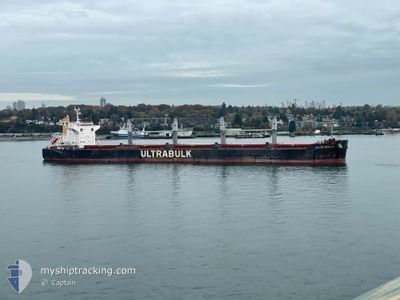
The vessel ULTRA QUALITY (IMO: 9866524, MMSI: 636019753) is a Cargo It's sailing under the flag of [LR] Liberia.
In this page you can find informations about the vessels current position, last detected port calls, and current voyage information. If the vessels is not in coverage by AIS you will find the latest position.
The current position of ULTRA QUALITY is detected by our AIS receivers and we are not responsible for the reliability of the data. The last position was recorded while the vessel was in Coverage by the Ais receivers of our vessel tracking app.
The current draught of ULTRA QUALITY as reported by AIS is 10.3 meters
Weather
| Temperature | 17.5°C / 63.5°F |
|---|---|
| Wind Speed | 21 knots |
| Direction | 176° S |
| Pressure | 995.6 hPa |
| Humidity | 90.3 % |
| Cloud Coverage | 51 % |
Featured Company
Last Trips
| Origin | Departure | Destination | Arrival | Distance |
|---|
Events
| Time | Event | Details | Position / Dest | Info |
|---|---|---|---|---|
| 2025-03-07 17:28 | Status Changed | Default Under way using engine |
18.95283 / -67.82758
PABLB
|
Speed: 12.2 kn Course: 31.5° |
| 2025-03-07 17:07 | OUT of Coverage |
18.89403 / -67.86428
North Atlantic Ocean
|
Speed: 12.2 kn Course: 31.5° |
|
| 2025-03-07 16:45 | Change Sea Area | Dominican Republic part of the North Atlantic Ocean Panamanian part of the Caribbean Sea |
18.82936 / -67.90621
North Atlantic Ocean
|
Speed: 12.3 kn Course: 31.9° |
| 2025-03-07 16:44 | Status Changed | Under way using engine Default |
18.82644 / -67.90816
PABLB
|
Speed: 12.3 kn Course: 33° |
| 2025-03-07 16:34 | IN Coverage |
18.82936 / -67.90621
North Atlantic Ocean
|
Speed: 12.3 kn Course: 31.9° |
|
| 2025-03-04 18:16 | Status Changed | Default Under way using engine |
9.81182 / -79.56691
PABLB
|
Speed: 12.7 kn Course: 53.3° |
| 2025-03-04 18:11 | OUT of Coverage |
9.80089 / -79.58183
Caribbean Sea
|
Speed: 12.7 kn Course: 53.3° |
|
| 2025-03-04 15:25 | Change Sea Area | Panamanian part of the Caribbean Sea Panamanian part of the North Pacific Ocean |
9.37392 / -79.91883
Caribbean Sea
|
Speed: 9.3 kn Course: 1.2° |
| 2025-03-04 14:56 | Status Changed | Under way using engine Default |
9.30944 / -79.91856
PABLB
|
Speed: 5.9 kn Course: 2° |
| 2025-03-04 14:56 | Status Changed | Default Under way using engine |
9.30855 / -79.91859
PABLB
|
Speed: 4.9 kn Course: 5° |