
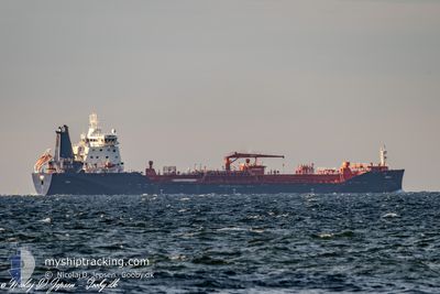
UIKKU
Tanker A
Current Trip
| Time Travelled | 1 day |
|---|---|
| Remaining Time | 3 days |
| Distance Travelled | 382.95 nm |
| Remaining Distance | 964.37 nm |
| AVG Speed | 11.6 Knots |
| MAX Speed | 14.1 Knots |
| AVG Wind | 14.7 knots |
| MAX Wind | 20 knots |
| MIN Temp | 1.9°C / 35.42°F |
| MAX Temp | 4.7°C / 40.46°F |
| Draught | 9.7 m |
| Position Received | 7 h, 37 m ago |
Current Position
| Longitude | --- |
|---|---|
| Latitude | --- |
| Status | Under way using engine |
| Speed | 10.3 Knots |
| Course | 26.5° |
| Area | North Sea |
| Station | T-AIS |
| Position Received | 7 h, 37 m ago |
Info
Information
The current position of UIKKU is in North Sea with coordinates 55.42905° / 5.85286° as reported on 2026-01-05 16:31 by AIS to our vessel tracker app. The vessel's current speed is 10.3 Knots and is heading at the port of PORVOO. The estimated time of arrival as calculated by MyShipTracking vessel tracking app is 2026-01-09 04:06 LT
The vessel UIKKU (IMO: 9797814, MMSI: 230689000) is a Tanker A It's sailing under the flag of [FI] Finland.
In this page you can find informations about the vessels current position, last detected port calls, and current voyage information. If the vessels is not in coverage by AIS you will find the latest position.
The current position of UIKKU is detected by our AIS receivers and we are not responsible for the reliability of the data. The last position was recorded while the vessel was in Coverage by the Ais receivers of our vessel tracking app.
The current draught of UIKKU as reported by AIS is 9.7 meters
Weather
| Temperature | 1.7°C / 35.06°F |
|---|---|
| Wind Speed | 4 knots |
| Direction | 138° SE |
| Pressure | 1011.5 hPa |
| Humidity | 59.2 % |
| Cloud Coverage | 90 % |
Featured Company
Last Port Calls
| Port | Arrival | Departure | Time In Port |
|---|---|---|---|
| 2025-12-30 08:28 | 2026-01-04 13:10 | 5 d | |
| 2025-12-21 20:25 | 2025-12-26 10:50 | 4 d | |
| 2025-12-14 08:15 | 2025-12-16 15:28 | 2 d | |
| 2025-12-06 21:05 | 2025-12-09 01:05 | 2 d | |
| 2025-12-06 19:25 | 2025-12-06 20:12 | 46 m | |
| 2025-12-02 21:41 | 2025-12-04 04:20 | 1 d | |
| 2025-11-27 20:02 | 2025-11-30 02:13 | 2 d | |
| 2025-11-20 20:42 | 2025-11-22 16:16 | 1 d | |
| 2025-11-12 23:43 | 2025-11-15 11:02 | 2 d | |
| 2025-11-07 20:27 | 2025-11-07 21:23 | 55 m |
Last Trips
| Origin | Departure | Destination | Arrival | Distance | |
|---|---|---|---|---|---|
| 2025-12-26 10:50 | 2025-12-30 08:28 | 142.97 nm | |||
| 2025-12-16 15:28 | 2025-12-21 20:25 | 1434.71 nm | |||
| 2025-12-09 01:05 | 2025-12-14 08:15 | 1347.63 nm | |||
| 2025-12-06 20:12 | 2025-12-06 21:05 | 7.30 nm | |||
| 2025-12-04 04:20 | 2025-12-06 19:25 | 75.97 nm | |||
| 2025-11-30 02:13 | 2025-12-02 21:41 | 330.57 nm | |||
| 2025-11-22 16:16 | 2025-11-27 20:02 | 338.73 nm | |||
| 2025-11-15 11:02 | 2025-11-20 20:42 | 1432.80 nm | |||
| 2025-11-07 21:23 | 2025-11-12 23:43 | 1343.89 nm | |||
| 2025-11-07 19:34 | 2025-11-07 20:27 | 4.97 nm |
Events
| Time | Event | Details | Position / Dest | Info |
|---|---|---|---|---|
| 2026-01-05 17:18 | Status Changed | Default Under way using engine |
55.55592 / 5.96629
BEANR>FISKV
|
Speed: 10.3 kn Course: 26.5° |
| 2026-01-05 16:31 | OUT of Coverage |
55.42905 / 5.85286
North Sea
BEANR>FISKV
|
Speed: 10.3 kn Course: 26.5° |
|
| 2026-01-05 15:36 | Change Sea Area | German part of the North Sea Dutch part of the North Sea |
55.27047 / 5.70741
North Sea
BEANR>FISKV
|
Speed: 11.3 kn Course: 27° |
| 2026-01-05 15:36 | Status Changed | Under way using engine Default |
55.27047 / 5.70741
BEANR>FISKV
|
Speed: 11.7 kn Course: 28° |
| 2026-01-05 15:36 | IN Coverage |
55.27047 / 5.70741
North Sea
BEANR>FISKV
|
Speed: 11.3 kn Course: 27° |
|
| 2026-01-04 19:25 | Status Changed | Default Under way using engine |
51.88207 / 3.11680
BEANR>FISKV
|
Speed: 11.5 kn Course: 335.7° |
| 2026-01-04 19:17 | OUT of Coverage |
51.85934 / 3.13223
North Sea
BEANR>FISKV
|
Speed: 11.5 kn Course: 335.7° |
|
| 2026-01-04 18:50 | ETA Changed | 2026/01/09 11:00 2026/01/09 12:00 |
51.78147 / 3.20281
BEANR>FISKV
|
Speed: 11.8 kn Course: 327.6° |
| 2026-01-04 18:48 | ETA Changed | 2026/01/09 12:00 2026/01/09 13:00 |
51.77687 / 3.20760
BEANR>FISKV
|
Speed: 11.8 kn Course: 327.1° |
| 2026-01-04 17:32 | Change Sea Area | Dutch part of the North Sea Belgian part of the North Sea |
51.54163 / 3.13132
North Sea
BEANR>FISKV
|
Speed: 13.3 kn Course: 38.6° |