
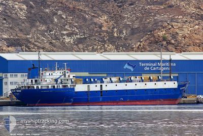
TULEEN
Livestock Carrier
Current Trip
| Time Travelled | 20 h, 10 mins |
|---|---|
| Remaining Time | --- |
| Distance Travelled | 110.72 nm |
| Remaining Distance | --- |
| AVG Speed | 8 Knots |
| MAX Speed | 9.2 Knots |
| AVG Wind | 10.5 knots |
| MAX Wind | 21 knots |
| MIN Temp | 9.1°C / 48.38°F |
| MAX Temp | 13.6°C / 56.48°F |
| Draught | 4.1 m |
| Position Received | 7 h, 51 m ago |
Current Position
| Longitude | --- |
|---|---|
| Latitude | --- |
| Status | Under way using engine |
| Speed | 9.3 Knots |
| Course | 196.8° |
| Area | Black Sea |
| Station | T-AIS |
| Position Received | 7 h, 51 m ago |
Info
Information
The current position of TULEEN is in Black Sea with coordinates 42.80736° / 28.46364° as reported on 2026-01-04 02:46 by AIS to our vessel tracker app. The vessel's current speed is 9.3 Knots and is heading at the port of HAIFA. The estimated time of arrival as calculated by MyShipTracking vessel tracking app is 2026-01-08 13:00 LT
The vessel TULEEN (IMO: 7396630, MMSI: 511100448) is a Livestock Carrier that was built in 1975 ( 51 years old ). It's sailing under the flag of [PW] Palau.
In this page you can find informations about the vessels current position, last detected port calls, and current voyage information. If the vessels is not in coverage by AIS you will find the latest position.
The current position of TULEEN is detected by our AIS receivers and we are not responsible for the reliability of the data. The last position was recorded while the vessel was in Coverage by the Ais receivers of our vessel tracking app.
The current draught of TULEEN as reported by AIS is 4.1 meters
Weather
| Temperature | 15.4°C / 59.72°F |
|---|---|
| Wind Speed | 38 knots |
| Direction | 214° SW |
| Pressure | 1011.8 hPa |
| Humidity | 69.8 % |
| Cloud Coverage | 54 % |
Featured Company
Last Port Calls
| Port | Arrival | Departure | Time In Port |
|---|---|---|---|
| 2026-01-01 15:59 | 2026-01-03 16:28 | 2 d | |
| 2025-12-25 14:25 | 2025-12-25 22:58 | 8 h | |
| 2025-12-19 13:53 | 2025-12-20 17:06 | 1 d | |
| 2025-12-13 13:43 | 2025-12-14 01:02 | 11 h | |
| 2025-12-04 09:43 | 2025-12-08 09:40 | 3 d | |
| 2025-11-26 20:18 | 2025-11-27 02:31 | 6 h | |
| 2025-11-21 15:56 | 2025-11-22 00:48 | 8 h | |
| 2025-11-14 03:24 | 2025-11-14 16:16 | 12 h | |
| 2025-11-08 12:03 | 2025-11-09 14:31 | 1 d | |
| 2025-11-02 13:19 | 2025-11-03 00:09 | 10 h |
Last Trips
| Origin | Departure | Destination | Arrival | Distance | |
|---|---|---|---|---|---|
| 2025-12-25 22:58 | 2026-01-01 15:59 | 1165.11 nm | |||
| 2025-12-20 17:06 | 2025-12-25 14:25 | 1077.45 nm | |||
| 2025-12-14 01:02 | 2025-12-19 13:53 | 1086.24 nm | |||
| 2025-12-08 09:40 | 2025-12-13 13:43 | 1058.36 nm | |||
| 2025-11-27 02:31 | 2025-12-04 09:43 | 1095.12 nm | |||
| 2025-11-22 00:48 | 2025-11-26 20:18 | 1049.40 nm | |||
| 2025-11-14 16:16 | 2025-11-21 15:56 | 1134.17 nm | |||
| 2025-11-09 14:31 | 2025-11-14 03:24 | 1043.20 nm | |||
| 2025-11-03 00:09 | 2025-11-08 12:03 | 1097.38 nm | |||
| 2025-10-28 01:44 | 2025-11-02 13:19 | 1082.49 nm |
Events
| Time | Event | Details | Position / Dest | Info |
|---|---|---|---|---|
| 2026-01-04 02:53 | Status Changed | Default Under way using engine |
42.79163 / 28.45713
ILHFA
|
Speed: 9.3 kn Course: 196.8° |
| 2026-01-04 02:46 | OUT of Coverage |
42.80736 / 28.46364
Black Sea
ILHFA
|
Speed: 9.3 kn Course: 196.8° |
|
| 2026-01-04 00:13 | Status Changed | Under way using engine Default |
43.15134 / 28.61582
ILHFA
|
Speed: 8 kn Course: 200° |
| 2026-01-04 00:08 | Status Changed | Default Under way using engine |
43.16325 / 28.62105
ILHFA
|
Speed: 8.3 kn Course: 198.6° |
| 2026-01-04 00:00 | Draught Changed | 4.1 4 |
43.18023 / 28.62857
ILHFA
|
Speed: 8.3 kn Course: 197.9° |
| 2026-01-04 00:00 | Destination Changed | ILHFA ROMID |
43.18023 / 28.62857
ILHFA
|
Speed: 8.3 kn Course: 197.9° |
| 2026-01-04 00:00 | ETA Changed | 2026/01/08 11:00 2025/12/31 05:00 |
43.18023 / 28.62857
ILHFA
|
Speed: 8.3 kn Course: 197.9° |
| 2026-01-03 23:46 | Status Changed | Under way using engine Default |
43.20851 / 28.64076
ROMID
|
Speed: 7.6 kn Course: 198° |
| 2026-01-03 23:40 | Status Changed | Default Under way using engine |
43.22072 / 28.64578
ROMID
|
Speed: 6.5 kn Course: 194.9° |
| 2026-01-03 23:12 | Status Changed | Under way using engine Default |
43.27454 / 28.66728
ROMID
|
Speed: 7.8 kn Course: 196° |