
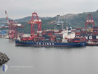
TS TOKYO
Cargo A
Current Trip
PH MNN
| Time Travelled | 3 days |
|---|---|
| Remaining Time | --- |
| Distance Travelled | 14.28 nm |
| Remaining Distance | --- |
| AVG Speed | 9.7 Knots |
| MAX Speed | 14.3 Knots |
| AVG Wind | 8.9 knots |
| MAX Wind | 15.5 knots |
| MIN Temp | 25°C / 77°F |
| MAX Temp | 28.9°C / 84.02°F |
| Draught | 9.6 m |
| Position Received | 1 d ago |
Current Position
| Longitude | --- |
|---|---|
| Latitude | --- |
| Status | At anchor |
| Speed | 0.1 Knots |
| Course | 28° |
| Area | South China Sea |
| Station | T-AIS |
| Position Received | 1 d ago |
Info
Information
The current position of TS TOKYO is in South China Sea with coordinates 14.52271° / 120.79906° as reported on 2025-12-22 10:07 by AIS to our vessel tracker app. The vessel's current speed is 0.1 Knots
The vessel TS TOKYO (IMO: 9784245, MMSI: 538007662) is a Cargo A It's sailing under the flag of [MH] Marshall Is.
In this page you can find informations about the vessels current position, last detected port calls, and current voyage information. If the vessels is not in coverage by AIS you will find the latest position.
The current position of TS TOKYO is detected by our AIS receivers and we are not responsible for the reliability of the data. The last position was recorded while the vessel was in Coverage by the Ais receivers of our vessel tracking app.
The current draught of TS TOKYO as reported by AIS is 9.6 meters
Weather
| Temperature | 26.3°C / 79.34°F |
|---|---|
| Wind Speed | 6 knots |
| Direction | 47° NE |
| Pressure | 1010.9 hPa |
| Humidity | 80.1 % |
| Cloud Coverage | 91 % |
Featured Company
Last Port Calls
| Port | Arrival | Departure | Time In Port |
|---|---|---|---|
| 2025-12-20 06:34 | 2025-12-21 06:50 | 1 d | |
| 2025-12-14 09:44 | 2025-12-14 17:43 | 7 h | |
| 2025-12-11 20:56 | 2025-12-12 07:19 | 10 h | |
| 2025-12-10 00:17 | 2025-12-10 15:49 | 15 h | |
| 2025-12-06 10:49 | 2025-12-07 08:29 | 21 h | |
| 2025-12-01 22:13 | 2025-12-03 04:09 | 1 d | |
| 2025-11-27 05:06 | 2025-11-27 13:20 | 8 h | |
| 2025-11-23 06:28 | 2025-11-23 17:32 | 11 h | |
| 2025-11-19 02:51 | 2025-11-20 00:20 | 21 h | |
| 2025-11-09 09:47 | 2025-11-09 23:28 | 13 h |
Last Trips
| Origin | Departure | Destination | Arrival | Distance | |
|---|---|---|---|---|---|
| 2025-12-14 17:43 | 2025-12-20 06:34 | 698.57 nm | |||
| 2025-12-12 07:19 | 2025-12-14 09:44 | 118.67 nm | |||
| 2025-12-10 15:49 | 2025-12-11 20:56 | 392.52 nm | |||
| 2025-12-07 08:29 | 2025-12-10 00:17 | 727.86 nm | |||
| 2025-12-03 04:09 | 2025-12-06 10:49 | 33.86 nm | |||
| 2025-11-27 13:20 | 2025-12-01 22:13 | 710.31 nm | |||
| 2025-11-23 17:32 | 2025-11-27 05:06 | 1176.21 nm | |||
| 2025-11-20 00:20 | 2025-11-23 06:28 | 457.33 nm | |||
| 2025-11-09 23:28 | 2025-11-19 02:51 | 1655.21 nm | |||
| 2025-11-09 08:01 | 2025-11-09 09:47 | 18.67 nm |
Events
| Time | Event | Details | Position / Dest | Info |
|---|---|---|---|---|
| 2025-12-22 10:10 | Status Changed | Default At anchor |
14.52272 / 120.79909
PH MNN
|
Speed: 0.1 kn Course: 28° |
| 2025-12-22 10:07 | Status Changed | At anchor Default |
14.52271 / 120.79906
PH MNN
|
Speed: 0.1 kn Course: 32° |
| 2025-12-22 10:07 | OUT of Coverage |
14.52271 / 120.79906
South China Sea
|
Speed: 0.1 kn Course: 304.9° |
|
| 2025-12-22 10:07 | Detected in Sea | Philippines part of the South China Sea |
14.52271 / 120.79906
South China Sea
|
Speed: 0.1 kn Course: 304.9° |
| 2025-12-22 10:01 | IN Coverage |
14.52271 / 120.79906
South China Sea
|
Speed: 0.1 kn Course: 304.9° |
|
| 2025-12-21 00:04 | STOP Moving | 10.13 nm, South West of MANILA |
14.52422 / 120.80193
PH MNN
|
Speed: 0.3 kn Course: 278° |
| 2025-12-20 22:50 | PORT DEPARTURE |
|
14.60501 / 120.91992
PH MNN
|
Speed: 10 kn Course: 272° |
| 2025-12-20 22:42 | START Moving |
14.60426 / 120.94106
[PH] MANILA
|
Speed: 6.3 kn Course: 271° |
|
| 2025-12-19 23:01 | STOP Moving |
14.60609 / 120.94880
[PH] MANILA
|
Speed: Course: 325° |
|
| 2025-12-19 22:34 | PORT ARRIVAL |
|
14.60398 / 120.93830
[PH] MANILA
|
Speed: 7.8 kn Course: 93° |