
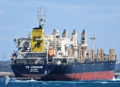
TS HONOUR
Cargo
Current Trip
| Trip Time | 14 h, 1 mins |
|---|---|
| Trip Distance | 116.30 nm |
| AVG Speed | 9.7 Knots |
| MAX Speed | 12.5 Knots |
| Draught | 7 m |
| AVG Wind | 15.4 knots |
| MAX Wind | 21 knots |
| MIN Temp | 10.5°C / 50.9°F |
| MAX Temp | 15.8°C / 60.44°F |
| Position Received | 8 d ago |
Current Position
| Longitude | --- |
|---|---|
| Latitude | --- |
| Status | Under way using engine |
| Speed | 12.7 Knots |
| Course | 115.5° |
| Area | Tasman Sea |
| Station | T-AIS |
| Position Received | 8 d ago |
Info
Information
The current position of TS HONOUR is in Tasman Sea with coordinates -41.37195° / 150.35369° as reported on 2025-12-04 10:41 by AIS to our vessel tracker app. The vessel's current speed is 12.7 Knots and is currently inside the port of DUNEDIN.
The vessel TS HONOUR (IMO: 9719393, MMSI: 538007114) is a Cargo It's sailing under the flag of [MH] Marshall Is.
In this page you can find informations about the vessels current position, last detected port calls, and current voyage information. If the vessels is not in coverage by AIS you will find the latest position.
The current position of TS HONOUR is detected by our AIS receivers and we are not responsible for the reliability of the data. The last position was recorded while the vessel was in Coverage by the Ais receivers of our vessel tracking app.
The current draught of TS HONOUR as reported by AIS is 7 meters
Weather
| Temperature | 9.9°C / 49.82°F |
|---|---|
| Wind Speed | 5 knots |
| Direction | 43° NE |
| Pressure | 1020.2 hPa |
| Humidity | 96.7 % |
| Cloud Coverage | 11 % |
Featured Company
Last Port Calls
| Port | Arrival | Departure | Time In Port |
|---|---|---|---|
| 2025-12-12 14:28 | |||
| 2025-12-09 13:37 | 2025-12-12 00:27 | 2 d | |
| 2025-11-27 04:54 | 2025-12-03 16:46 | 6 d | |
| 2025-11-19 19:03 | 2025-11-25 06:12 | 5 d | |
| 2025-11-15 19:14 | 2025-11-17 22:14 | 2 d | |
| 2025-10-20 08:28 | 2025-10-23 01:46 | 2 d | |
| 2025-10-10 01:06 | 2025-10-12 19:55 | 2 d | |
| 2025-10-04 13:44 | 2025-10-06 06:08 | 1 d |
Last Trips
| Origin | Departure | Destination | Arrival | Distance | |
|---|---|---|---|---|---|
| 2025-12-12 00:27 | 2025-12-12 14:28 | 116.30 nm | |||
| 2025-12-03 16:46 | 2025-12-09 13:37 | 1457.27 nm | |||
| 2025-11-25 06:12 | 2025-11-27 04:54 | 564.79 nm | |||
| 2025-11-17 22:14 | 2025-11-19 19:03 | 565.11 nm | |||
| 2025-10-23 01:46 | 2025-11-15 19:14 | 4118.65 nm | |||
| 2025-10-12 19:55 | 2025-10-20 08:28 | 1296.69 nm | |||
| 2025-10-06 06:08 | 2025-10-10 01:06 | 1120.83 nm | |||
| 2025-09-26 11:56 | 2025-10-04 13:44 | 488.79 nm |
Events
| Time | Event | Details | Position / Dest | Info |
|---|---|---|---|---|
| 2025-12-12 01:44 | STOP Moving |
-45.87650 / 170.52028
[NZ] DUNEDIN
|
Speed: 0.2 kn Course: 11° |
|
| 2025-12-12 01:28 | PORT ARRIVAL |
|
-45.87386 / 170.53262
[NZ] DUNEDIN
|
Speed: 5.5 kn Course: 251° |
| 2025-12-11 22:30 | START Moving | 17.58 nm, North East of PORT CHALMERS |
-45.60300 / 170.92015
NZ TIU
|
Speed: 7.3 kn Course: 227° |
| 2025-12-11 20:41 | STOP Moving | 15.96 nm, North East of PORT CHALMERS |
-45.60667 / 170.86833
NZ TIU
|
Speed: Course: -1° |
| 2025-12-11 19:46 | START Moving |
-45.52500 / 170.95666
NZ TIU
|
Speed: 7 kn Course: 222° |
|
| 2025-12-11 18:46 | STOP Moving |
-45.52833 / 170.94833
NZ TIU
|
Speed: Course: -1° |
|
| 2025-12-11 11:28 | START Moving | 0.81 nm, East of TIMARU |
-44.38409 / 171.27821
NZ TIU
|
Speed: 6.1 kn Course: 86° |
| 2025-12-11 11:27 | PORT DEPARTURE |
|
-44.38409 / 171.27821
NZ TIU
|
Speed: 1 kn Course: 35° |
| 2025-12-09 00:55 | STOP Moving |
-44.39269 / 171.25858
[NZ] TIMARU
|
Speed: 0.3 kn Course: 226° |
|
| 2025-12-09 00:37 | PORT ARRIVAL |
|
-44.38667 / 171.26167
[NZ] TIMARU
|
Speed: 5.6 kn Course: 240° |