
TRUD R
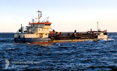
Trailing Suction Hopper Dredger
Current Trip
| Time Travelled | --- |
|---|---|
| Remaining Time | --- |
| Distance Travelled | 1327.11 nm |
| Remaining Distance | --- |
| AVG Speed | 5.3 Knots |
| MAX Speed | 10.7 Knots |
| AVG Wind | 7.8 knots |
| MAX Wind | 23.9 knots |
| MIN Temp | 4.2°C / 39.56°F |
| MAX Temp | 32°C / 89.6°F |
| Draught | 2.8 m |
| Position Received | 17 h, 6 m ago |
Current Position
| Longitude | 153.70113° |
|---|---|
| Latitude | -28.60729° |
| Status | Under way using engine |
| Speed | 10 Knots |
| Course | 176.6° |
| Area | Coral Sea |
| Station | T-AIS |
| Position Received | 17 h, 6 m ago |
Info
Information
The current position of TRUD R is in Coral Sea with coordinates -28.60729° / 153.70113° as reported on 2024-08-31 11:49 by AIS to our vessel tracker app. The vessel's current speed is 10 Knots
The vessel TRUD R (IMO: 8957156, MMSI: 219964000) is a Trailing Suction Hopper Dredger that was built in 1995 ( 29 years old ). It's sailing under the flag of [DK] Denmark.
In this page you can find informations about the vessels current position, last detected port calls, and current voyage information. If the vessels is not in coverage by AIS you will find the latest position.
The current position of TRUD R is detected by our AIS receivers and we are not responsible for the reliability of the data. The last position was recorded while the vessel was in Coverage by the Ais receivers of our vessel tracking app.
The current draught of TRUD R as reported by AIS is 2.8 meters
Weather
| Temperature | 27°C / 80.6°F |
|---|---|
| Wind Speed | 7 knots |
| Direction | 76° ENE |
| Pressure | 1012.2 hPa |
| Humidity | 39.5 % |
| Cloud Coverage | --- |
Featured Company
Last Port Calls
Last Trips
| Origin | Departure | Destination | Arrival | Distance |
|---|
Events
| Time | Event | Details | Position / Dest | Info |
|---|---|---|---|---|
| 2024-08-31 21:52 | STOP Moving | 3.22 nm, North West of YAMBA |
-29.38141 / 153.30394
YAMBA
|
Speed: 0.1 kn Course: 109° |
| 2024-08-31 20:48 | START Moving | 3.15 nm, East of YAMBA |
-29.40653 / 153.40048
YAMBA
|
Speed: 3.5 kn Course: 206° |
| 2024-08-31 19:48 | STOP Moving | 3.68 nm, North East of YAMBA |
-29.39923 / 153.40817
YAMBA
|
Speed: 0.3 kn Course: 335° |
| 2024-08-31 11:52 | Status Changed | Default Under way using engine |
-28.61661 / 153.70195
YAMBA
|
Speed: 10 kn Course: 176.6° |
| 2024-08-31 11:49 | OUT of Coverage |
-28.60729 / 153.70113
Coral Sea
YAMBA
|
Speed: 10 kn Course: 176.6° |
|
| 2024-08-31 10:24 | Status Changed | Under way using engine Default |
-28.37051 / 153.64787
YAMBA
|
Speed: 9.7 kn Course: 169° |
| 2024-08-31 10:16 | Status Changed | Default Under way using engine |
-28.34785 / 153.64314
YAMBA
|
Speed: 9.8 kn Course: 168.1° |
| 2024-08-31 09:56 | Status Changed | Under way using engine Default |
-28.29627 / 153.63181
YAMBA
|
Speed: 9.1 kn Course: 170° |
| 2024-08-31 09:56 | Status Changed | Default Under way using engine |
-28.29495 / 153.63155
YAMBA
|
Speed: 9.3 kn Course: 168.4° |
| 2024-08-31 09:40 | Destination Changed | YAMBA DREDGING OPERATION |
-28.24801 / 153.61050
YAMBA
|
Speed: 8.6 kn Course: 151.7° |