
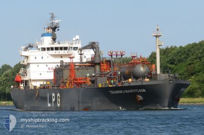
TRAMMO MARYCAM
Lpg Tanker
Current Trip
FOR ORDERS
| Time Travelled | 6 days |
|---|---|
| Remaining Time | --- |
| Distance Travelled | 2354.44 nm |
| Remaining Distance | --- |
| AVG Speed | 14.2 Knots |
| MAX Speed | 16.8 Knots |
| AVG Wind | 14.9 knots |
| MAX Wind | 19 knots |
| MIN Temp | 25.7°C / 78.26°F |
| MAX Temp | 31.3°C / 88.34°F |
| Draught | 7 m |
| Position Received | 8 h, 27 m ago |
Current Position
| Longitude | --- |
|---|---|
| Latitude | --- |
| Status | Under way using engine |
| Speed | 13.6 Knots |
| Course | 296.2° |
| Area | North Atlantic Ocean |
| Station | T-AIS |
| Position Received | 8 h, 27 m ago |
Info
Information
The current position of TRAMMO MARYCAM is in North Atlantic Ocean with coordinates 9.22714° / -57.24596° as reported on 2025-12-11 05:11 by AIS to our vessel tracker app. The vessel's current speed is 13.6 Knots
The vessel TRAMMO MARYCAM (IMO: 9409168, MMSI: 563195100) is a Lpg Tanker that was built in 2009 ( 16 years old ). It's sailing under the flag of [SG] Singapore.
In this page you can find informations about the vessels current position, last detected port calls, and current voyage information. If the vessels is not in coverage by AIS you will find the latest position.
The current position of TRAMMO MARYCAM is detected by our AIS receivers and we are not responsible for the reliability of the data. The last position was recorded while the vessel was in Coverage by the Ais receivers of our vessel tracking app.
The current draught of TRAMMO MARYCAM as reported by AIS is 7 meters
Weather
| Temperature | 27.2°C / 80.96°F |
|---|---|
| Wind Speed | 16 knots |
| Direction | 80° E |
| Pressure | 1014.2 hPa |
| Humidity | 75.4 % |
| Cloud Coverage | 7 % |
Featured Company
Most Visited Ports (Last year)
| Port | Arrivals | |
|---|---|---|
| 5 | ||
| 4 | ||
| 3 | ||
| 3 | ||
| 3 | ||
| 2 |
Last Trips
| Origin | Departure | Destination | Arrival | Distance | |
|---|---|---|---|---|---|
| 2025-11-24 02:34 | 2025-12-03 10:50 | 2607.99 nm | |||
| 2025-11-08 14:42 | 2025-11-23 03:41 | 4452.83 nm | |||
| 2025-10-19 03:12 | 2025-11-06 11:51 | 1978.03 nm | |||
| 2025-10-12 05:07 | 2025-10-17 17:41 | 1724.08 nm | |||
| 2025-09-24 04:03 | 2025-10-09 09:14 | 3433.72 nm |
Events
| Time | Event | Details | Position / Dest | Info |
|---|---|---|---|---|
| 2025-12-11 05:18 | Status Changed | Default Under way using engine |
9.23866 / -57.26951
FOR ORDERS
|
Speed: 13.6 kn Course: 296.2° |
| 2025-12-11 05:11 | OUT of Coverage |
9.22714 / -57.24596
North Atlantic Ocean
|
Speed: 13.6 kn Course: 296.2° |
|
| 2025-12-10 23:28 | Change Sea Area | Guyanese part of the North Atlantic Ocean Surinamese part of the North Atlantic Ocean |
8.65542 / -56.05010
North Atlantic Ocean
|
Speed: 13.8 kn Course: 296° |
| 2025-12-10 20:01 | Detected in Sea | Surinamese part of the North Atlantic Ocean |
8.30468 / -55.33565
North Atlantic Ocean
|
Speed: 13.8 kn Course: 294.9° |
| 2025-12-10 20:01 | Status Changed | Under way using engine Default |
8.30468 / -55.33565
FOR ORDERS
|
Speed: 13.6 kn Course: 297° |
| 2025-12-10 19:46 | IN Coverage |
8.30468 / -55.33565
North Atlantic Ocean
|
Speed: 13.8 kn Course: 294.9° |
|
| 2025-12-04 18:38 | Status Changed | Default Under way using engine |
-13.04781 / -38.33693
FOR ORDERS
|
Speed: 12.5 kn Course: 59.7° |
| 2025-12-04 18:37 | OUT of Coverage |
-13.04899 / -38.33897
South Atlantic Ocean
|
Speed: 12.5 kn Course: 59.7° |
|
| 2025-12-04 18:31 | Status Changed | Under way using engine Default |
-13.06009 / -38.35842
FOR ORDERS
|
Speed: 12.5 kn Course: 60° |
| 2025-12-04 18:30 | Status Changed | Default Under way using engine |
-13.06214 / -38.36208
FOR ORDERS
|
Speed: 12.4 kn Course: 59.7° |