
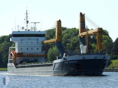
TRADE NAVIGATOR
Cargo
Current Trip
| Time Travelled | 3 days |
|---|---|
| Remaining Time | 13 h, 7 mins |
| Distance Travelled | 461.09 nm |
| Remaining Distance | 155.82 nm |
| AVG Speed | 9.4 Knots |
| MAX Speed | 12.8 Knots |
| AVG Wind | 16.5 knots |
| MAX Wind | 31 knots |
| MIN Temp | 1.5°C / 34.7°F |
| MAX Temp | 6.8°C / 44.24°F |
| Draught | 5.1 m |
| Position Received | 5 m ago |
Current Position
| Longitude | --- |
|---|---|
| Latitude | --- |
| Status | Under way using engine |
| Speed | 12.4 Knots |
| Course | 348.4° |
| Area | North Sea |
| Station | T-AIS |
| Position Received | 5 m ago |
Info
Information
The current position of TRADE NAVIGATOR is in North Sea with coordinates 58.00398° / 4.54793° as reported on 2026-01-04 17:23 by AIS to our vessel tracker app. The vessel's current speed is 12.4 Knots and is heading at the port of AAGOTNES. The estimated time of arrival as calculated by MyShipTracking vessel tracking app is 2026-01-05 07:35 LT
The vessel TRADE NAVIGATOR (IMO: 9631371, MMSI: 244650331) is a Cargo It's sailing under the flag of [NL] Netherlands.
In this page you can find informations about the vessels current position, last detected port calls, and current voyage information. If the vessels is not in coverage by AIS you will find the latest position.
The current position of TRADE NAVIGATOR is detected by our AIS receivers and we are not responsible for the reliability of the data. The last position was recorded while the vessel was in Coverage by the Ais receivers of our vessel tracking app.
The current draught of TRADE NAVIGATOR as reported by AIS is 5.1 meters
Weather
| Temperature | 2.3°C / 36.14°F |
|---|---|
| Wind Speed | 17 knots |
| Direction | 114° ESE |
| Pressure | 1002.7 hPa |
| Humidity | 67.2 % |
| Cloud Coverage | 100 % |
Featured Company
Last Port Calls
| Port | Arrival | Departure | Time In Port |
|---|---|---|---|
| 2025-12-29 03:30 | 2025-12-31 19:04 | 2 d | |
| 2025-11-30 16:27 | 2025-12-06 15:36 | 5 d | |
| 2025-11-28 19:06 | 2025-11-29 05:46 | 10 h | |
| 2025-11-02 18:13 | 2025-11-02 19:49 | 1 h |
Last Trips
| Origin | Departure | Destination | Arrival | Distance | |
|---|---|---|---|---|---|
| 2025-12-06 15:36 | 2025-12-29 03:30 | 5278.97 nm | |||
| 2025-11-29 05:46 | 2025-11-30 16:27 | 365.87 nm | |||
| 2025-11-02 19:49 | 2025-11-28 19:06 | 283.55 nm | |||
| 2025-10-08 22:57 | 2025-11-02 18:13 | 6436.06 nm |
Events
| Time | Event | Details | Position / Dest | Info |
|---|---|---|---|---|
| 2026-01-04 16:30 | Status Changed | Under way using engine Default |
57.82770 / 4.61798
NOAGO
|
Speed: 12.2 kn Course: 348° |
| 2026-01-04 16:30 | IN Coverage |
57.82770 / 4.61798
North Sea
NOAGO
|
Speed: 12.4 kn Course: 348.2° |
|
| 2026-01-04 10:58 | Status Changed | Default Under way using engine |
56.79149 / 5.02210
NOAGO
|
Speed: 11 kn Course: 347° |
| 2026-01-04 10:41 | OUT of Coverage |
56.73838 / 5.04248
North Sea
NOAGO
|
Speed: 11 kn Course: 347° |
|
| 2026-01-04 10:00 | Change Sea Area | Norwegian part of the North Sea Danish part of the North Sea |
56.61010 / 5.09167
North Sea
NOAGO
|
Speed: 11.6 kn Course: 346.4° |
| 2026-01-04 08:04 | ETA Changed | 2026/01/05 08:00 2026/01/05 15:00 |
56.25022 / 5.17678
NOAGO
|
Speed: 11.2 kn Course: 353° |
| 2026-01-04 02:22 | Change Sea Area | Danish part of the North Sea German part of the North Sea |
55.25788 / 5.31588
North Sea
NOAGO
|
Speed: 10.2 kn Course: 4.2° |
| 2026-01-04 01:18 | Change Sea Area | German part of the North Sea Dutch part of the North Sea |
55.07967 / 5.28860
North Sea
NOAGO
|
Speed: 8.6 kn Course: 4.3° |
| 2026-01-04 01:17 | IN Coverage |
55.07967 / 5.28860
North Sea
NOAGO
|
Speed: 8.6 kn Course: 4.3° |
|
| 2026-01-03 14:17 | OUT of Coverage |
53.81217 / 4.95622
North Sea
NOAGO
|
Speed: 7.5 kn Course: 14.5° |