
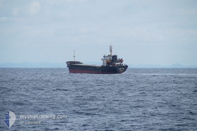
TONG YUN
Cargo
Current Trip
| Time Travelled | 18 h, 33 mins |
|---|---|
| Remaining Time | 1 day |
| Distance Travelled | 188.45 nm |
| Remaining Distance | 404.79 nm |
| AVG Speed | 10.4 Knots |
| MAX Speed | 11.4 Knots |
| AVG Wind | 9.3 knots |
| MAX Wind | 13 knots |
| MIN Temp | 5.7°C / 42.26°F |
| MAX Temp | 8.2°C / 46.76°F |
| Draught | 6.1 m |
| Position Received | 11 d ago |
Current Position
| Longitude | --- |
|---|---|
| Latitude | --- |
| Status | Under way using engine |
| Speed | 8.4 Knots |
| Course | 180.6° |
| Area | Japan Sea |
| Station | T-AIS |
| Position Received | 11 d ago |
Info
Information
The current position of TONG YUN is in Japan Sea with coordinates 36.01563° / 129.66368° as reported on 2025-03-02 12:05 by AIS to our vessel tracker app. The vessel's current speed is 8.4 Knots and is heading at the port of GWANGYANG. The estimated time of arrival as calculated by MyShipTracking vessel tracking app is 2025-03-15 22:21 LT
The vessel TONG YUN (IMO: 9537599, MMSI: 370672000) is a Cargo It's sailing under the flag of [PA] Panama.
In this page you can find informations about the vessels current position, last detected port calls, and current voyage information. If the vessels is not in coverage by AIS you will find the latest position.
The current position of TONG YUN is detected by our AIS receivers and we are not responsible for the reliability of the data. The last position was recorded while the vessel was in Coverage by the Ais receivers of our vessel tracking app.
The current draught of TONG YUN as reported by AIS is 6.1 meters
Weather
| Temperature | 5.9°C / 42.62°F |
|---|---|
| Wind Speed | 12 knots |
| Direction | 42° NE |
| Pressure | 1029 hPa |
| Humidity | 73.5 % |
| Cloud Coverage | 1 % |
Featured Company
Last Port Calls
| Port | Arrival | Departure | Time In Port |
|---|---|---|---|
| 2025-03-12 07:34 | 2025-03-13 15:08 | 1 d | |
| 2025-02-12 12:18 | 2025-02-14 12:13 | 1 d | |
| 2025-02-09 21:09 | 2025-02-09 22:29 | 1 h | |
| 2025-01-28 21:42 | 2025-02-09 15:11 | 11 d | |
| 2025-01-07 08:48 | 2025-01-10 16:43 | 3 d |
Last Trips
| Origin | Departure | Destination | Arrival | Distance | |
|---|---|---|---|---|---|
| 2025-02-14 12:13 | 2025-03-12 07:34 | 1467.98 nm | |||
| 2025-02-09 22:29 | 2025-02-12 12:18 | 557.13 nm | |||
| 2025-02-09 15:11 | 2025-02-09 21:09 | 20.73 nm | |||
| 2025-01-10 16:43 | 2025-01-28 21:42 | 1783.41 nm | |||
| 2024-12-31 14:12 | 2025-01-07 08:48 | 1312.50 nm |
Events
| Time | Event | Details | Position / Dest | Info |
|---|---|---|---|---|
| 2025-03-13 06:08 | PORT DEPARTURE |
|
37.02469 / 126.70245
KR YEOSU
|
Speed: 8.8 kn Course: 307° |
| 2025-03-13 05:08 | START Moving |
36.94775 / 126.84097
[KR] PYEONGTAEK
|
Speed: 5 kn Course: 4° |
|
| 2025-03-11 23:45 | STOP Moving |
36.94497 / 126.83996
[KR] PYEONGTAEK
|
Speed: Course: 334° |
|
| 2025-03-11 22:34 | PORT ARRIVAL |
|
37.01100 / 126.70923
[KR] PYEONGTAEK
|
Speed: 8.1 kn Course: 137° |
| 2025-03-11 20:39 | START Moving | 5.75 nm, North of DANGJIN |
37.15699 / 126.47569
KR YEOSU
|
Speed: 5.9 kn Course: 162° |
| 2025-03-06 19:27 | STOP Moving | 6.36 nm, North of DANGJIN |
37.16558 / 126.46705
KR YEOSU
|
Speed: 0.2 kn Course: 102° |
| 2025-03-05 03:30 | START Moving | 6.8 nm, East of YEOSU |
34.72670 / 127.80151
KR YEOSU
|
Speed: 5.4 kn Course: 79° |
| 2025-03-05 00:22 | STOP Moving | 6.5 nm, East of YEOSU |
34.72656 / 127.79548
KR YEOSU
|
Speed: 0.2 kn Course: 223° |
| 2025-03-04 22:00 | START Moving | 18.52 nm, South of SINSUAN-GIL |
34.59363 / 128.08667
KR YEOSU
|
Speed: 5.8 kn Course: 244° |